Blog

Our Greenway Network Action Plan for 2015

Livable City’s Greenway Network campaign is creating a linked-up open space system for San Francisco of landscaped boulevards, green streets, and linear parks which link the city’s neighborhoods to one another, and to our major parks, wildlife corridors, waterfront, and public transit hubs. The Network will serve as sustainable transportation infrastructure (walking, bicycling, and public transit), and provide stormwater infiltration and management, natural habitat, recreation, and neighborhood economic development.

In 2015, the campaign will focus on the three regional trails – Ridge Trail, Coast Trail, and Bay Trail – that cross San Francisco, as well as Golden Gate Park. We will also work to strengthen city plans and policies that foster greenways, open space, biodiversity, and healthy watersheds.

The Ridge Trail and San Miguel Hills

The Bay Area Ridge Trail is a proposed 550-mile trail encircling San Francisco Bay. 350 miles of the trail have public access. In San Francisco, the Ridge Trail runs mostly on city streets, from the Golden Gate Bridge to Fort Funston, via Buena Vista Park, Twin Peaks and Stern Grove.

The San Miguel Hills are San Francisco's central range of hills, and includes Twin Peaks, Mt Sutro, Mt. Davidson, Glen Canyon, and Laguna Honda. This zoning map shows the extent of publicly-owned lands (in gray, marked "P") that could form an interconnected public open space network.
The San Miguel Hills are San Francisco’s central range of hills, and includes Twin Peaks, Mt Sutro, Mt. Davidson, Glen Canyon, and Laguna Honda. This zoning map shows the extent of publicly-owned lands (in gray, marked “P”) that could form a network of connected public open spaces.

Livable City’s vision is to create a continuous public open space in the San Miguel Hills, San Francisco’s central range of hills that extends between Golden Gate Park and Glen Park, and includes Twin Peaks, Mt. Sutro, Mt. Davidson, Glen Canyon, and Laguna Honda. Our vision for the San Miguel Hills includes hilltop and canyon open spaces, restored streams and natural lakes, and a network of trails for walking and cycling. It would include the Ridge Trail, as well as branches to Golden Gate Park via Laguna Honda and Mt. Sutro, and to McLaren park via Glen Canyon. In 2015, we will work to:

  • Secure public access around Sutro Tower as a condition of the proposed antenna expansion on the tower.
  • Support Glen Park Association’s plan for a Glen Park Greenway, extending from Glen Canyon Park to Diamond Street.
  • Make it city policy to preserve, connect, and restore the various publicly owned lands in the San Miguel Hills.

The Bay Trail

bay-trail

The San Francisco Bay Trail is a regional project to create a walking and cycling path that encircles San Francisco and San Pablo bays, including several bridges. 340 miles of the planned 500 miles are complete. In San Francisco, the Bay Trail runs along the eastern shoreline from the Golden Gate Bridge to the San Mateo County line. In 2015, Livable City will work to:

  • Improve the public spaces around the Ferry Building. The public spaces surrounding the Ferry Building are the most accessible waterfront public spaces in the region, located at the nexus of bus, BART, light rail, and ferry lines. Livable City has helped defeat two proposals to turn the Ferry Building Plaza into a parking lot. Last year, we participated in a design charette to identify near- and longer-term improvements to the plaza.
  • Improve bicycle and pedestrian access to The Embarcadero, including completing a plan for an Embarcadero bikeway and complementary improvements to pedestrian crossings of the Embarcadero to connect the landslide neighborhoods to the waterfront.
  • Complete the Bay Trail connection past the Marina Yacht harbor with a protected bicycle and pedestrian trail.
  • ensure world-class bicycle and pedestrian connections along Terry Francois Boulevard.
  • Advance plans for the public open spaces in the voter-approve plan for Pier 70
  • Reaffirm the city’s Bay Trail resolution, create an inter-departmental action plan to complete the Bay Trail from the Golden Gate Bridge to the San Mateo County line.

The Coast Trail

The California Coastal Trail is a planned 1200-mile trail along California’s shoreline. It is roughly half complete. In San Francisco, SPUR’s Ocean Beach Master Plan proposes improving walking and cycling along San Francisco’s Ocean edge, and addressing coastal erosion and sea-level rise by restoring dunes and removing vulnerable and ill-sited roads and parking lots. In 2015, Livable City will advocate for near-term improvements to enhance walking and cycling access, protect and restore the coastal environment, and that support Sunday Streets events on the Great Highway and Golden Gate Park, including:

  • Closing Great Highway south of Sloat Boulevard, and replacing it with a pedestrian and bicycle path.
  • Pedestrian safety improvements at the Lincoln/Great Highway intersection.
  • Signage to direct traffic to alternate routes when Great Highway is closed by sand (approximately 60 days per year), or for planned open streets events like Sunday Streets.

Golden Gate Park

Golden Gate Park is San Francisco’s largest public park. However, parts of the park suffer from poor pedestrian and bicycle access and speeding traffic, and the roads bordering the Park – Lincoln, Stanyan, Fulton, Oak, and Fell – are dangerous, high speed roadways that separate the park from the City. Golden Gate Park will celebrate its 150th Anniversary in 2021, and needs a 21st-Century update to its Master Plan to improve pedestrian and bicycle and pedestrian access to and through the park, reduce speeding and traffic danger, facilitate regular car-free space on JFK Drive, and transform Lincoln, Fulton, Stanyan, Oak, and Fell streets into safer, greener streets that support walking, cycling, and transit access to and around the park.

Plans and policies

Several key city open space policies are up for renewal or adoption in 2015. Strong policies provide essential support for preserving and enhancing open spaces, recreation, and biodiversity, and greening the city’s streets. in 2015 we will:

  • support adoption of the General Plan’s Recreation and Open Space Element.
  • support a strong Urban Forest Plan, including a funding and maintenance strategy for the city’s street trees.
  • advance the city’s biodiversity strategy.

Annie Alley – Creating Open Space in a Neglected Alley

We are working hard to reclaim our public spaces and ensure privately-owned places are still welcoming to everyone. Public rights-of-way – streets and alleyways – make up about a quarter of San Francisco’s land area. Projects that reclaim alleyways as neighborhood-serving public places with greening, traffic-calming, and pedestrianization are moving forward in 2015.

Living Alleys, also known as woonerfs, are shared space alleyways that prioritize pedestrian use and open space, using special paving, traffic calming, lighting, seating, green landscaping, and other design features to indicate that vehicles are visitors and pedestrians have primacy across the full width of the right-of-way.

Pedestrianized alleyways, or paseos, are closed to auto traffic. Some alleyways, like Maiden Lane in Union Square, are pedestrian spaces for part of the day, but allow delivery and other auto access at other times. Others, like Annie Street, are working to become permanent paseos.

In November of last year, a block of Annie Street between Mission and Ambrose Bierce streets was transformed into Annie Street Plaza, with seating and landscaping. The Hearst Corporation, which owns the nearby parking garage, initially supported the plaza, but appealed several months later to tear out the plaza. After an outpouring of community support, Hearst eventually dropped its appeal, but now the plaza is at risk of being returned to a desolate alley used for car traffic and disuse.

Over the last several months, NelsonNygaard Consulting has conducted an in-depth review of the changes to the street. The results are overwhelmingly positive. The Hearst Corporation’s parking garage continues to earn more revenue than in the past, 44% of survey respondents use the plaza several times each week, and vehicles are impacted by just 110 seconds during peak hours.

Annie Street Plaza faces a critical moment this Thursday, when its permit is up for renewal. If you value public space and want to protect a street dedicated to making it safe to walk, congregate, socialize, and relax in SoMa’s densely trafficked neighborhood, we hope you’ll lend your support the renewal of the Annie Street Alley permit.

You can attend the ISCOTT permit hearing:
Thursday, July 23
9 a.m.
SFMTA 7th Fl, Rm 7080 (1 South Van Ness Blvd.)

Or, if you can’t attend in person, send an e-mail before Thursday morning supporting the plaza. Here is a sample letter you can cut and paste to get you started:
—–

Dear Directors Reiskin and Nuru:

I am writing to urge you to support the reauthorization of Annie Street Plaza as designed. As a San Franciscan who is passionate about our community and creating livable neighborhoods and increased open space, I believe Annie Street Plaza is an irreplaceable asset for residents, employees, students and visitors to the Yerba Buena Neighborhood.

The plaza, a result of years of community visioning and planning with residents and business owners engaged in the process, is a neighborhood gem in a part of San Francisco sorely lacking in open space. Annie Street Plaza provides a wonderful variety of free public programming – an important strategy keeping our alleys safe and friendly, especially in the evenings. The conversion of the plaza to a pedestrian zone also made the area much safer for pedestrians and provides everyone a safe place to gather and relax. It also is a great place to host free programming.

Yerba Buena Community Benefit District (YBCBD) is committed to continuing to maintain and support the project. YBCBD’s post-occupancy traffic study and public life evaluation contains positive findings, with minimal increases in delays (less than two minutes during peak times) to few cars along Jessie Street and overall positive reception to the plaza, its maintenance and programming. Nearly one year after the project’s development, YBCD continues to devote staff time to programming the space, helping to spark the arts, promote health, and improve partnerships with local organizations and businesses.

Annie Street Plaza is an oasis of publicly-accessible open space for one of our City’s most crowded and dense neighborhoods. As this area continues its rapid growth with dense residential and office buildings, Annie Street Plaza’s importance will continue to grow. Please make San Francisco a more livable city by reauthorizing Annie Street Plaza.

Sincerely,


CC:      Edwin Lee, Mayor, City and County of San Francisco

Gillian Gillette, Director of Transportation Policy, Office of the Mayor

Jane Kim, Supervisor, District 6

John Rahaim, Director, San Francisco Planning Department

Meryl Klein, Temporary Street Closures I Special Events, SFMTA

Nick Elsner, Bureau of Street-use and Mapping, SFDPW


Planning for a Better City

For many decades, transportation planning in San Francisco was focused almost entirely on the automobile, and walking, cycling, and public transit were marginalized. We need to put sustainable modes at the center of our transportation plans, and replace “predict and provide” models of traffic and parking planning with ones that take into account the potential of better pricing and management, and that strengthen the role of alternatives to the private automobile.

It’s a truism that land use planning and transportation planning are inseparable, but in practice, transportation planning in San Francisco lags far behind land development. San Francisco needs to commit to the plans it has already made, and commit to planning, and building, needed neighborhood transportation improvements.

Many of the biggest new developments planned or under construction – Mission Bay, Hunters Point Shipyard, and Treasure Island –  are throwbacks to the automobile-centered planning of the last decade, and need to be re-thought if they are to contribute to a more livable and sustainable San Francisco.

Big buildings with large parking structures and parking lots Mission Bay.
Big buildings with large parking structures and parking lots along 4th Street in Mission Bay.

Sustainability also needs to be at the heart of our planning. Land Use and transportation plans must address climate protection, pollution and waste reduction, preserving and restoring biodiversity and habitat, and stewarding urban waters and restoring the health of our streams, lakes, groundwater, wetlands, bay, and ocean.

In the 19th century, public health was at the center of land use planning, and we are working to restore planning’s focus on improving mental and physical health.

Land use and transportation planning should support a diverse and robust city economy, which allows local businesses and sustainable manufacturing to thrive in San Francisco.

Plans must also address equity. Land use planning must address San Francisco’s housing affordability crisis, neighborhood plans should plan for equitable access to transportation, open space and parks, community facilities, and essential services. Our transportation plans must ensure sustainable mobility for all San Franciscans, while preventing the burden of our transportation choices, including traffic danger, noise, pollution, and degraded public spaces, to continue to fall on San Francisco’s poorest and least automobile-dependent neighborhoods.

Planning tends to focus on the material and quantifiable, but livability includes important qualitative factors that ought not be marginalized. Our planning should focus on, and foster, greater happiness. As we plan the future of our neighborhoods, their beauty, history, and character must be taken into account.

Current Projects

View of Market Street at Octavia from the Central Freeway
  • Neighborhood Planning. Livable City helped shape most of the City’s recent neighborhood plans, including those for Market & Octavia, Balboa Park, The Mission, Tenderloin, and SoMa. We are working to ensure that  neighborhood transportation and open space projects in these areas get built, and that the City maintains its commitment to neighborhood planning.
  • Revise San Francisco’s Planning Code. At over 2,300 pages, San Francisco’s Planning Code, the blueprint for building and development in San Francisco, is in need of cleanup and revision. Livable City has been leading the effort to revise and update the code for clarity legibility, to remove outdated requirements – like minimum parking requirements in transit-rich areas – and to strengthen its provisions for permitting housing in transit corridors, pedestrian-oriented urban design and streetscapes, sustainability, and securing public benefits from development.
  • Planning for Health. Livable City worked with San Francisco’s Health Department to create their Healthy Development Tool, and is advocating for a greater role for health and safety in land use and transportation planning.
  • Planning for Sustainability. Livable City authored San Francisco’s Climate Protection ordinance, and is working to integrate climate change, watersheds, local food production, sustainable transportation, and habitat protection into San Francisco planning.
  • Post-Redevelopment. Since the State dissolved redevelopment agencies in 2012, Livable City has worked to ensure that the City’s redevelopment plans are updated and integrated into the city’s Planning Code, and that the Redevelopment Agency’s planned investments in affordable housing, sustainable transportation, and public open spaces can be sustained.
  • Sustainable Production, Distribution, and Repair. We are working with SF Made and others to ensure that San Francisco’s planning and zoning support and foster the city’s diverse production, distribution, and repair businesses, while maintaining neighborhood livability.

Livable Downtown Initiative

Livable City’s Livable Downtown Initiative seeks to make Downtown San Francisco a more vital, sustainable, and livable place.

It has been over twenty years since the city’s landmark Downtown Plan was adopted. The Downtown plan set out to create a vital downtown office and shopping district oriented to walking and public transit.

market+montgomery

The vision of a walkable and transit-oriented downtown has mostly proved successful. During the 1980s, office employment grew dramatically, and this increase in employment was largely decoupled from increases in driving and parking. As a result, Downtown San Francisco is one of the best transit-served employment centers in the country, and enjoys one of the highest rates of transit ridership. The 1990s saw a significant increase in regional transit service into the downtown, with the extension of three BART lines and the expansion of Caltrain service.

Despite these successes, there are a number of ways in which Downtown could do be better:

  • Despite the large number of residents, workers and visitors who walk and take public transit, Downtown streets are still dominated by auto traffic, and many Downtown streets are poorly designed for walking, cycling, and public transit.
  • Thousands of new housing units are being built downtown and in the neighborhoods surrounding downtown, but much of it is out of the financial reach of most San Franciscans.
  • Downtown and the surrounding neighborhoods lack many of the basic amenities, including as shops, schools, and open spaces, of livable neighborhoods.
  • While major investments have been made to expand regional public transit service into the downtown over the past three decades, many neighborhoods inside and outside the city still lack timely and reliable transit service into downtown.

The goal of Livable City’s Downtown Initiative is to develop a new consensus around the future of downtown, focused on creating a livable and sustainable downtown neighborhood.

Elements of the Livable Downtown Initiative

The Livable Downtown Initiative has four main elements:

  1. Livable Streets,
  2. Managing Parking and Traffic,
  3. Improving Public Transit, and
  4. Balancing Jobs with Housing

Livable Streets

Quality streetscapes and public open spaces are essential to a livable and economically vital downtown. Despite the adoption of a Downtown Streetscape Plan in the 1990s, Most Downtown streets are poorly designed, dominated by automobiles, and can be unfriendly to walkers and cyclists. Most of Downtown’s public spaces, despite their great setting, are poorly designed and maintained.

Livable City has led reforms of the City’s planning code to protect downtown streets from excessive traffic, driveway cuts, and dead street frontages. The landmark Downtown parking reform legislation was approved by the Board of Supervisors in May 2006. Livable City successfully advocated for City approval for Mint Plaza, a new car-free public space in the downtown that will be financed through an innovative public-private partnership.
The Livable Downtown Initiative will:

  • Design a Downtown public life survey to examine how downtown public spaces are currently used, and make recommendations to improve them. The evaluation would look at downtown’s parks and plazas, as well as significant streets like Market and Powell.
  • Convene Downtown stakeholders, including residents, businesses, advocacy groups, and public agencies, in a series of meetings, charettes, and workshops to improve downtown streets and public spaces, including Hallidie Plaza and Washington and Clay streets.
  • Update the Downtown Streetscape Plan by working with city agencies to develop a complete and high-quality street design plan and standards for the downtown as part of the City’s Streetscape Master Plan. The plan should address different street types, and improve pedestrian safety and amenity, bicycle safety and amenity, and public transit access.
  • Promote the creation of car-free streets in the downtown to allow visitors and residents to enjoy walking, bicycling, shopping, and dining without the intrusion of traffic.
  • Make Market Street a Great Street: Allan Jacobs describes Market Street as a “once great street”; making Market Street great again is essential to a successful downtown. The street should be redesigned for better bicycle and pedestrian safety and to enhance public transit service, as well as address streetscape elements like lighting, BART station entrances, etc. that would enhance the street. Livable City will bring Market Street stakeholders together to fully implement the recommendations of the Transportation Authority’s Market Street plan, as well as plan a next round of improvements to the street.

Managing Parking and Traffic

Livable City worked with the San Francisco Planning Department to develop a comprehensive transportation and streetscape plan for downtown and South of Market. Elements of this plan became part of the SFMTA’s EN TRIPS study. We we will work with the City get the rest of the plan fully funded and staffed. The plan will include:

  • A traffic management plan for downtown, which would reduce traffic on key pedestrian and transit streets, facilitate deliveries and goods movement, and lessen the impact of Downtown traffic on the surrounding neighborhoods.
  • Create a parking management plan for downtown,  which manages the supply and price of parking to support the traffic management goals, decrease drive-alone commute trips into downtown, and shift existing parking from commuter parking to short-term parking that supports downtown shops and restaurants.

Improve Downtown Transit

Livable City has helped secure funding and the right-of-way needed to rebuild the Transbay Terminal as a regional rail and and terminal, and as San Francisco’s main high speed rail station. Livable City is working to:

  • Create a Citywide master plan for new and improved light rail, bus rapid transit, and transit-preferential streets, to connect most San Francisco neighborhoods to Downtown with transit service that is reliable, convenient, accessible, and time-competitive with the automobile.
  • Enhance regional transit service into downtown by securing funding for the first phase of the Transbay Terminal project and Caltrain electrification, the first steps in extending Caltrain into downtown and upgrading it to regional metro service. Livable City will also advocate for continued progress on a statewide high speed rail network, and on an integrated regional rail plan for the Bay Area.

Balance Jobs and Housing

This year, Livable City advocated successfully for comprehensive planning and zoning changes that make it easier to build car-free housing Downtown. Livable City also remained involved in several neighborhood planning efforts, including the Market and Octavia Plan, the East SoMa Plan, West SoMa task force, and the Tenderloin Transportation Plan, where we advocated for more housing and reduced parking requirements. Livable City is working to:

  • Support creation of a ’24-hour downtown’, with a balance of housing, offices, shopping, entertainment, and cultural facilities.
  • Revitalize Mid Market as a vital, livable, and sustainable downtown neighborhood.
  • Support car-free living in the downtown, by planning the amenities that make it a livable neighborhood, and by
  • Building livable residential neighborhoods around the downtown, including Mid-Market, Rincon Hill, Transbay, and parts of South of Market and the Central Waterfront, with more affordable and car-free housing, walkable streets, and amenities like shops, restaurants, parks, schools, community facilities, and childcare.
  • Promote “transit villages” on regional transit lines serving downtown, to create or enhance a network of vital, walkable, and livable neighborhoods in San Francisco, the East Bay, and the Peninsula with convenient downtown access.

Creating Sustainable Door-to-Door Transportation

Although sprawling, the overwhelming majority of Bay Area residents have convenient access to sustainable modes of transit. A major hurdle for many potential users is the short distance between home and transit, and again between work and transit. These first and last mile challenges keep many people who either live or work in transit poor areas from accessing sustainable transit modes. The Bay Area’s climate – both our mild weather and our reputation for innovation – present many options to create cheap, short-term fixes while implementing long-term infrastructure and land use changes.

We will address these challenges and solutions at Livable City’s Tomorrow Transit: Connecting the Bay to the Last Mile panel discussion on Monday, June 29 from 6:00-7:30. This free event is open to all, and features transportation experts from Bay Area Bike Share, Caltrain, Lyft, and SFMTA’s Taxis and Accessible Services Division.

tickets

How can San Francisco and the Bay Area quickly and decisively become a place where walking, cycling, and public transit are the best choices for most trips, and where private auto ownership is unnecessary? Since World War 2, the Bay Area and cities across the U.S. have invested heavily in sprawl development and automobile dependence, along with some significant investments in regional and local transit. The region’s official vision for its future, known as Plan Bay Area, is more compact and transit-oriented, and less automobile-dependent. This planning shift mirrors a large cultural shift, which Alan Ehrenreich calls “the Great Inversion,” which is seeing more Americans favor living in walkable urban neighborhoods.

What we know about travel behavior

Research and data helps us understand how people make transportation choices. They can help guide us to design transportation systems that are both convenient and sustainable – which will make us happier and healthier.

  • Walking and cycling can make us happier and healthierResearchers at the University of East Anglia found that commuters who walked and cycled, even for a portion of their trip, reported increased happiness. Active transportation (cycling and walking) increased happiness more that taking public transit. Even transit riders were happier than commuters who drove alone. Other studies correlate better physical health – including reduced obesity and hypertension –  with walking, cycling, and taking public transit rather than driving.
  • Wait time weighs heavier. Research has consistently shown that transit commuters weigh the time spent waiting for transit, including waiting to transfer between lines, heavier than time spent on a moving vehicle.
  • Transit riders are are generally willing to walk further on the home end of a transit trip than on the work end. A 2004 study of transit-oriented development in California found that a walk of up to half a mile on the home end of the trip made little difference on transit commute rates, but that transit ridership decreased more quickly with distance from the transit stop to work. People are also generally willing to walk further for faster transit.
  • Cycling can increase the range of transit. Cycling can increase the convenient distance from home or work to a transit stop up to 2 or 3 miles, where there are safe and direct cycling routes, bike access on transit vehicles, secure bicycle parking, and public bike systems.
  • Investments in better walking and cycling around stations increase transit use. The UC Berkeley study found that “creating an attractive, comfortable, and safe walking environment can induce transit riding among station area residents.” Similarly, a well-connected system of walking and cycling paths around transit stations – a small-scale street grid rather than a suburban-style superblocks or cul-de-sacs – increases the reach of transit.
  • Information and price are key. Better information – from basics like good signage and real-time schedule displays to more sophisticated tools like moble trip planning tools – orient and empower transit users, and enable them to make the best travel choices. Pricing transportation options to reflect their true costs is also important; employers and cities that subsidize drive-alone commuting actively discourage sustainable transportation choices.

Turning knowledge into action – a strategy for Bay Area mobility

So how can San Francisco and the Bay Area quickly and decisively become a place where active, sustainable modes are the best transportation choices, and where owning a private auto is unnecessary? As the Bay Area approaches transportation gridlock and our global environmental crisis worsens, we must quickly take action to embrace the range of solutions, from immediate, low-cost, and near term, to strategic and long-term plans.

Cities around the world are making increasingly bold strides towards sustainable mobility. Helsinki has set the ambitious goal of making auto ownership obsolete within ten years by integrating existing transit services, bike sharing, taxis, and car sharing and ride sharing services with a comprehensive trip-planning tool and an integrated payment system. Improving streets for walking and cycling, prioritizing transit on roadways, and expanding the regional transit network and improving land-use planning are parts of Helsinki’s comprehensive strategy.

  • Use the power of information technology. The proliferation of convenient and reliable trip-planning tools is helping unlock the Bay Area’s transit network, made up of over two dozen often poorly-coordinated transit operators. These trip planning tools can integrate more sustainable modes – bikes, for example – to extend transit’s reach. The region’s next generation Clipper Card should include all the region’s transit operators, as well as bike share, secure bicycle parking, and taxi into a single convenient payment system.
  • Safer streets. Walking and cycling are the most sustainable and healthful modes of transportation, but in many parts of the Bay Area are merely an afterthought. Walking and cycling need to be at the center of transportation planning – from transforming the region’s three big downtowns (San Francisco, Oakland, and San Jose) into bikeable and walkable places and growing safe and attractive walking and cycling networks into every Bay Area neighborhood.
  • Seamlessly coordinated transit. A seamlessly coordinated transit network – coordinated fares and fare payment, timed and physically connected transfers, and universal information – is essential, and possible even in a region with over two dozen public transit operators. Better schedule and service coordination can create no-wait transfers on a timed-transfer network – between BART and Caltrain at Millbrae, for example, or between feeder bus lines and mainline rail. Doing so would eliminate millions of hours of riders’ wasted transfer time at little or no additional cost. State-of-good repair maintenance and establishing transit priority on city streets improves reliability (essential for timed transfers to work) and reduces transit travel time. Investing in accessible transit – low-floor vehicles, for example – expands mobility for more users.
  • Bikes and Transit. Cycling and public transit are a great pairing for sustainable mobility. In the past few years bicycle access to transit has grown, with all-hours BART access and bike racks on more Bay Area buses. There needs to be secure bicycle parking at every station and Bay Area Bike Share pods at every regional transit station and major regional destination.
  • Taxis, car-sharing, and ride-sharing. Shared cars and shared rides serve an important role in transitioning from a transit system based on private autos to a sustainable transporation future. Taxis and paratransit provide essential mobility for folks who can’t use fixed-route transit for some or all trips. Making car-sharing ubiquitous in urban neighboroods has been shown to decrease car ownership, which reduces household travel costs, reduces miles travelled, and liberates space in buildings, yards, and public right’s of way from car parking.
  • Get smarter about parking. In most of the Bay Area, parking is over-provided and under-priced, generating traffic congestion, degrading the environment, occupying valuable urban space, and requiring vast public and private subsidy for land, construction, and maintenance. Reforming parking requirements, as San Francisco has done over the past decade, and pricing parking to reflect its true costs, will advance sustainable mobility and liberate vast societal resources for other pressing priorities, like public transit and housing.
  • Strategic investments in Transit. The region needs to invest more in transit, and invest smarter. The planned Caltrain electrification and modernization of Caltrain will transform it from commuter rail to a regional metro connecting the region’s two largest cities, primary airport, and dozens of cities and jobs centers in between. Extending Caltrain to Downtown San Francisco will serve the the region’s largest concentration of jobs, and connect Caltrain and planned High Speed Rail to BART and dozens of Muni lines. As we add jobs and housing in the region’s urban core, we need to make long-neglected investments in BART and Muni capacity and reliability. We also need to expand Muni’s rail and bus rapid transit network within San Francisco.
  • Getting land use right. Land use policies across the Bay Area should focus new jobs within walking distance of regional transit. Restrictions on residential density and mix of uses in transit-rich areas must be relaxed to allow new housing, and the neighborhood-serving shops and services that make neighborhoods walkable. Recent studies show that such compact neighborhoods generate far less auto traffic than planners predict. Reducing parking requirements near transit further decreases auto traffic, increases transit use, reduces development costs and impacts on the environment, and frees ground-floor building space for active street-facing uses. Stronger urban design standards for buildings, streets, and public spaces is essential to creating livable and walkalble places.

To bring about long-term, sustained change, we need local and regional leadership to adopt a shared land use vision. This includes creating walkable communities that are close to jobs and services, major infrastructure projects, and coordination within and between transportation agencies to facilitate transfers and routes. Many employers and developers are already on board, creating convenient shuttle services for their employees, developing car-free housing and transit-oriented developments. Some of these major projects eliminate first/last mile issues altogether: by bringing Caltrain into the Transbay Terminal, regional travelers can step out of the terminal and into their homes or offices. Simple changes, like expanding SFPark’s dynamic meter pricing across San Francisco every day, helps reduce unnecessary trips and car storage. Parking reform can help push single-occupancy drivers into ride-share, car-share, taxis, and public transit. By eliminating the gaps in first and last mile, we can dramatically reduce the Bay Area’s impact on the environment, deliver healthier, happier residents to their destinations, and create a transportation network that can grow and adapt with our region.

Please join us on Monday, June 29 from 6:00-7:30 for a lively discussion about solving our region’s first and last mile issues.

tickets

A Brief History of Parking in San Francisco

parking-sf-50s

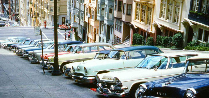
1955: San Francisco established its first residential parking space requirements of one space for each newly created dwelling unit.

1960: Revisions to the Planning Code were adopted which continued the residential requirement but allowed one of the required spaces to be a tandem space, and added requirements for commercial and industrial off street parking and loading for the first time.  No residential or commercial parking was required in the Downtown Commercial (C-3) districts.

1959-1966: San Francisco’s “freeway revolt”; the Board of Supervisors rejects planned extensions to freeways within the city.

1964: The provision allowing tandem parking spaces was dropped from the Planning Code, mandating instead that all required spaces be independently accessible.

1968: The Planning Code was amended to require special permission (conditional use) for providing on-site parking exceeding 150% of the minimum requirement. A residential parking requirement, ranging from one space for every five to one space for every two units, depending on the number of bedrooms, was established for the Downtown Commercial (C-3) districts.

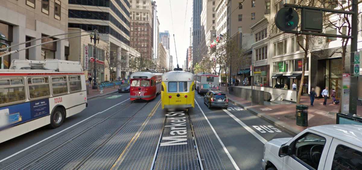
1973: BART begins rapid transit service between San Francisco and the East Bay. San Francisco adopts its first Transit First Policy. An OPEC oil embargo causes the 1973 oil crisis.

1970’s: first reductions in non-residential Code-required parking.

1985: Downtown Plan and rezoning of the downtown commercial district (C-3), eliminated minimum commercial parking requirements downtown, and established a cap of 7% of gross floor area dedicated to office parking. The minimum residential requirement was lowered to 1 space for every four units, and no limits placed on retail or short-term parking.

1988-1992: Van Ness Special Use District created, which increased residential minimum parking requirements to one space per unit from the previous one space for every four units. The Van Ness plan was the last neighborhood plan to increase minimum parking requirements; these higher requirements were removed in 2014.

1995: The revised Transportation Element of the General Plan includes policies supporting a multi-modal approach to transportation planning, transit-first, and reducing automobile dependence.

1996: City requires secure bicycle parking in all city-owned and -leased buildings.

1997-1998: Mission Bay Plan adopted, the first neighborhood plan to eliminate minimum residential parking requirements, and establish a cap of 1:1 (one parking space per dwelling unit).

2002-2006: Planning Commission starts requiring unbundling of residental parking in large projects on a case-by-case basis until citywide requirements were imposed in 2006.

2002: Draft Market and Octavia Plan was the first neighborhood plan to call for residential parking maximums below one space per unit, and proposed two new zoning designations (RTO, residential transit-oriented) and NCT (neighborhood commercial transit-oriented) with no minimum residential or commercial parking requirements.

2005: Rincon Hill plan adopted, with no minimum parking requirements for residential and non-residential uses, a .5:1 maximum by right, and 1:1 with conditional use, so long as the developers use a non-independently-accessible parking layout. All parking is required to be underground, and parking entrances were prohibited on Folsom Street. Rincon Hill was the first neighborhood plan to require all residential spaces be unbundled, minimum residential bicycle parking requirements (.5:1) and dedicated car-share spaces in larger developments.

2005: Transbay Redevelopment Plan adopted, with no minimum parking requirements, 1:1 residential maximum by right, and the requirement that all parking be underground.

2005: Draft zoning amendments for Market and Octavia released, which increased the proposed residential parking maximums.

2006: Downtown Parking Reform Ordinance, Sponsored by Supervisors Daly and Peskin, working with Livable City. In the Downtown Commercial (C-3) districts, it eliminated residential minimum requirements, established the first residential maximum below 1:1 (.75:1 for studios and one-bedroom units), and required that all parking, save for three sites in the Mid-Market area, be located underground, or on the ground floor if wrapped in active uses on all public frontages. The legislation banned new driveways on Market Street, and restricted new driveways on other important walking, cycling, and transit routes in the downtown. Citywide, it established minimum residential bicycle parking requirements (.5 bike spaces per dwelling unit) and car-share requirements in larger projects. The amendments allowing parking on upper floors under specific conditions were added after a mayoral veto of the first ordinance.

2007: Market and Octavia Plan adopted by the Planning Commission, with parking maximums set at the C-3 standards.

2007: Eastern Neighborhoods draft zoning plan released, which called for eliminating minimum parking requirements in East SoMa and portions of the Mission, Showplace Square, and Central Waterfront neighborhoods.

2007: Western SoMa Citizens Planning Task Force votes to support elimination of minimum residential and commercial parking requirements in the portion of the plan area north of Harrison Street.

November 2007: Two-thirds of voters reject Proposition H, which would have effectively eliminated downtown office parking maximums and locked in existing residential and commercial minimums across most of the city.

April 2008: With the strong support of neighborhood associations within the plan area, the Board of Supervisors approves the Market & Octavia Neighborhood plan, with lower residential parking maximums similar to the 2002 proposed controls.

June 2008: Board of Supervisors approves legislation, sponsored by Supervisor Peskin working with Livable City, to eliminate minimum parking requirements for group housing and housing dedicated to seniors and people with physical disabilities, require parking unbundling, and permitting space-efficient parking (stackers, lifts, and valet parking) and tandem parking (under certain conditions) without special approval.

June 2008: Draft Western SoMa plan released for public review; proposes eliminating minimum parking requirements and establishing maximums throughout the Western SoMa plan area.

2008: Draft Eastern Neighborhoods rezoning adopted by the Board of Supervisors. The rezoning removes minimum parking requirements in much of Eastern SoMa, most of the northeast Mission, and in the Mission Street, 24th Street, and 3rd Street corridors, but leaves one-space-per-unit requirements in place throughout most of the residentially-zoned portions of the Mission and Potrero Hill.

2009: The Balboa Park Better Neighborhoods Plan is adopted by the Board of Supervisors, eliminating minimum parking requirements in the Neighborhood Commercial zoning Districts around Balboa Park Station.

2010: The Board of Supervisors adopts legislation, authored by Supervisor David Chiu, which removes minimum residential parking requirements from Telegraph Hill, Chinatown, and the North Beach and Broadway commercial corridors.

2010: The Planning Code is amended to permit conversion of any off-street parking space to a car share space.

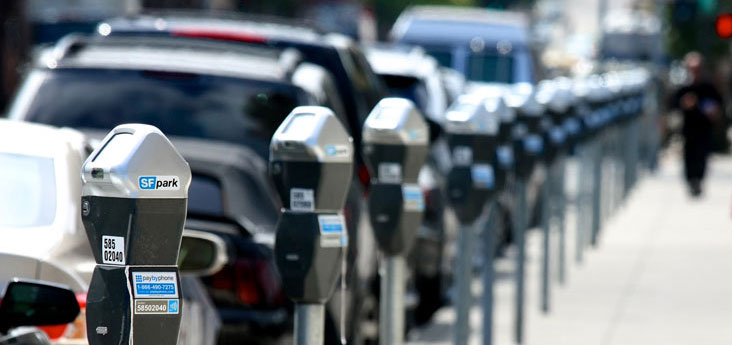
2011: The SFpark pilot projects begin, introducing demand-responsive variable parking meter pricing and real-time information in seven neighborhoods.

February 2011: The Board of Supervisors approves legislation, authored by Livable City and neighborhood groups, which removes minimum parking requirements in the Upper Market Neighborhood Commercial District.

January 2011: The Board of Supervisors adops legislation, sponsored by Supervisor Ross Mirkarimi and authored by Livable City, which establishes street-frontage requirements in all Residential-Commercial, Commercial, Neighborhood Commercial, and Mixed Use districts, requiring parking in new and renovated buildings to be hidden from view behind active street-fronting uses, and limiting the width of driveways and garage entrances.

April 2011: The Board of Supervisors approves legislation, sponsored by Supervisor Jane Kim and authored by Livable City, which removed the remaining parking minimum requirements in South of Market zoning Districts, and to establish lower maximums in keeping with Eastern Neighborhoods.

May 2011: The Board of Supervisors approves legislation, sponsored by Supervisor Ross Mirkarimi and authored by Livable City, which established street-frontage requirements in all Residential districts, which limit the width of driveways and garage entrances and restrict garages from obliterating residential front yards. In addition, the ordinance removes minimum parking requirements for projects in historic buildings and in the Tenderloin, and makes it simpler to get exceptions from minimum parking requirements in the city’s Neighborhood Commercial and Residential-Commercial districts and under other circumstances.

Winter 2012: SFMTA begins a pilot program for on-street car share pods, to improve the security and convenience of car-sharing, and address the steady conversion of surface parking lots and service stations which typically house car-share pods.

April 2012: The Board of Supervisors approve creation of the Glen Park Neighborhood Commercial District, with no minimum parking requirements.

May 2012: SFMTA approves parking meter enforcement on Sundays citywide, effective in January 2013, and evening meter hours in neighborhood commercial districts with high evening demand.

July 2012: the Board of Supervisors approve an ordinance, sponsored by Supervisor David Chiu and authored by Livable City, which exempts secure bicycle parking in buildings exempt from floor-area ratio limits, providing an incentive for voluntarily providing bicycle parking and/or exceeding minimum requirements, and requiring secure bicycle parking in more types of building projects.

August 2012: The Board of Supervisors approve the Transbay Transit Center District Plan, which imposes the lowest office parking limits to date – a maximum of 3.5 percent of gross floor area can be devoted to office parking.

July 2013: Supervisors approve an ordinance permitting any off-street parking space to be converted to bicycle parking.

November 2013: The Board of Supervisors create the Outer Mission – Excelsior Neighborhood Commercial District, with no minimum parking requirements.

April 2014: Legislation is approved to legalize existing in-law units citywide, and build new in-law units in the Castro neighborhood, without off-street parking spaces.

April 2014: The SFMTA, at the behest of Mayor Ed Lee and over the objections of business, environmental, and transportation advocates, rescinds Sunday parking meter enforcement.

April 2014: SFMTA announces plans to lease as many as 900 on-street parking spaces to car-share organizations, starting in Summer 2014.

parking-reform

November 2014: 62% of San Francisco voters reject Proposition L, a policy statement opposing Sunday and evening meter enforcement, and calling for SFMTA to prioritize moving automobiles and building parking.

November 2014: The Board of Supervisors approve legislation creating Divisadero and Fillmore neighborhood commercial districts with no minimum parking requirements, and remove the remaining minimum parking requirements in Chinatown, North Beach, Broadway, and Residential-Commercial Districts (which include Van Ness Avenue, lower Nob Hill, and Golden Gateway).

May 2015: The Board of Supervisors enact the Parking Flexibility Ordinance, which permits exceptions from minimum parking requirements in San Francisco’s RM (residential, mixed) zoning districts, and waives parking requirements in other circumstances, like when lots face onto a curbside transit or bicycle lane. It also applies above-ground parking to Floor-Area Ratio calculations, to encourage compact and underground parking and facilitate conversion of parking to other uses. With this change, all SF zoning districts except RH (residential, house) either require no parking, or permit simple exceptions.

May 2015: The Board of Supervisors allow parking and other exceptions when adding units to buildings undergoing city-mandated earthquake safety retrofits.

August 2016: The Board of Supervisors permits Accessory Dwelling Units in existing buildings in most neighborhoods, and makes such units exempt from off-street parking requirements.

February 2017: The City’s Transportation Demand Management ordinance acknowledges that parking generates auto traffic, and permits exceptions from minimum parking requirements for large development projects if the reduced parking is part of an approved Transprtation Demand Management plan.

May 2017: The Board of Supervisors adopt the HOME-SF affordable housing density bonus program, which allows required parking to be reduced up to 75%.

December 2017:
The SFMTA votes to extend SFpark’s variable meter pricing citywide.

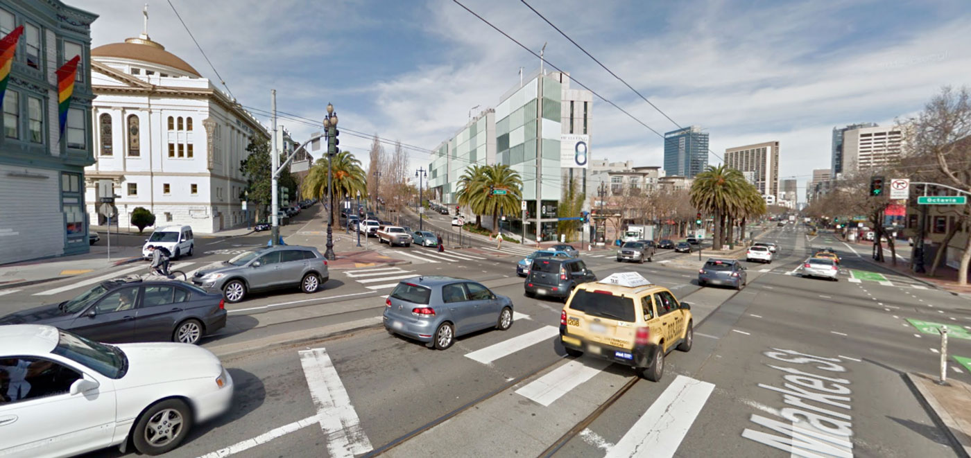
October 2018: The Board of Supervisors enact legislation restricting new automobile driveways on the City’s major walking, cycling, and transit streets.

December 2018: The Board of Supervisors vote to eliminate the City’s remaining minimum parking requirements.

A Decade of Change

Like every other US city, San Francisco imposed minimum parking requirements after World War 2.  The 1970’s saw the emergence of the environmental, historic preservation, and livable streets movements that offered a strong critique of automobile dependence. The opening of BART in 1973 provided the impetus for limiting commuter parking in San Francisco’s growing downtown, which resulted in the first parking limits as part of the city’s Downtown Plan. Since then plans and policy changes have increasingly embraced a new understanding of the role of reduced and better managed parking in creating healthy, livable, and sustainable urban neighborhoods.

Between 1968 and 1997, every neighborhood in the city had a minimum residential parking requirement, no neighborhood had a residential maximum, and only one neighborhood (Downtown) placed an upper limit on the amount of non-residential parking. Since 2005, parking requirements have been removed throughout the City and maximums established, at first neighborhood-by-neighborhood, and finally Citywide early in 2019.

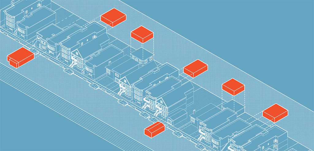
In addition to reducing parking requirements, the City has developed a toolkit of complementary development requirements to reduce automobile dependence, including unbundling parking costs from housing costs, building secure bicycle parking in new and renovated buildings, requiring car-share spaces in large new developments, and improving sidewalks and transit stops adjacent to new developments.

Looking Forward

Livable City has been the City’s principal parking reform advocate for nearly two decades, and continues working with neighbors, planners, and the Board of Supervisors to improve the City’s parking policies and parking management, and to expand unbundling, car-sharing, and bicycle parking citywide.

Parking reform is an important element of creating a sustainable civic culture that supports car-free living, but not the only one; we also need to complete and improve our fragmented bicycle and pedestrian networks, improve Muni service, link up and expand regional transit, and design walkable communities where jobs, shops, schools, parks, and recreational and cultural facilities are located within convenient walking and cycling distance.

Livable City remains San Francisco’s leading advocate for progressive parking reforms; see our parking reform campaign page to learn about our current campaigns, and to get involved.

Livable City’s Greenway Initiative

The goal of the Greenway Network Initiative is to create a citywide network of landscaped boulevards, green streets, and linear parks which link the city’s neighborhoods to one another and to the major parks, wildlife corridors, waterfront, and public transit hubs. The Network will serve as sustainable transportation infrastructure (walking, bicycling, and public transit), and provide stormwater infiltration and management, natural habitat, recreation, and neighborhood economic development. The Greenway Network will also include the San Francisco portions of the regional Bay Trail and Ridge Trail and the statewide Coast Trail.

Like many older cities, San Francisco has a combined sewer system, and its historic creeks have mostly been filled and culverted to create its combined sewer network. Fortunately, several of San Francisco’s historic lakes and streams have not been built over, and can be restored.

The city’s park system is extensive and covers almost 30% of the urban area.  Unfortunately, its most densely-populated eastern neighborhoods lack open space, and the streets in these neighborhoods have heavy traffic volumes, little greenery, and high rates of pedestrian deaths and injuries from traffic.

Greenway Network

Purposes

  • Recreation: provide a citywide network of paths suitable for walking, jogging, and bicycling.
  • Open space: provide open space in neighborhoods, and link neighborhoods to major open spaces.
  • Water quality: provide opportunities for groundwater recharge, cleansing urban runoff, and preventing sewage outflows into the Bay.
  • Environmental restoration: restore natural vegetation as well as streams, lakes, and wetlands where feasible.
  • Environmental Education
  • Wildlife corridors: allow plants and animals to move between larger habitat areas, overcoming the effects of habitat fragmentation.
  • Hazard reduction: prevent or mitigate hazards from flooding, landslides, liquefaction.
  • Sustainable economic development: the greenway network will enhance neighborhood character and stimulate local economic revitalization.

Objectives

From isolated parks to open space network

  • Link major parks to one another.
  • Link neighborhoods with few parks to the city’s major parks and to the shoreline.
  • Link to regional greenway networks (bay trail, ridge trail, coast trail).
  • Integrate current greenway proposals into a continuous system (Blue Greenway, Mission Creek Greenway, Islais Creek Greenway).
  • Provide new greenway connections using publicly-owned lands (Glen Park to Golden Gate Park)

Create high quality and continuous bicycle, pedestrian, and public transit networks.

  • Create standards for pedestrian, bicycle, and public transit facilities and amenities.
  • Connect greenway network to transit network.
  • Integrate with the bike network and provide Class 1 bike trails where possible.

Serve as “green infrastructure” to improve water quality and lower “grey infrastructure” costs

  • Shift from 19th century water management model to watershed model.
  • Integrate tree planting, landscaping, permeable paving, and depaving projects.
  • Enable groundwater recharge.
  • Restore natural drainage and watershed patterns where possible.

Conserve and enhance biodiversity

  • Restore wetland and riparian habitats (Islais Creek, Laguna Honda, etc.)
  • Link significant natural areas to one another
  • Reduce or eliminate sewage releases into the bay
  • Improve groundwater and stream water quality
  • Provide wildlife corridors across the city

Greenway Network News

Restore Sharp Park!

Livable City supports the campaign to Restore Sharp Park, by converting a flood-prone golf course owned by the City of San Francisco into a restored creek and coastal wetland habitat, with more opportunities for healthy outdoor recreation. Sharp Park can become a connector between the California Coast Trail and the Bay Area Ridge Trail.

Greening San Francisco’s Waterfront

San Francisco’s waterfront used to be one of the world’s great cargo ports. The switch to shipping containers and superior rail access have made Oakland into the Bay Area’s prime cargo port, creating the opportunity to reimagine San Francisco’s waterfront. Some maritime industries remain viable (fish processing at Pier 45, and a working dry dock at Pier 70) and should be preserved, but much of the waterfront can be opened to recreation, open space, and environmental restoration. The Waterfront’s fine buildings, especially the historic pier buildings on the northern waterfront, and the buildings and Pier 70 should be restored, and new uses found for them. New development on port lands should complement, not dominate, the public uses of the waterfront. Livable City’s waterfront priorities include:

  • Creating a continuous bikeway along the water side of the Embarcadero, and creating new public spaces along the water on what are now parking lots. (Livable City worked with designer Carrie Nielson on her Embikeadero Proposal.
  • Prevent the Port of San Francisco from turning the waterfront plaza behind the Ferry Building into a parking lot, and instead create a set of world-class public places around the Ferry Building.
  • Transform the little-used, four-lane Terry Francois Boulevard into a waterfront promenade and bicycle path.
  • Complete Cargo Way’s transformation into a green boulevard with a separated bicycle path. Livable City worked with the Port and the Redevelopment Agency to craft the the Cargo Way conceptual plan (Final Report [PDF]).

Burnham’s Plan for San Francisco

The last comprehensive plan San Francisco had for a greenway network was over a hundred years ago, when architect Daniel Burnham proposed a greenway network as part of his comprehensive plan for San Francisco.

Livable City’s Greenway Network proposal seeks to capture the spirit of the Burnham Plan by connecting the city’s parks through reclaiming utility easements and street and freeway rights-of-way as public spaces, and by transforming the city streets into a pedestrian-oriented network of boulevards and green neighborhood streets.

Converting Garages in San Francisco

In a city where housing is increasingly scarce and expensive, and where commercial rents are skyrocketing, converting garage spaces to new housing and storefronts can help make space for residents and neighborhood-serving small businesses.

Réveille Coffee, at 4076 18th Street in the Castro, opened in a former garage space. Livable City helped author the ordinance that allowed this garage conversion.

Converting garages can also improve neighborhood livability by restoring features like front gardens, green backyards, front porches, storefronts, building lobbies, street trees, and even on-street parking spaces.

For decades San Francisco had off-street parking requirements which precluded garage conversion, but no longer – after progressively chipping away at requirements for more than a decade, San Francisco completely eliminated minimum requirements at the end of 2018. San Francisco still requires off-street freight loading for certain large buildings, and secure bicycle parking in most buildings.

Will conversion of garages mean more competition for street parking? Recent studies suggest it may not. An exhaustive UCLA study found that only 25% of American garages were used to store a car. Three-quarters of garages were used for storage. A 2007 survey of the Mission District found that adding garages to houses had removed 41% of on-street car parking spaces, but that only half of garages were used to store cars. If curb parking spaces are restored when garages are removed, loss of off-street parking can be offset by new on-street spaces. In commercial districts, driveway cuts will be replaced by the high-turnover metered parking spaces helpful to shoppers and neighborhood businesses.

Some bigger societal shifts are also reducing the need for garages. Americans, in particular younger Americans, are driving less. In recent years, the number and percentage of San Franciscans walking, cycling, using transit or employer shuttles, car-sharing, and ride-sharing has increased. New households in San Francisco are overwhelmingly car-free.

What follows is a simplified guide to the new rules. Most of these rules vary by zoning district. To find the zoning district for your property, consult San Francisco’s online Property Information Map. In addition to the Planning Code requirements outlined here, Building Code requirements also apply, and construction permits may be required.

Converting Garages to Bicycle Parking

Any off-street parking space can be converted to bicycle parking.

Converting Garages to Housing

Recent Planning Code changes expanded opportunities to convert off-street parking to housing. Accessory Dwelling Units (ADUs) are now permitted in all zoning districts that permit housing. ADUs can be built without parking spaces, and may convert a parking space to a new dwelling unit. Detached garages and carriage houses may also be converted into ADUs.

Existing housing units can also expand into garage space. Houses and apartments can expand into ground floor spaces in keeping with the ‘rooms down’ standards.

Housing is permitted in the City’s residential,  commercial neighborhood commercial, and mixed-use districts. The only areas where parking cannot be converted to housing are the City’s industrially-zoned districts (called PDR districts), and on certain commercial streets where ground-floor residential uses are restricted, specified in Section 145.4 of the Planning Code.

Converting Garages to Storefronts

garage on Linden Alley became Blue Bottle Coffee
This garage on Linden Alley became Blue Bottle Coffee

In districts that permit commercial uses, off-street parking spaces can be converted to commercial spaces.

Removing off-street parking is permitted citywide, however the replacement use may require additional review and approval, depending on the specific use proposed and the rules for the zoning district. Off-street freight loading or bicycle parking that meets current requirements must be retained.

Commercial uses are limited in Residential districts. However, existing commercial uses in Residential districts are grandfathered in, and require no off-street parking. Former storefronts in Residential districts may now be reactivated (Sec. 186), with no required parking. New corner commercial uses are permitted in RTO, RTO-M, RM-3, and RM-4 districts (Sec. 231), and Commercial uses may be conditionally permitted in historic buildings in Residential districts (Sec. 209.9(e)).

All storefronts, existing and new, are subject to the Planning Code’s transparency requirements.

Converting Garages to Community Uses

Community clubhouses, neighborhood centers, and community cultural centers are permitted in most zoning districts, including Residential districts, as are religious institutions, childcare, and other institutional uses.

Reconfiguring Parking

Parking may be also be reconfigured to be more space-efficient, freeing up space for other uses. Several years ago Livable City helped relax the Planning Code’s restrictions on space-efficient parking, and tandem parking is now permitted in all districts, as are lifts and stackers.

Resources

2015 Livability Awards

Please join Livable City for our annual Livability Awards on June 1 from 6 to 9 p.m. at Public Works SF in the Mission.

  This event is an opportunity for Livable City to recognize innovators, advocates, and public servants for their leadership and accomplishments and celebrate with our amazing members and friends. Enjoy an open bar, great food and drink from our friends at Delfina, Tartine Bakery, Dolores Park Cafe, and New Belgium!

Everyone is welcome to attend, and 2015 Livable City supporters come for free! Earlybird tickets are $45 each and $55 at the door.

purchase tickets


2015 Awardees

[one_third]

[/one_third]

[two_third_last]

Sam Mogannam

Livability Innovator in Sustainable Business

Sam Mogannam is the second-generation owner of Bi-Rite Market and founder of the Bi-Rite family of businesses, which includes Bi-Rite Creamery, 18 Reasons, and Bi-Rite Farms. He also serves on the board of the National Association for the Specialty Food Trade. Sam has been featured in Food & Wine, Bon Appétit, Sunset, and the San Francisco Chronicle, and programs such as Foodcrafters. Sam stepped into the family grocery business in 1997, after working as a chef at his own restaurant, and transformed the market into a culinary landmark.
The Livable City Board of Directors is honored to award Sam the Livability Innovator in Sustainable Business award for several reasons. Bi-Rite directly employs several hundred employees, and encourages car-free commuting. He has established partnerships with Northern California farmers (and established his own farm) to bring fresh, local produce to urbanites. The 18 Reasons non-profit provides free Cooking Matters classes in low ­income communities around the Bay Area, empowering San Francisco with confidence and creativity to buy, cook, and eat good food every day.

[/two_third_last]

[one_third]


[/one_third]

[two_third_last]

Bonnie Nelson

Livability Pioneer in Transportation Planning

Bonnie Nelson, Principal and Founder of NelsonNygaard Consulting Associates has reshaped the transportation industry, and she has deeply impacted the careers of hundreds of influential transportation professionals. Over her career, she has helped rethink access to our National Parks, reducing vehicle traffic by providing alternatives to driving within the parks. She has worked to reorganize streets across the U.S. that prioritize quality of life, safety, and reduced emissions. Since 1987, with colleague Diane Nygaard, Bonnie has established a fun, flexible, egalitarian, and creative work environment. The woman-owned business continues to be a national leader in supporting other small, women-owned and minority-owned businesses.
The Livable City Board of Directors is honored to recognize Bonnie’s body of work in progressive transportation, as an international leader and mentor in transportation planning, and for her promotion of women in transportation planning.
[/two_third_last]

[one_third]

IMG_3690 copy

[/one_third]

[two_third_last]

San Francisco Planning Department – Legislative Affairs Team

Livability Awardees for Public Service

The Legislative Affairs team has made a tremendous impact on how we interact with our city. The diverse team of Kimia Haddadan, AnMarie Rodgers, Diego Sanchez, and Aaron Starr bring a wealth of knowledge to creating effective legislation. Kimia has worked to create a pathway to legalization for tens of thousands of in-law units and spearheaded bicycle parking legislation, which overhauled and upgraded the City’s requirements for bicycle storage with a more bicycle friendly approach. AnMarie has initiated and shepherded new city laws for green landscaping, formula retail and bird-safe buildings, winning a congressional commendation for her work on integrated neighborhood transit. Diego’s work has created an array of ordinances that make San Francisco a more livable city, including Supervisor Breed’s Off-Street Parking Exceptions Ordinance and Supervisor Kim’s McCoppin Plaza Rezoning.  He is also working with the Mayor’s Office and Supervisor Campos’ Office to explore changes to existing land use controls in the Mission District’s 24th Street corridor with the aim of preserving and enhancing the corridor’s vibrancy and appeal. Aaron has worked with Livable City on reforming the Restaurant Ordinance, which rationalized and consolidated the city’s restaurant definitions; the Article 2 reorganization, which simplified Article 2 of the planning code, consolidated all use definitions into one section of the planning code, and the Short-term rental ordinance.
Livable City is proud to recognize the Legislative Affairs team for their fast, professional analysis and recommendations on every planning law approved by the City, and their work in completing long-needed overhauls of planning regulations, including those for zoning districts, land uses, restaurants, and formula retail.

[/two_third_last]

[one_third]

DS-headshot-medium1 copy

[/one_third]

[two_third_last]

Dave Snyder

Livability Advocate in Cycling and Active Transportation

Dave Snyder is a long-time organizer and advocate for socially just transportation and land-use policies. Dave is the founding Executive Director of Livable City, which originally grew from the San Francisco Bicycle Coalition. Dave recently concluded nearly six years of service on the Golden Gate Bridge Highway & Transportation District Board of Directors, where he advocated for public transit, cycling and pedestrian rights. Today, Dave is the Executive Director of the California Bicycle Coalition. CalBike has achieved a number of state-wide victories for cycling access and safety, including the establishment of a three-foot rule between cyclists and vehicles, and increased spending on cycling infrastructure.
The Livable City Board of Directors is proud to recognize Dave for his tireless work to promote and expand cycling rights and infrastructure.

[/two_third_last]

purchase tickets

 Have you donated $45 or more to Livable City in 2015? Contact us for your complimentary ticket!

Sponsorship Opportunities

[one_third]

Steam_shovel_WDC_1933 copy

[/one_third]

[two_third_last]

As a sponsor for Livable City’s Livability Awards, you are supporting a San Francisco of great streets and complete neighborhoods, where walking, bicycling, and transit are the best choices for most trips, where public spaces are beautiful, well-designed, and well-maintained, and where housing is more plentiful and more affordable, along with supporting programs like Sunday Streets. You are also recognizing the achievements of our awardees, Sam Mogannam, Bonnie Nelson, the San Francisco Planning Department’s Legislative Affairs Team, and Dave Snyder.
Your tax-deductible contribution reinforces the work of our awardees and Livable City’s efforts throughout the year. For information on how you can become a sponsor, click here.

[/two_third_last]

2015 Sponsors

 PLATINUM SPONSOR

 GOLD SPONSOR

SILVER SPONSORS

[one_third]

[/one_third]

[one_third]

[/one_third]

[one_third_last]

[/one_third_last]

[one_third]

logo_only_-_orange_-_pantone159U_-_raster_600dpi[/one_third]

[one_third]

ggra_logotype_big-jpg.original

[/one_third]

[one_third_last]

[/one_third_last]

[one_half]

[/one_half]

[one_half_last]CASE-SCB-01-logo-[/one_half_last]

BRONZE SPONSORS

[one_third]

Fehr & Peers

[/one_third]

[one_third]

Tartine Bakery

[/one_third]

[one_third_last]

Pizzeria Delfina

[/one_third_last]


[one_half]

New Belgium Brewing Company

[/one_half]

[one_half_last]

Dolores Park Cafe

[/one_half_last]


 Public Works is located at 161 Erie Street (off Mission St. between Duboce & 14th Street). We will have complimentary bike parking for this event.

View photos from last year’s event here.   

New Accessory Dwelling Units Could be Allowed in More SF Neighborhoods

accessoryunitLivable City has long championed legalizing the addition of new apartments, known as accessory dwelling units or in-law units, to existing buildings. As we explained back in December:

Adding housing to existing buildings is great way to add housing to neighborhoods while preserving their character and history. Adding housing to existing buildings is greener – the energy and resources embodied in these building is conserved, and new units take advantage of existing investments in structure and infrastructure. New units in rent-controlled buildings are rent-controlled, so allowing new units in existing buildings can grow the city’s rent-stabilized housing stock over time.

Last year, The Board of Supervisors approved Supervisor Wiener’s ordinance permitting new units in existing buildings in the Castro neighborhood. The ordinance permits exceptions from certain Planning Code requirements – density, off-street parking, private open space, and exposure requirements – which typically prevent the addition of new units to existing buildings.

This spring, two supervisors have introduced legislation to permit new accessory dwelling units in more areas of the city. On April 14, Supervisor Wiener announced he was introducing legislation to permit new accessory units in Noe Valley, Glen Park, and Diamond Heights.

On April 28, Supervisor Julie Christensen announced that she is drafting legislation to permit new accessory dwelling units in the 3rd Supervisorial District, which includes Chinatown, North Beach, Russian Hill, Nob Hill, Polk Gulch, and the Northeast Waterfront:

These new units, which Planners call Accessory Dwelling Units, can be added within the envelope of older, existing residential buildings, many on ground floors where they are accessible for our seniors and persons with disabilities. These units, when created in a currently rent-controlled building, will also be rent-controlled. As 95% of our residential buildings in District 3 were built before 1979, this opens the opportunity for the addition of a number of units.
These units are less expensive to build than other apartments due to several factors: no new land is required, the buildings are already built, the entitlement process is shorter, and most supportive infrastructure is already in place. The creation of these units will add new housing without changing the feel and character of our neighborhoods.

in-laws-units

On April 25, Supervisor Wiener’s ordinance permitting new units in buildings undergoing earthquake-safety retrofits went into effect. This ordinance permits the addition of new rent-controlled units in existing buildings across the city if the buildings comply with the City’s mandatory or voluntary retrofit standards, creating a financial incentive to protect existing residential buildings from earthquakes.

Get in Touch

Staff Directory

Darin Ow-Wing, Executive Director
[email protected]

Jessica Tovar, Program Director
[email protected]

Sally Chen, Deputy Director
[email protected]

Tom Radulovich, Senior Policy Fellow
[email protected]

Isaac Santiago, Sunday Streets Program Manager [email protected]

Reina Terry, Program & Development Associate, reina@livablecity.org