Blog

S.F. Expands Priority Conservation Areas

On April 21, the San Francisco Board of Supervisors approved the designation of five Priority Conservation Areas (PCAs) in San Francisco.

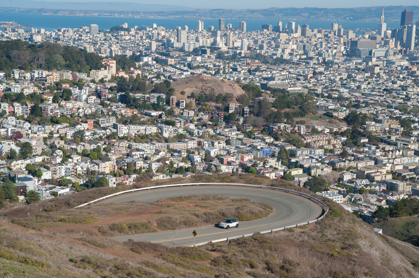
view from twin peaks

Priority Conservation Areas are Bay Area open spaces that “provide regionally significant agricultural, natural resource, scenic, recreational, and/or ecological values and ecosystem functions; are in urgent need of protection due to pressure from urban development or other factors; and are supported by local consensus.”

PCAs are eligible for regional funding for land acquisition, public access and recreation improvements, and environmental restoration. PCAs are intended to complement the designated Priority Development Areas,and both are elements of Plan Bay Area, the Association of Bay Area Governments’ regional transportation and land use strategy.

San Francisco’s five priority conservation areas are the Palou Phelps Natural Area, Bayview Hill Natural Area, McLaren Park, Twin Peaks Bioregion (San Miguel Hills), and San Francisco Bay Area Water Trail.

Livable City successfully advocated for an expanded priority conservation in the San Miguel Hills, reaching from the edge of Golden Gate Park to Glen Park, and including Mount Sutro, Laguna Honda, Sutro Tower Twin Peaks, Glen Canyon, and surrounding publicly-owned lands. The current designation greatly expands on the prior PDA, and advances the vision of an interconnected network of public parks across central San Francisco.

Livable City nominated two additional areas – Yerba Buena Island, and the Eastern Waterfront. These were not included in Supervisors’ Resolution, but we will work to include them in the next update.

“Unaccepted” Townsend Street is Unacceptable

San Francisco has about 850 miles of streets, in 12,500 street segments, covering about a quarter of San Francisco’s land area. 2,224 of those street segments are “unaccepted streets” – streets that are not maintained by SF’s Department of Public Works. Over half of those streets are paved, but often one or more features – sidewalks, drainage, pavement – are not built to City standards. Some of these streets meet city standards, but are maintained by other agencies – Recreation and Parks, The Port, the Redevelopment Agency, or Caltrans. Others are privately maintained streets and alleys. 323 are “paper streets” – streets that are legislated as public rights of way, but are unbuilt and often impassible.

Whether a street is accepted and unaccepted streets is often a result of historical accident, rather than a coherent policy. Sections of some of San Francisco’s most-travelled streets, including Beale, Bryant, 15th, Howard, and Townsend streets and Geneva, Ocean, and San Jose avenues, are unaccepted. Some unaccepted streets meet city standards, yet many accepted streets are substandard.

San Francisco has a similarly piecemeal approach to sidewalks. Sidewalks are generally the responsibility of adjacent property owners to install and maintain. However where sidewalks are substandard or nonexistent, there is no obligation to install them except as a condition of certain building approvals – new buildings, and some major additions and changes of use.

Some unaccepted streets should be repurposed into parks, pedestrian paths, or community gardens – valuable open spaces in an increasingly crowded city. Some other streets are important paths of travel for walking, cycling, transit, or auto traffic, and need to be upgraded and properly maintained.

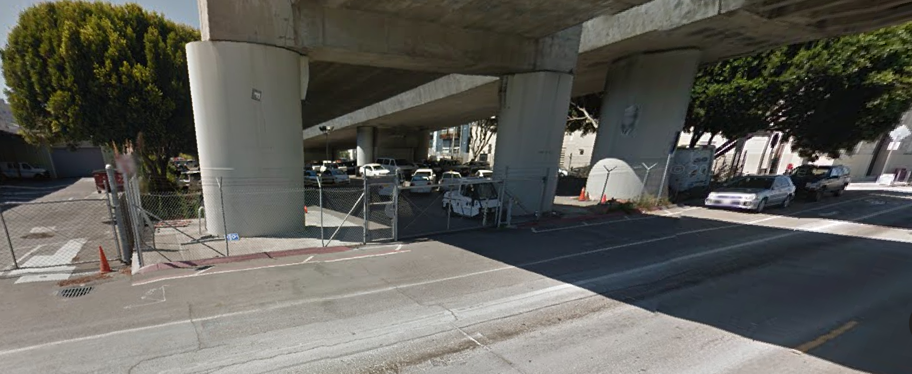
Townsend Street, which is unaccepted between 5th and 7th streets, is a good illustration of how San Francisco’s piecemeal system of street acceptance and maintenance breaks down, which makes the street inaccessible for many, and puts street users in mortal danger. Townsend is the primary pedestrian connection between the Caltrain station at 4th and Townsend streets and the Showplace Square neighborhood, which is home to thousands of jobs and residents. Townsend lacks continuous sidewalks, and while it is a street in the bicycle network, street lighting is inadequate, and the pavement is dangerously rutted and lacks proper drainage.
Townsend@6th

A 2008 Chronicle article documented Townsend Street’s fundamentally dangerous design:

In the 21st century, a city street without a sidewalk is like an apartment without a refrigerator or a skyscraper without an elevator. Shouldn’t happen. But a stretch of San Francisco’s South of Market corridor on Townsend Street has no sidewalks. . Several people have contacted ChronicleWatch to complain, saying pedestrians using Townsend Street between Fourth and Seventh streets have to walk in the street- and risk being sideswiped by traffic.

85-year-old resident Francis Rigney was injured in a collision with a bicyclist; the lack of sidewalks forced him to walk in the street, and the poor street lighting made him difficult to see. In response, the Department of Public Works jury-rigged a walkway (not a proper sidewalk) on the south side, but this walkway ends short of 7th Street. No improvements have been made to Townsend since then.

A recent Streetblog article documented the dangerous conditions for cyclists near the Caltrain Station, and made the case for protected bicycle lanes on Townsend Street. Townsend, which has no intersecting streets on the south side between 4th and 7th Streets, is ideal for a separated cycle path.

In a City that has officially embraced Vision Zero, major streets without sidewalks is unacceptable. Townsend street’s design creates an absolute barrier to access for people with disabilities, and imposes dangerous conditions on all other users. The urgency of improving Townsend is greater than ever – hundreds of new office jobs are springing up along Towsend, and hundreds of new apartments under construction in Showplace Square, while the Central Subway is under construction on 4th Street, and a new Caltrain station with an extension to downtown is planned. Bicycle network improvements are in place or  planned on several intersecting streets, including 2nd, Embarcadero, 5th, 7th, 8th, Division, and Henry Adams. Livable City is partnering with neighbors and advocates to get Townsend Street from the Embarcadero to 8th, redesigned, rebuilt, and the unaccepted  blocks from 4th to 7th accepted for city maintenance.

DPW Map of unaccepted streets, April 2015


Reclaiming San Francisco’s Alleyways

Public rights-of-way – streets and alleyways – make up about a quarter of San Francisco’s land area. Projects that reclaim alleyways as neighborhood-serving public places with greening, traffic-calming, and pedestrianization are moving forward in 2015.

Living Alleys, also known as woonerfs, are shared space alleyways that prioritize pedestrian use and open space, using special paving, traffic calming, lighting, seating, green landscaping, and other design features to indicate that vehicles are visitors and pedestrians have primacy across the full width of the right-of-way.

Pedestrianized alleyways, also called paseos, are closed to auto traffic. Some alleyways, like Maiden Lane in Union Square, are pedestrian spaces for part of the day, but allow delivery and other auto access at other times.

Market-Octavia Living Alleyways

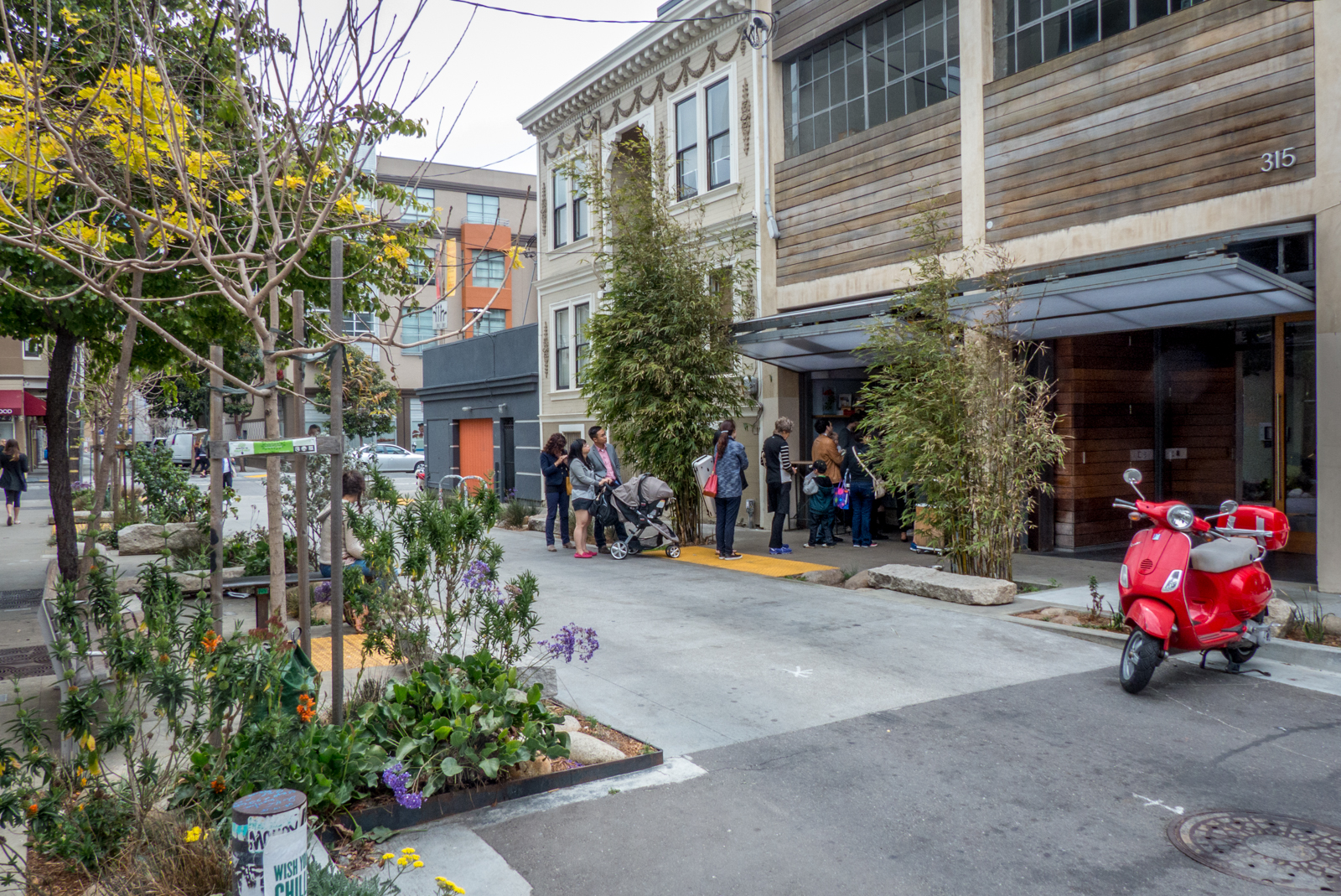
The 2008 Market and Octavia Neighborhood plan recognized the potential of Hayes Valley’s many alleys to become safe, green, and inviting public places.

linden alley-blue-bottle

Neighbors David Winslow and Loring Sagan created the Linden Living Alley, which won an award for innovation by Livable City in 2011. To build on the success of Linden Alley, the Planning Department created the Market Octavia Living Alleyways program, which unveiled its Living Alleys Toolkit this week. The toolkit serves as a how-to guide and pattern book for transforming alleyways in Hayes Valley and beyond.

Annie Street Plaza

In November of last year, a block of Annie Street between Mission and Ambrose Bierce streets was transformed into a Annie Street Plaza, with seating and landscaping. The Hearst Corporation, which owns the nearby parking garage, initially supported the plaza, but appealed several months later to tear out the plaza. After an outpouring of community support, Hearst dropped its appeal, leaving Annie Street Plaza secure for now for neighbors, workers, and visitors to enjoy.

SoMa Alleyways

SoMa’s pattern of big blocks and wide streets is crisscrossed with dozens of alleyways, which are home to SoMa’s many residential enclaves. The SoMa alleyways project got a boost in January, when the last SoMa redevelopment bond funds were allocated to the project. The second phase of the SoMa Alleyways project will install traffic calming treatments, lighting, landscaping, and new paving on six alleyways – Minna, Natoma, Tehama, Clementina, Shipley, and Clara – that run between 6th and 5th Streets. The first phase, which included Minna and Natoma between 7th to 6th streets and Moss, Russ, and Harriet between Howard and Folsom streets, was completed in 2011.

Action for Alleyways

Livable City has helped enact city policies that preserve and improve alleyways – requiring alleyways be lined with active, pedestrian-oriented uses, relaxing off-street parking requirements in dense alleyway neighborhoods, protecting sunlight to alleyways, allowing developments to satisfy public open space requirements by greening and pedestrianizing adjacent alleyways, and requiring new streets and alleyways in certain large developments on large blocks.

However, there’s more the City should do preserve and enhance our alleyways, and realize their potential as safe and green neighborhood-serving public places.

Protect alleyways from privatization. Dozens of San Francisco’s streets and alleyways disappeared during the Redevelopment era, with its mania for wide roads and superblocks. Newer City policies call for the preservation of small blocks and human-scaled streets and alleys. Unfortunately, city government sometimes abandons its urbanist principles for politically-connected projects, like the massive 5M project, which propose alleyway privatization.

Neighborhood alleyway plans. Neighborhood alleyway plans, the Chinatown Alleyways Master Plan, the Downtown Streetscape Plan, and SoMa Alleyways plan, allow neighbors to plan the future of their alleyways, and have provided an action plan for implementation. The City should support new neighborhood alleyway plans, revive and extend older plans like the Downtown Streetscape Plan, and commit staff and funding to implementing these plans.

Strengthen City support for alleyway projects. The city often makes it difficult to reclaim and transform alleyways. The city’s imposing bureaucracy, lack of clear standards and policies, and liability requirements can  be a barrier to people-oriented projects in the public right-of-way. The City generally requires adjacent property owners to maintain living alleys and people-oriented street designs, but will maintain conventional automobile-oriented streets at public expense. The City should support green and people-oriented streets with improved standards and design and construction assistance, and better strategies for maintaining these places over time.


Daniel Burnham’s Plan for San Francisco

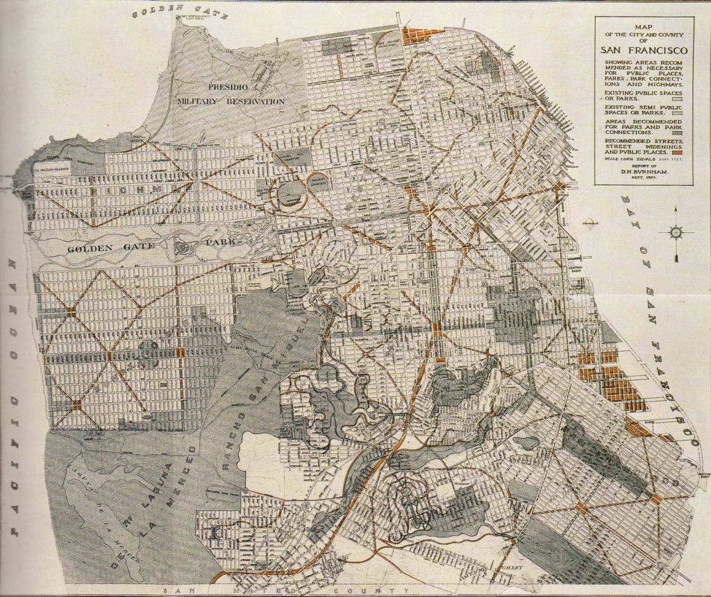
The last comprehensive plan San Francisco had for a greenway network was over a hundred years ago, when architect Daniel Burnham proposed it as part of his comprehensive plan for the City.

When Burnham submitted completed plans and drawings to the City, Mayor Schmitz declared, “On behalf of the citizens of San Francisco, it gives me great pleasure to accept these plans and to state that in the future, they shall forever be our guiding star, as far as the beauty of the city is concerned.”

Burham’s plan was released, with great fanfare, just a few weeks before the 1906 Earthquake and Fire. It proposed carving a network of monumental new boulevards and public spaces through the city’s street grid. The plan also proposed that much of what was then undeveloped San Francisco remain as parkland – a great park, for example, would have swept from Twin Peaks to Lake Merced, and the canyon of Islais Creek, now occupied by Interstate 280, would have been a canyon park like Washington DC’s Rock Creek Park.

Although the 1906 Earthquake and Fire devastated two-thirds of San Francisco, the Burnham Plan’s vision for an integrated system of boulevards and parks was largely ignored, and the city’s subsequent development left the city’s parks largely separate from one another.

Livable City’s Greenway Network proposal seeks to capture the spirit of the Burnham Plan by connecting the city’s parks through reclaiming utility easements and street and freeway rights-of-way as public spaces, and by transforming the city streets into a pedestrian-oriented network of boulevards and green neighborhood streets.

2014 in Review: Complete Streets and Greenways

2014 saw progress towards complete streets and a greenway network for San Francisco – and also showed that the city’s projects and practices are still falling far short of its standards, policies, and goals.

viz valley walk

Vision Zero

Vision Zero – the goal of eliminating traffic deaths within a decade – made progress in 2014. Various city agencies adopted Vision Zero policies, and some adopted action plans to get to zero. In 2013 City’s Pedestrian Strategy identified the six percent of city streets where over half of pedestrian deaths and serious injuries occur, and the WalkFirst program, announced in March, aims to improve 170 priority intersections over the next five years. Many low-cost projects, including adjustments to traffic signal phases, higher-visibility crosswalksintersection daylighting and a smaller number of corner bulbouts, got underway in 2014. However, the city has yet to commit to fully funding WalkFirst, and the Mayor delayed the vote on a proposed Vehicle License Fee increase with funding for Vision Zero until 2016. Fortunately the passage of Propositions A and B in the November 2014 election provide additional funding that can be used for pedestrian safety projects.

Complete Streets

Complete Streets are streets that successfully integrate walking, bicycling, and public transit into street design, and serve as green public spaces that support neighborhood livability. San Francisco’s Better Streets Policy calls for such a wholistic approach to street design, and our Complete Streets ordinance requires integration of walking, cycling, transit, and greening elements into major streets projects.

Notable Complete Streets projects in 2014 include Castro Street, which completed in October with wide sidewalks, street lighting and street trees, and public art. Low-cost improvements were made to Persia Triangle in the Excelsior, and a short stretch of Annie Alley downtown was converted into a pedestrian plaza.

SFMTA missed opportunities for a complete streets approach as it rolled out several transit-priority street projects as part of the Transit Effectiveness Project, and DPW proved unwilling to coordinate complete streets projects into its repaving and curb ramp programs. Passage of Proposition A in November will generate nearly a half-billion dollars for transit-priority projects, so lack of will, not lack of money, will remain the major impediment to Complete Streets going forward.

Livable City championed Planning Code amendments, approved at the end of 2014, to strengthen the streetscape improvements required of development projects.

A greener, more accessible waterfront

The second proposal to install a parking lot on the plaza behind the Ferry Building was abandoned early in 2014, and in June San Francisco voters passed a measure requiring a public vote to increase allowable building heights on the Port’s waterfront lands. Livable City participated in a waterfront open space task force that identified both new open space opportunities along the Embarcadero and improvements to existing open spaces. Planning began for a continuous bicycle path along the Embarcadero, along with complementary pedestrian improvements. A project to improve the Bay Trail by replacing parking with dedicated pedestrian and bicycle paths along the Marina Yacht Harbor advanced. Northeast Wharf Park, the second new waterfront park funded by San Francisco’s 2009 Parks Bond, opened next to the new Cruise Ship Terminal at Pier 27. Proposition F, a Pier 70 plan which included commitments to several acres of new waterfront open space as part of a mixed use project, was approved by voters in November.

On the City’s Western shoreline, the Ocean Beach Master Plan held workshops to identify near-term improvements that can be completed over the next few storm seasons.

Greenway Network

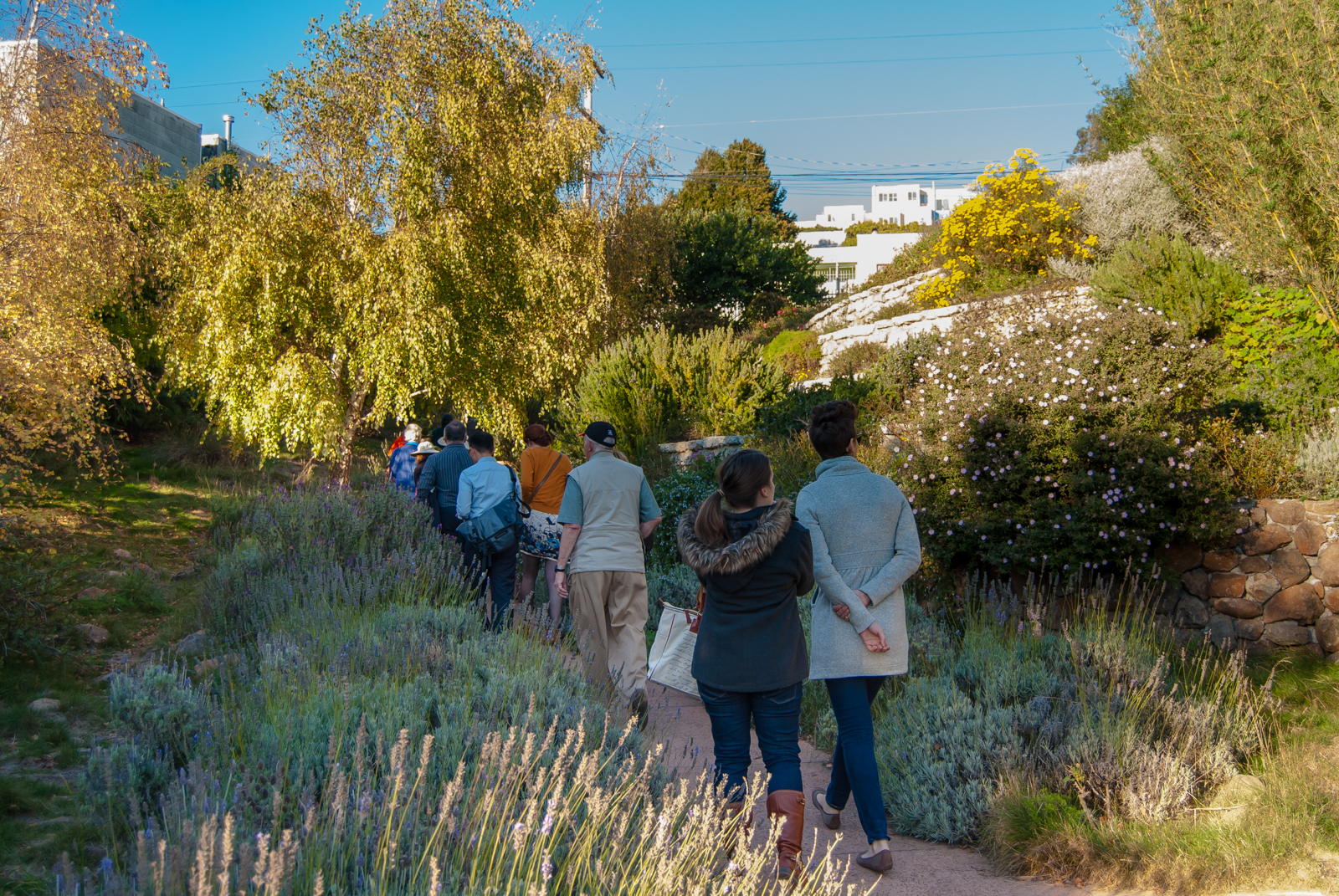
A citywide Greenway Network, first proposed by Livable City almost a decade ago, was embraced in the draft Recreation and Open Space Element (ROSE) of San Francisco’s General Plan. The ROSE was adopted by the Planning Commission in April, but the Board of Supervisors has yet to adopt it. The Green Connections Plan, completed in March 2014, identified walking or hiking routes criss-crossing the city, and the ROSE included a proposed Crosstown Greenway that includes the Greenway Network’s Glen Park-to-Golden Gate Park Greenway, and extends it north to the Presidio and southeast to McLaren Park.


The Future of Downtown’s Public Spaces

powell-street-sf

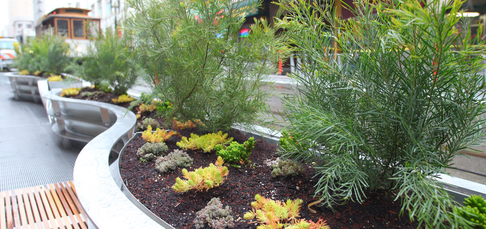
As San Francisco’s Downtown gets denser, and increasingly mixed-use – housing, retail, hotels, entertainment, and cultural institutions along with offices – it needs better public amenities – better streets, greenery, and usable and appealing public open spaces. The Downtown Plan, adopted in 1985, emerged from the ‘Planning Wars’ of the late 1970s and early 1980s. The Downtown Plan’s intent was to improve building design and establish better controls on building height and bulk, and to preserve and improve Downtown’s streets and public open spaces. Privately-owned public open spaces – POPOS – have been a mainstay of the Downtown public space strategy for the past three decades.

Recent changes strengthen open space commitments

In recent years there has been an increased focus on preserving and improving Downtown public spaces, including POPOS. SPUR published a guide to Downtown’s 68 POPOS. Observers, including the Chronicle’s John King, observed how inaccessible many of these public spaces are, and how they vary greatly in quality. In 2012, the Planning Department strengthened their standards for POPOS signage and public access, and stepped up enforcement of their requirements.

Streets and alleyways are also important parts of the Downtown public space network. As Downtown becomes more residential and new development spreads into the huge South of Market blocks, pedestian-oriented alleyways become more important to maintaining and establishing human scale and livability. Pedestrianized alleyways, like Maiden Lane and Mint Plaza, have become fine public spaces. Livable City helped enact zoning changes to require that large sites on large blocks extend streets and alleyways, and allow these new pedestrian alleyways, or converted alleyways, to meet open space requirements. We also worked to require public open spaces as part of large retail projects, and ensure that new buildings face streets and alleyways with active, pedestrian-oriented uses.

Intercontinental Hotel proposes POPOS privatization

The Intercontinental Hotel site was spot-zoned in 2003 to double the allowable height, and increase both permitted bulk and floor-area ratio (FAR). The project built two POPOS, on the 4th and 6th floors. The POPOS may not have been built as agreed or to City standards.

Supervisor Jane Kim introduced an ordinance in July on behalf of the property owner, allowing a building within the Downtown Support Special Use District (a zoning district created especially for the Intercontinental Hotel) to cash out of its POPOS obligation at a rate of $87.84, and convert its POPOS to private space by granting the building yet another FAR exception.

Even if we accept the notion that existing POPOS obligations ought to be able to be cashed out and existing POPOS fully privatized, the fee per square foot ought to reflect the actual cost to acquire land and build usable open space in the Downtown. Planners estimate that the rate could be $500 or more per square foot.

The privatization proposal has received more media attention than its sponsors bargained for, and the reaction has been deservedly negative. Supervisor Kim’s proposed ordinance is a bad deal for the public and sets a bad precedent, and she should withdraw it. On February 12, the Planning Commission put the ordinance on ‘indefinite continuance.’ Let the Planning Commission know what you think of this proposal; contact information for the Planning Commissioners can be found on our advocacy page.

The future of Downtown public spaces

The Planning Department is not currently considering broader changes to POPOS requirements. However, some changes may be in order. Many POPOS, including those in enclosed spaces and on upper floors, don’t fulfill their public purpose. Existing POPOS commitments should be enforced, and signage and way finding improved. POPOS should always include drinking fountains. Standards should be strengthened to ensure that future POPOS are more truly public. For those POPOS that are so poorly designed that they can’t fulfill their purpose, the City may want to consider a way to replace poorly-built or sited POPOS with better designed and better located ones of equal size.

The City is contemplating big changes to Market Street to improve transit service, walkability, and bicycle access. However, Market Street’s public spaces – Civic Center Plaza, Hallidie Plaza, and the open spaces where Market Street meet the Embarcadero – aren’t fulfilling their potential, and deserve attention.

The Downtown Streetscape Plan, created in the mid-1990s, should be revived and updated. The Winter Walk, which transformed two blocks of Stockton Street into a pedestrian plaza over the Winter holidays, demonstrated the potential of Downtown Streets as public places. San Francisco can follow the lead of cities as diverse as New York, Paris, Hong Kong, and Copenhagen that are boldly reclaiming downtown streets for people.

Rumors of the demise of POPOS are as yet unfounded, but the renewed interest in their efficacy presents a great opportunity to update and strengthen POPOS’ potential.

Transit Victories of 2014

In 2014, San Francisco and Alameda County voters strongly affirmed their support for transit, walking, and cycling. In San Francisco, Prop L, a policy measure which sought to undermine the City’s transit-first policy, traffic calming, and innovative parking management programs, was resoundingly defeated in the November election. Proposition A, a $500 million bond for transit priority projects and complementary walking and cycling projects, was approved with 72% of the vote. Proposition B, which allocates additional funding to Muni as the City’s population increases, passed with 61% of the vote. Alameda County voters approved Measure BB, a half-cent sales tax for transportation that expands funding for bus service, walking, cycling, and road repairs.

BART and Caltrain ridership continued to break records. BART’s average weekday ridership was 431,000 per average weekday in the third quarter of 2014, a 5% increase from the prior year. 2014 marked the 10-year anniversary of Caltrain’s Baby Bullet express service, and ridership in the 2014 fiscal year grew by 9.2% over the prior year.

Now San Francisco enters 2015 with a strong transit-first mandate, funding for transit improvements – and a plan:

Transit Effectiveness Project Rolls into Action

In April, the SFMTA adopted the Transit Effectiveness Project, allowing the project to finally proceed.

The Transit Effectiveness Project began as a performance audit of the SFMTA by the Controller’s Office. It evolved into a review of Muni’s routes and service, the first comprehensive update since the 1980s.

The TEP proposed service improvements on Muni’s most-used bus and light rail lines to improve speed and reliability. The TEP’s rapid network includes 10 bus lines (1 California, 5 Fulton, 8 Bayshore Express, 9 San Bruno, 22 Fillmore/16th, 14 Mission, 49 Van Ness, 28 19th Avenue, and 30 Stockton), and five light rail lines (J, K, M, N, and T).

Service improvements to the rapid corridors include increasing frequency on overcrowded lines, and adding or improving limited-stop or express services – adding a 5-L service and an N-L service, and expanding the 14-L service to include commute hours. To increase speed and reliability, physical changes will be made to the streets in the rapid network, including adjusting stop spacing and location, adding transit bulbs and boarding islands, traffic signal and stop sign changes, adding turn lanes, restricting auto turns, and transit-only lanes.

Initially the TEP was a zero-sum proposal – added service on the rapid network would come from reductions in service on less-used community routes. Neighborhoods advocated for maintaining basic bus services, and the TEP now proposes an overall increase in service hours.

Muni hasn’t yet figured out how it will pay for the additional operating costs, but Proposition B and the proposed Vehicle License Fee increase will help close the funding gap.

Photo Credit: Aaron Bialick, Streetsblog
Photo Credit: Aaron Bialick and Streetsblog

Corridor improvements move forward

SFMTA decided to implement a few new services and transit-priority projects as pilot projects to test their effectiveness. These include a the new 5L – Fulton Limited service, which began in October 2013. Red transit lanes were painted on 3rd Street, Geary and O’Farrell Streets, and Market Street in 2014. Approval of the TEP will allow these and other projects to be made permanent.

SFMTA unveiled plans to improve transit performance on Haight street for the 71 and 6 routes, and on Fulton and McAllister streets for the 5. As complete streets projects, SFMTA’s initial proposals fell short; pedestrian advocates objected to replacing many stop signs with traffic lights, and most of the pedestrian bulbouts proposed by SFMTA were not to city standards. The SFMTA board approved the projects in November, but asked staff to improve the pedestrian facilities.

The proposed bus rapid transit (BRT) line on Van Ness Avenue took two major steps forward, with the environmental documents approved in September, and the parking and traffic changes approved in November.

A proposal for a BRT line on Geary Boulevard is moving more slowly, but SFMTA finally announced some near-term improvements this December, including longer bus zones, stop consolidation, and sections of a bus-only lane will be completed by 2017.

Building a better Market Street

Market Street is the primary street in the City’s transit network, an important cycling and pedestrian artery, and the city’s main civic way. SFMTA’s Better Market Street project, a major redesign of Market Street to improve walking, cycling, transit, and urban design and public spaces, held a set of public workshops in 2013 with alternatives for a full rebuild of the street. Livable City and other advocates pressed for more near-term improvements to improve transit, walking, and cycling. In 2014, SFMTA proposed Safer Market Street, a set of additional pedestrian and bicycle safety improvements and restrictions on private autos that are scheduled for approval in early 2015, and completion by late 2015 or early 2016.

Livable City also worked with SFMTA and DPW to identify and advance a set of complementary projects – projects to improve adjacent streets and the public places along Market Street. These projects bring Market closer to becoming a complete street – improving safety, neighborhood and commercial vitality, and transportation.

Muni Metro capacity strategy gets underway

San Francisco’s Muni Metro system is one of the city’s biggest transit investments, yet the subway continues to be plagued with capacity and reliability problems. Help may finally be on the way. SFMTA kicked off its Rail Capacity Strategy midyear, aimed at improving the capacity, reliability, and accessibility of Muni’s rail system. The study will continue into 2015, and identify the projects necessary to meet current and future passenger needs. Projects to be assessed include increasing the throughput and reliability of the Muni Metro underground through upgrades to the train control system, lengthening platforms and adding turn-backs, creating dedicated lanes on surface lines to reduce traffic delays. Additional projects will add new rail lines and close gaps in the network, like the proposed light rail line on Geneva Avenue from Balboa Park Station to the T-3rd terminus on Bayshore Boulevard.

Transbay Terminal and Caltrain electrification move forward

Phase One of the massive Transbay Terminal project is under construction. The project, scheduled for completion in late 2017, will create a regional bus terminal and connecting ramps to the Bay Bridge, a rooftop park, and the underground box for a future train station.

In September, the Board of Supervisors, despite threats of lawsuits from a big developer, approved a special property tax on parcels around the terminal that is necessary to fund the second phase of the project, which will complete the underground train station and extend Caltrain downtown to the new terminal.

Electrification of Caltrain advanced in 2014, with a regional strategy to provide funding for the project, and completion of a draft environmental impact report. Adoption of the final environmental impact report is scheduled for early 2015, and electrified service, with new electric  trainsets running up to six trains per hour in each direction, is planned to begin in 2019.

San Francisco also commenced a planning study to look at options for removing the northernmost portion of Interstate 280 in SoMa and Mission Bay and putting the northern portion of the current Caltrain line underground. Doing so would allow the construction of a new neighborhood. It would connect Mission Bay to SoMa and Potrero, and resolve how to alter the Caltrain line to accommodate more frequent commute service and High Speed Rail.

Livable City’s Action Plan for Housing Marks a Year of Successes

Last December, Livable City put forward our Action Plan for Housing, a set of complementary strategies for making San Francisco a more livable, sustainable, and affordable city.

We aimed to address San Francisco’s unprecedented housing crisis by putting forward a set of strategies for preserving existing housing and protecting tenants, while increasing the supply of housing that is affordable, well-designed, and located near transit.

One year on, our Action Plan has scored many major successes.

Protecting Existing Housing

affordable housing sf

Early in the year, we helped craft an ordinance that strengthened protections against the loss of rent-controlled and affordable units to merger, conversion, or demolition. A companion ordinance permitted legal units that exceed current density limits to be improved and even enlarged, so long as the building itself is not enlarged. This ordinance affected over 50,000 units citywide. We worked as part of a coalition to create a path to legalization for tens of thousands of existing housing units built without permits over the past fifty years. All of these ordinances included provisions to protect existing tenants against speculative evictions.

Incentives for Affordable Housing

State law requires incentives for affordable housing projects, and for market-rate projects that increase the number of affordable units or make units more deeply affordable. We worked to exempt affordable units in projects that are 20% or more affordable from density limits. This provision allows affordable developers to add more units to projects if they can meet the other requirements of the code, and provides an incentive for more tax-credit projects that are 20% or more affordable. We are working with the City’s Housing Working Group to strengthen other affordability incentives.

Legalizing Car-free Housing

Nearly a third of San Francisco households live car-free. An overwhelming majority of new households and existing households in transit-rich neighborhoods live car-free. Car-free housing costs less than housing with parking, generates less traffic, and enhances the City’s walkable character – and on-street parking – by eliminating the need for driveways and garage doors.  Yet housing without off-street parking is not permitted in three-quarters of the city. We worked to permit car-free housing in our most walkable and transit-rich areas, and this year minimum off-street parking requirements  were removed from several major transit corridors, including Van Ness, Divisadero, Fillmore, Stockton, Columbus, and The Embarcadero.

Permitting New Housing in Existing Buildings

Adding housing to existing buildings is great way to add housing to neighborhoods while preserving their character and history. Adding housing to existing buildings is greener – the energy and resources embodied in these building is conserved, and new units take advantage of existing investments in structure and infrastructure. New units in rent-controlled buildings are rent-controlled, so allowing new units in existing buildings can grow the city’s rent-stabilized housing stock over time.

accessoryunitThis year, we championed Planning Code changes that ease the conversion of historic buildings and buildings housing nonconforming uses to housing. A pilot project to permit new ‘in-law’ units in the Castro neighborhood was enacted. As mentioned above, relaxing parking requirements in neighborhoods can enable new units in existing buildings in those neighborhoods. An ordinance permitting new units in buildings undergoing earthquake safety retrofits was introduced earlier this year, and will be heard by the Planning Commission early in 2015. This provides an incentive to building owners to retrofit their buildings while adding rent-controlled housing.

Taken together, these measures protect as many as 100,000 existing units and permit the creation of many more units new and existing buildings.

Endorsements for the November 4, 2014 Election

2014 brings with it a packed ballot, both on matters of state and local importance. There are several important measures on the ballot this year that touch upon housing, transit, health, and a living wage. On Tuesday, voters will cast ballots on three key transportation-related measures. These measures can either help fund necessary infrastructure and transit improvements, or reverse our progress as a city that favors sustainable transit and help create more parking lots. For the November 4, 2014 election, Livable City recommends:

San Francisco

Yes on A – Transportation and Road Improvement Bond
Yes on B – Adjusting Transportation Funding for Population Growth
Yes on E – Soda Tax
Yes on F – Pier 70
Yes on G – Anti-speculation tax
Yes on J – Minimum Wage Increase
Yes on K – Affordable housing policy statement
No on L – Transportation priorities policy statement

Alameda County

Yes on Measure BB – Sales tax for transportation

San Francisco Measures

Yes on A – Transportation and Road Improvement Bond
This $500,000,000 general obligation bond was placed on the ballot by the Mayor and the Supervisors. It requires a two-thirds majority to pass. The bond proceeds will fund cost-effective projects that improve reliability, speed, safety, and accessibility of Muni’s bus and rail lines. The bond will also fund projects for safer walking and cycling, and improvements to Muni stops and Muni maintenance facilities. These projects will help increase the share of trips on foot, on bike, and on transit, get San Francisco closer to our Vision Zero commitment to eliminating traffic fatality, and make the city more accessible for seniors and people with disabilities.

Link to the bond text [PDF]

Yes on B – Adjusting Transportation Funding for Population Growth
This Charter Amendment amends the existing SFMTA funding formula in the SF Charter so that, starting July 1 2015, it increases with increases in San Francisco’s day-time or night-time population. The first year’s increase is also retroactive for the past decade. The increased funding for Muni and streets will be $22 million in the first year (FY 15/16), and, should San Francisco’s population continues to grow at the current rate, about $2 million/year for the years following. 75% of the new funding would be for Muni operations and maintenance, and 25% for street safety projects.

As San Francisco adds jobs and residents, it’s essential that Muni increase service to keep pace. Some critics of Measure B argue that the funding for Muni will come at the expense of social services. Muni is an essential social service – transit and paratransit provide essential mobility for San Franciscans, including youth, seniors, people with disabilities, and low-income San Franciscans. Robust transit service provides other economic, health, and environmental benefits – reducing congestion and pollution, and health and emergency services costs. In San Francisco’s $8.2 billion city budget, we can find $22 million to expand transit service.

Link to the measure text: [PDF]

Yes on E – Soda Tax

This ordinance will place a tax of 2¢ per fluid ounce on sugar-sweetened beverages, defined as non-alcoholic beverages that have one or more added caloric sweeteners and more that 25 calories per 12 fluid ounces, and excluding milk, milk alternatives (aka soy or almond milk), natural fruit and vegetable juices, infant formula, medical food, and nutritionally-balanced meal replacements.

All funds collected by the new tax would go into a new Active Recreation, Nutrition, and Public Health Fund. The Fund would be disbursed to health, nutrition, and  prevention programs: student nutrition and physical education (40%); heathy food access, drinking fountains, oral health, chronic disease prevention and public education programs (25%), recreation programs, organized sports, athletic programming, and grants to community-based organizations for active recreation programs serving low-income and underserved communities; and community-based organization programs that support healthy food access, active recreation, oral health, chronic disease prevention, and public education. The fund will have an appointed Oversight Committee of 15 members, with members having specific expertise.

The negative health effects of sugary beverages are well-documented. Proceeds from this tax will fund programs that directly mitigate the negative health consequences of sugar-sweetened beverages, and encourage San Franciscans to eat healthier by and expanding access to heathy food and beverages, and discouraging consumption of unhealthy ones.

Link to the measure text: [PDF]

Yes on F – Pier 70
Pier 70 is not actually a pier, but rather a collection of  historic industrial buildings and piers on the Bay shore, east of Illinois Street and north of 22nd Street. Pier 70 has been the subject of years-long public planning process, which envisions a mixed-use neighborhood that includes housing, offices, and space for industry and artisans, new public parks and shoreline access, and the preservation of Pier 70’s fine historic buildings. Several Pier 70 projects will soon be under construction, including a new waterfront park at Crane Cove, and Orton Company’s historic rehabilitation of Pier 70’s historic core on 20th Street.

Since voters approved Proposition B in June, all height limit increases in Port Jurisdiction must go before the voters. Forest City Development, the developer chosen to plan and build on the was awarded the southern portion of the site, authored Measure F. It would raise permitted heights on a portion of Pier 70, which is in Port jurisdiction, from the current 40 feet to 90 feet, provided that a project on the site comply with various policies contained in Prop. F:
* 9 acres of waterfront parks and playgrounds,
* 30% of units affordable to low- and moderate-income households,
* between 1000 and 2000 housing units, mostly rental,
* restoration of historic structures essential to the Union Iron Works Historic District,
* substantial new and renovated space for arts, culture, small-scale manufacturing, local retail, and neighborhood services,
* between 1,000,000 and 2,000,000 square feet of new commercial and office space, in addition to that in reused historic buildings,
* accessory parking consistent with an “innovative transportation demand management program that enhances mobility in the district and neighborhood.”

The development standards mandated by Measure F  are consistent with the Pier 70 Master Plan and appropriate to public trust lands, and provides and broad set of public benefits – affordable housing, parks, preservation, arts space, etc. Prop F does not circumvent the public planning process or environmental review.

Link to the measure text: [PDF]

Yes on G  – Additional Transfer Tax on Residential Property Sold Within 5 Years of Purchase

A housing strategy that is equitable and sustainable makes room for new residents  without displacing existing residents. In the past year, Livable City has helped make some long-overdue changes to city law that will help preserve existing housing and protect tenants, including providing a path to legalization for tens of thousands of in-law units, and discouraging the demolition, conversion, and merging of rental apartments. However, the loss of rental units and displacement of tenants for real estate speculation has grown, and efforts to contain it at the state level were unsuccessful.  This speculation on apartment buildings, evicting and flipping units, is one of the factors at the heart of San Francisco’s current housing crisis, driving up rents and sales prices. Proposition G aims to discourage this behavior, by imposing a purposely stiff graduated transfer tax on all sales of multi-family apartment buildings, starting at 24% of the sales price for resales within the first year, and stepping down to zero at year five. It is narrowly crafted to stop the evictions due to rental building flipping, so it does not apply to single-family homes, condominiums,  owner-occupied buildings, or even to in-law units – only to the two-to-thirty unit buildings that are not owner-occupied, where these evictions are prevalent. Proposition G is essential to saving the diversity of our neighborhoods and preventing the displacement of our fellow San Franciscans.

Link to the measure text: [PDF]

Yes on J – Minimum wage increase

Keeping San Francisco affordable for all residents is one of the biggest challenges we face. We need to make housing and sustainable transportation more affordable. Increasing wages for the lowest-paid employees helps make the city more equitable and affordable. Proposition J would increase San Francisco’s minimum wage in four yearly steps from its current $10.74/hour to $15/hour by 2018, and it would increase with inflation from 2019 on. The City’s Office of Economic analysis estimates that 11% of San Francisco’s workforce, or about 60,000 people, earn the minimum wage. San Francisco’s minimum wage workers are mostly in food preparation, food service, and personal service occupations.

San Francisco first established a higher municipal minimum wage in 2004, so we have a decade’s experience with it. The Office of Economic Analysis’ economic impact report on the minimum wage increase found that “The data is fairly conclusive that there was little to no negative employment effect associated with the introduction of the City’s minimum wage in 2004.” The industries with the largest concentrations of minimum wage workers – restaurants and bars, retail trade, manufacturing, and personal services, maintenance services, and repair services – increased employment in the last decade, despite the recession. Wages aren’t the only factor that can affect a local businesses’ ability to thrive in San Francisco. We have championed various measures to make industries like manufacturing,repair services, neighborhood-serving bars and restaurants, and food production viable, like removing outdated land use restrictions on “accessory uses” – allowing more production and distribution with retail businesses, permitting manufacturing businesses to have factory stores, and facilitating true live-work arrangements for artists, artisans and one-person businesses. With a higher minimum wage and measures like these, we can maintain a local economy that is both diverse and equitable.

Link to the measure text: [PDF]

Yes on K – Affordable housing policy statement

If we are to make San Francisco affordable again, we need to build more units, and make a much larger proportion of those units affordable to low and moderate-income households. Proposition K is a policy statement, placed on the ballot by the Mayor and Supervisors, that calls for 30,000 new housing units to be built, with at least 33% of new units affordable up to the median income. These are worthwhile goals, and will get us part of the way to where we need to go. Statements of policy like this one don’t change laws, so success will depend on implementing measures like those in our Action Plan for Housing, but Prop K’s goals will give further focus to the City’s current efforts to increase housing affordability.

Link to the measure text: [PDF]

No on L – Policy Regarding Transportation priorities

Proposition L is another statement of policy, aimed at rolling back San Francisco’s efforts to calm traffic in neighborhoods, establish transit-priority on Muni’s busiest routes, improve pedestrian and bicycle safety, and manage on-street parking effectively. Funded by the Republican Party and tech billionaire Sean Parker, Proposition L hopes to establish the movement of private autos as San Francisco’s overarching transportation priority, with all others as secondary. Prop L’s policies are physically, environmentally, fiscally, and socially untenable, but its passage could embolden opponents of San Francisco’s often tentative efforts to improve transit, reduce traffic congestion, manage neighborhood parking, and improve pedestrian and bicycle safety. The result? More gridlock, more parking lots, and a more dangerous, less healthy, less sustainable, less affordable, and less livable San Francisco.

Link to the measure text: [PDF]

Alameda County measures

Yes on BB – Alameda County Transportation Sales Tax

Alameda County’s Measure BB would renew its current half-cent sales tax for transportation. The measure includes a very progressive package of transportation programs and improvements, including support for AC Transit service, pedestrian and bicycle improvements, local streets and roads funding tied to complete streets standards, investments in paratransit and accessibility, BART core system maintenance and capacity, and building walkable mixed-use neighborhoods around transit stations. Measure BB will greatly improve livability, mobility, and sustainability in Alameda County, and sets the bar for transportation sales tax measures in the Bay Area.

Link to measure text: [PDF]

Be sure to vote on Tuesday!


[one_fourth]Prop-A-Banner[/one_fourth]

[one_fourth]

1544424_718809318173301_2462122251656042652_n

[/one_fourth]

[one_fourth]

Prop-E-logo-(1)_copy

[/one_fourth]

[one_fourth_last]

logo

[/one_fourth_last]

[one_fourth]

Prop-G-San-Francisco-2014-logo_3

[/one_fourth]

[one_fourth]

propJ-logo

[/one_fourth]

[one_fourth]

propositionK-logo

[/one_fourth]

[one_fourth_last]

10537849_1523080947910485_7983965320458884343_n

[/one_fourth_last]

ACTC_YESBB_LOGO_FINAL_(1)


Livable City Challenges Sunday Meter Rollback

Livable City and the San Francisco Transit Riders Union have appealed SFMTA’s decision to roll back San Francisco’s successful Sunday parking meter program.

In January 2013, San Francisco finally started enforcing parking meters from 12-6 pm on Sundays on the City’s commercial streets. An evaluation [PDF] completed in December found the program to be successful – it increased parking availability for neighborhood businesses, reduced the amount of traffic circling on neighborhood streets, and increased funding for Muni, walking, and cycling.

Last month, the SFMTA board, while acknowledging the program’s success, rescinded it under pressure from the Mayor’s office. The SFMTA did not properly analyze the environmental effects – increased traffic, greenhouse gas emissions, danger to pedestrians and cyclists, delays to transit, etc. – of the change, but instead invoked an environmental exemption designed to increase fees during fiscal emergencies. SFMTA also blew an $11 million hole in its operating budget, so the agency raised transit fares and refused to fund the pedestrian and bicycle safety investments sought by safe streets advocates.
In this case, however, the emergency wasn’t fiscal (no fiscal emergency necessitates cutting revenues), it was political. SFMTA acted improperly, and Livable City and the San Francisco Transit Riders Union have appealed SFMTA’s environmental finding. By San Francisco law, appeals go first to the Board of Supervisors, and our appeal is scheduled for June 17. Let your Supervisor know you support the appeal – use our advocacy page to find their contact information.

Get in Touch

Staff Directory

Darin Ow-Wing, Executive Director
[email protected]

Jessica Tovar, Program Director
[email protected]

Sally Chen, Deputy Director
[email protected]

Tom Radulovich, Senior Policy Fellow
[email protected]

Isaac Santiago, Sunday Streets Program Manager [email protected]

Reina Terry, Program & Development Associate, reina@livablecity.org