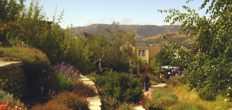
The goal of the Greenway Network Initiative is to create a citywide network of landscaped boulevards, green streets, and linear parks which link the city’s neighborhoods to one another and to the major parks, wildlife corridors, waterfront, and public transit hubs. The Network will serve as sustainable transportation infrastructure (walking, bicycling, and public transit), and provide stormwater infiltration and management, natural habitat, recreation, and neighborhood economic development. The Greenway Network will also include the San Francisco portions of the regional Bay Trail and Ridge Trail and the statewide Coast Trail.
Like many older cities, San Francisco has a combined sewer system, and its historic creeks have mostly been filled and culverted to create its combined sewer network. Fortunately, several of San Francisco’s historic lakes and streams have not been built over, and can be restored.
The city’s park system is extensive and covers almost 30% of the urban area. Unfortunately, its most densely-populated eastern neighborhoods lack open space, and the streets in these neighborhoods have heavy traffic volumes, little greenery, and high rates of pedestrian deaths and injuries from traffic.
Purposes
- Recreation: provide a citywide network of paths suitable for walking, jogging, and bicycling.
- Open space: provide open space in neighborhoods, and link neighborhoods to major open spaces.
- Water quality: provide opportunities for groundwater recharge, cleansing urban runoff, and preventing sewage outflows into the Bay.
- Environmental restoration: restore natural vegetation as well as streams, lakes, and wetlands where feasible.
- Environmental Education
- Wildlife corridors: allow plants and animals to move between larger habitat areas, overcoming the effects of habitat fragmentation.
- Hazard reduction: prevent or mitigate hazards from flooding, landslides, liquefaction.
- Sustainable economic development: the greenway network will enhance neighborhood character and stimulate local economic revitalization.
Objectives
From isolated parks to open space network
- Link major parks to one another.
- Link neighborhoods with few parks to the city’s major parks and to the shoreline.
- Link to regional greenway networks (bay trail, ridge trail, coast trail).
- Integrate current greenway proposals into a continuous system (Blue Greenway, Mission Creek Greenway, Islais Creek Greenway).
- Provide new greenway connections using publicly-owned lands (Glen Park to Golden Gate Park)
Create high quality and continuous bicycle, pedestrian, and public transit networks.
- Create standards for pedestrian, bicycle, and public transit facilities and amenities.
- Connect greenway network to transit network.
- Integrate with the bike network and provide Class 1 bike trails where possible.
Serve as “green infrastructure” to improve water quality and lower “grey infrastructure” costs
- Shift from 19th century water management model to watershed model.
- Integrate tree planting, landscaping, permeable paving, and depaving projects.
- Enable groundwater recharge.
- Restore natural drainage and watershed patterns where possible.
Conserve and enhance biodiversity
- Restore wetland and riparian habitats (Islais Creek, Laguna Honda, etc.)
- Link significant natural areas to one another
- Reduce or eliminate sewage releases into the bay
- Improve groundwater and stream water quality
- Provide wildlife corridors across the city
Greenway Network News
Restore Sharp Park!
Livable City supports the campaign to Restore Sharp Park, by converting a flood-prone golf course owned by the City of San Francisco into a restored creek and coastal wetland habitat, with more opportunities for healthy outdoor recreation. Sharp Park can become a connector between the California Coast Trail and the Bay Area Ridge Trail.
Greening San Francisco’s Waterfront
San Francisco’s waterfront used to be one of the world’s great cargo ports. The switch to shipping containers and superior rail access have made Oakland into the Bay Area’s prime cargo port, creating the opportunity to reimagine San Francisco’s waterfront. Some maritime industries remain viable (fish processing at Pier 45, and a working dry dock at Pier 70) and should be preserved, but much of the waterfront can be opened to recreation, open space, and environmental restoration. The Waterfront’s fine buildings, especially the historic pier buildings on the northern waterfront, and the buildings and Pier 70 should be restored, and new uses found for them. New development on port lands should complement, not dominate, the public uses of the waterfront. Livable City’s waterfront priorities include:
- Creating a continuous bikeway along the water side of the Embarcadero, and creating new public spaces along the water on what are now parking lots. (Livable City worked with designer Carrie Nielson on her Embikeadero Proposal.
- Prevent the Port of San Francisco from turning the waterfront plaza behind the Ferry Building into a parking lot, and instead create a set of world-class public places around the Ferry Building.
- Transform the little-used, four-lane Terry Francois Boulevard into a waterfront promenade and bicycle path.
- Complete Cargo Way’s transformation into a green boulevard with a separated bicycle path. Livable City worked with the Port and the Redevelopment Agency to craft the the Cargo Way conceptual plan (Final Report [PDF]).
Burnham’s Plan for San Francisco
The last comprehensive plan San Francisco had for a greenway network was over a hundred years ago, when architect Daniel Burnham proposed a greenway network as part of his comprehensive plan for San Francisco.
Livable City’s Greenway Network proposal seeks to capture the spirit of the Burnham Plan by connecting the city’s parks through reclaiming utility easements and street and freeway rights-of-way as public spaces, and by transforming the city streets into a pedestrian-oriented network of boulevards and green neighborhood streets.


