
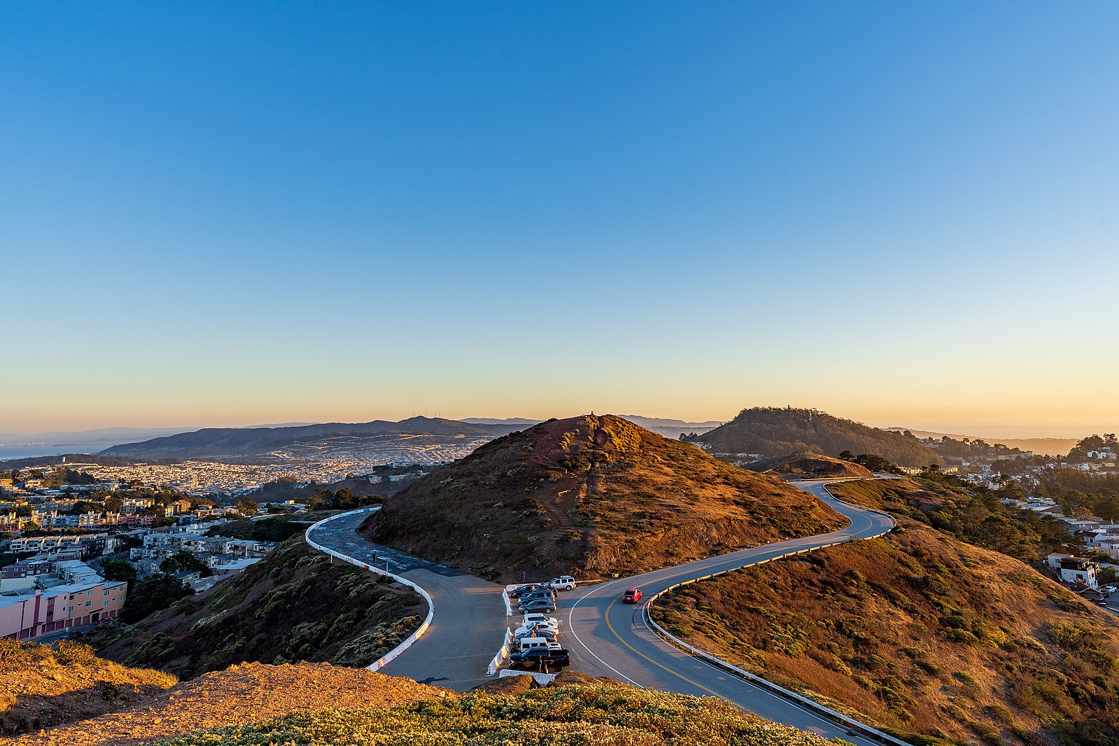
Twin Peaks is one of San Francisco’s best-known public spaces. It has been a City landmark for centuries. When surveyor Jasper O’Farrell laid out Market Street in 1847 he aligned it to Twin Peaks. It is a popular spot with visitors as well as locals and immediate neighbors.
Twin Peaks is also one of the City’s outstanding natural areas. It provides habitat for San Francisco’s diverse native plants and animals, including the endangered Mission Blue Butterfly.
Twin Peaks’ public lands are owned and managed by five separate City agencies – the Recreation and Parks, Real Estate, and Public Works departments, SF Municipal Transportation Agency, and the SF Public Utilities Commission. These agencies do coordinate some activities, but they have never worked together on a plan for conserving, improving, managing, and accessing Twin Peaks.
Livable City is undertaking a planning effort for Twin Peaks, in partnership with three American Indian organizations – the American Indian Cultural District, Association of Ramaytush Ohlone, and The Cultural Conservancy. Robin Chiang and Associates and creo Landscape Architecture are the lead designers. The plan is engaging neighbors, visitors, San Francisco’s American Indian community, and public agencies. The project is funded by a grant from the City’s Office of Economic and Workforce Development. We will seek to understand how people use and experience Twin Peaks now, what they would like to see conserved and improved, and explore options for a visitors center, access, connections, and governance. We will engage several important questions:
- How can people and enjoy Twin Peaks open spaces while respecting the area’s outstanding habitat and its neighbors?
- Would new or improved facilities improve the Twin Peaks experience?
- How should Twin Peaks be managed and governed?
- How can we improve safe, comfortable, and accessible and sustainable transportation options to Twin Peaks?
Based on the input we receive and the conversations we have, we will present a plan with options and recommendations to the community and the City.
First public workshop
We held a first public workshop on July 13, where we presented how Twin Peaks is currently managed, approved plans and projects currently underway, and discussed opportunities to improve access, experience, and care for the land, as well as draft planning principles to guide development of the plan. A pdf version of the presentation is available here.
Second public workshop
We held a second public workshop on Saturday, November 23rd from 10:30 to 12:30 pm at the Noe Valley Library, 451 Jersey Street. We presented draft recommendations for Twin Peaks, as well as designs for the Christmas Tree Point overlook and gateways to Twin Peaks’ public open spaces. The workshop presentation can be viewed here.
Notes from the two public meetings can be viewed here.
We can also attend your meetings or organize an on-site tour with you; contact us to set something up.
Draft Plan
The draft plan for public review is available here. We invite comments and questions, and any received by January 15 will inform the final report. We are finalizing the plan to submit to the City in June 2025. The plan groups its recommendations into six main areas.
- Conservation – Sustain and strengthen biodiversity and habitat conservation and restoration on Twin Peaks. Restore additional habitat on Twin Peaks public lands, and extend habitat corridors to nearby natural areas including Mt. Sutro and Glen Canyon. Acquire key undeveloped private parcels to create habitat and trail connections. Engage neighbors in stewardship of Twin Peaks’ public open spaces and support them in creating wildlife-friendly landscaping in yards and public rights-of-way.
- Landscape and public places – Improve the existing Christmas Tree Point overlook with better circulation, landscaped areas, interpretive gardens and signage, and a permanent restroom. Improve the three main open space gateways with safety and accessibility improvements and signage.
- Trails and pathways – Improve the Ridge Trail connection between Twin Peaks and Mount Sutro, and the Creeks to Peaks trail from Twin Peaks to Glen Canyon. Improve public walkways, stairways, and landscaping in the public right-of-way.
- Transportation – Retain the existing automobile circulation. Enhance walking and cycling access to Twin Peaks by installing missing sidewalks and cycle paths and reconfiguring dangerous intersections. Extend Muni bus service to Twin Peaks. Manage parking and tour bus access to reduce conflicts and congestion.
- Portola Parkway – Transform Portola Drive into a scenic multi-modal parkway, accommodating both through traffic and access to homes and the commercial district, safe and comfortable access for people walking, cycling and riding transit, linking green spaces inviting to neighbors and wildlife.
- Governance and management – Transfer the Christmas Tree Point lands from the City’s Real Estate Division to the Recreation and Parks Department, and provide the funding necessary to maintain the land and public places on Twin Peaks. Strengthen interagency agreements to provide basic park amenities like sidewalks and wayfinding signage on the Reservoir Lands.
How to get engaged
Please take our questionnaire, and circulate it using this link: https://bit.ly/3vHcllf