Blog

Rethinking Residential Zoning

Residential zoning districts encompass 70 percent of San Francisco’s private land. Current zoning permits only one or two units per lot on most of the City’s residentially-zoned land. As the housing crisis in San Francisco and the Bay Area worsens, and as the City and the region continue to struggle with transportation and sustainability, the practice of exclusionary zoning – zoning that segregates people by income or economic class – is coming under increasing scrutiny.

Exclusionary zoning practices:

  • Segregate neighborhoods by income
  • Make housing less affordable
  • Limit housing choices for moderate and low-income households
  • Exclude new residents from transit-rich areas and abet sprawl development.
  • Privilege driving and parking over walking, cycling, and transit.

Defenders of low-density residential zoning counter with appeals to defend the established character of neighborhoods, and concerns about the effects of increased density and more residents, particularly on parking and traffic.

Recent changes to San Francisco and state law have opened up areas of low-density residential zoning to more housing and more diverse housing by legalizing accessory dwelling units. In December, San Francisco eliminated minimum parking requirements in residential districts, which allows housing to expand into existing garage spaces, and reduces the cost of building new housing. Ordinances permitting accessory units in new construction, and permitting new cottages on corner lots and through lots, will soon be considered by our Board of Supervisors.

Even bigger changes could be on the way. SB 50, a bill by Senator Scott Wiener that would radically alter residential zoning controls in transit-rich areas of California, including most of San Francisco, will be debated in the state legislature this year.

San Francisco, with its progressive and environmental values, ought to be in the forefront of reforming exclusionary practices. But over half the city’s land area is still subject to exclusionary zoning. There’s an increasingly clear way forward for San Francisco to reduce economic exclusion, diversify income-segregated neighborhoods, and expand housing opportunities, while preserving the character and livability of neighborhoods, preventing the loss and displacement of existing housing and residents, and improving access and expanding sustainable mobility in neighborhoods. San Francisco should be a leader, not a laggard, in reforming residential zoning.

Exclusionary zoning in San Francisco

Exclusionary zoning can be defined as “a legal practice that has been used for decades to keep lower-income people—disproportionately racial minorities—out of wealthy and middle-class neighborhoods across the country.” As legislative analyst Elliott Anne Rigsby explains:

“The Fair Housing Act prohibits discrimination based on race, color, national origin, religion, sex, ability, and familial status. Notably, however, it does not prohibit class-based discrimination. As a result, the Fair Housing Act provides a loophole for discrimination that confines low-income people to certain neighborhoods by systematically preventing them—through economic tactics such as minimum lot size and other expensive requirements—from moving into areas of with access to opportunity.”

San Francisco’s high housing prices mean that exclusionary zoning excludes not only low-income households, but increasingly middle-income households.

San Francisco exclusionary practices include strict density limits – limiting the number of dwelling units per lot to one or two units. It also includes minimum lot sizes, prohibitions on secondary buildings, and how dwelling units are defined. Exclusionary zoning prohibits many missing middle housing types – multi-unit or clustered housing types compatible in scale with single-family houses.

Residential zoning districts cover a majority of San Francisco’s private land. RH-1 zoning, which permits only only one house per lot, covers 27 percent of all San Francisco’s private land. RH-1-D, which permits only one house per lot and requires side yards between buildings, covers another 11 percent. RH-2 districts, which permit a maximum of two units per lot, cover 16%. RH-3 districts cover 5%, and RM districts, which permit a mix of houses and apartments, cover 9%. Transit-oriented residential districts like RTO, RED, which have no density limits or parking requirements, cover only 2% of the city. 37% of the city’s private land is zoned for only one unit per lot, and a majority of the city’s private land is zoned for a maximum of either one or two units.

Most of San Francisco was built prior to the imposition of zoning laws after World War II, and most of the City’s neighborhoods evolved for decades without zoning. This created the diversity of housing types and uses that one sees in most older San Francisco neighborhoods – single-family houses mixed with houses of stacked flats and apartment buildings, cottages and carriage houses tucked in the back of lots or along alleys, and storefronts at street corners or lining public transit routes. The imposition of zoning in San Francisco severely limited opportunities to add housing or diversify housing in neighborhoods. Strict density limits made the addition of new units, whether in new buildings or existing ones, illegal. The zoning of San Francisco also made over 50,000 existing units ‘nonconforming’ – denser than the new zoning allowed – and encouraged the removal of non-conforming units. Minimum parking requirements made housing more expensive to build, made it practically infeasible to add or divide units in many instances. Parking requirements also degraded neighborhood character by proliferating garage doors and driveways instead of front gardens and generous porches.

Beyond exclusionary zoning

While all zoning excludes something, ending exclusionary zoning doesn’t mean doing away with zoning altogether. Zoning done right can contribute enormously to the livability of cities, and can do much more to preserve and foster inclusion and diversity than laissez-faire approaches. San Francisco’s current zoning is a complicated mix of practices which institutionalize exclusion and others which promote inclusion. Progressive reform of San Francisco’s planning and zoning laws can reduce exclusion and instead foster inclusion, affordability, and livability.

It makes sense to limit development in environmental hazard zones – areas subject to flooding or coastal erosion, and steep slopes subject to fire and landslides – and to protect historic buildings and unspoiled areas of wild habitat and scenic beauty. It also makes sense to separate housing from certain incompatible uses, like heavy industry. Zoning can limit the size of new buildings and building lot coverage to respect the established built character of neighborhoods, provide public and private open space, and preserve residents’ access to sunlight, greenery, and views.

Sometimes, ‘preserving neighborhood character’ is code for a desire to exclude – not wanting to live near renters or lower-income people. But often neighborhood character means the things we love about our neighborhoods – distinctive and historic architecture, mature trees, gardens, and green open spaces, and established residents, businesses, and community institutions. We can reject exclusion while embracing character, and insisting that new development respect and enhance the character of neighborhoods.

San Francisco’s exclusionary zoning often serves to erode character. In most of the city, it’s easier to build an oversized monster home than to build a modestly-sized three-unit building, or add a rear cottage to a lot with a modestly-sized house. As many cities with overheated real estate markets are finding, zoning codes that permit only ever-larger single-family homes while excluding modestly-sized multi-unit housing are eroding both housing affordability and the built character of neighborhoods.

Many cities are turning to form-based codes to preserve and enhance neighborhood character while adding compatible new housing and commercial uses to neighborhoods. Unlike conventional zoning, also known as Euclidean Zoning, which typically hard-wires exclusion, form-based codes can build-in housing diversity by accommodating diverse housing types in a given neighborhood, including those in the ‘missing middle’.

Creating housing diversity by embracing the missing middle

Missing middle housing types. Source: Opticos Design

The ‘missing middle’ includes a range of housing types compatible in scale with single-family houses, but which allow greater density and variety than currently permited by single family zoning in San Francisco and elsewhere. It includes familiar San Francisco housing types, like townhouses, stacked flats, and cottages, and types like courtyard apartments and bungalow courts seldom seen in San Francisco but common in older neighborhoods in other California cities. Legalizing the missing middle means relaxing current zoning limits on density. To accomodate some missing middle types, zoning can allow small residential buildings on both the front and rear of a lot, or to provide open space in a central court rather than a rear yard.

Both San Francisco and California law now allow one accessory dwelling unit (ADU) on any residential lot. ADUs in San Francisco must be within an existing building, including detached cottages and garages, and cannot expand into an existing residential unit. ADUs can be built in parking spaces, and can be built without off-street parking. Under current San Francisco law, ADUs can’t be built at the same time as the main dwelling; they can only be added to a main dwelling that’s at least three years old. Allowing ADUs to be built at the same time as the main dwelling would decrease the cost and disruption of adding ADUs, and encourage more of them to be built.

San Francisco also prohibits new housing at the rear of a lot, which mostly prohibits new cottages. Cottages are only permitted at the rear of a lot if the lot has street frontage at both ends (typically lots that run between a street and a rear alley) and if both adjacent lots already have residential buildings at the rear of the lot. However a garage is permitted at the rear of any lot. Changing the law to allow required rear yard space to be located between a front dwelling and a rear cottage instead of only at the back of a lot would permit many more cottages without eliminating mid-block open space. Vancouver legalized small cottages along residential alleys in 2010 (known locally as laneway houses) and the city now has over 2000 new laneway houses. San Francisco has fewer residential alleyways, but enough for laneway houses to make a contribution to housing diversity in the neighborhoods which do.

The Alfred E. Clarke Mansion, also known as the Caselli Mansion, on Caselli Avenue in the Castro. This Victorian mansion, built as a single house, was divided into 15 apartments of various sizes.

Another strategy that permits more housing and more affordable options in low-density neighborhoods is to remove the City’s minimum lot size requirements. San Francisco’s Planning Code requires a minimum lot size of 2500 to 4000 square feet. Permitting smaller lots would allow smaller and more affordable houses, including ‘pocket neighborhoods’ of row houses or cottages with individual or shared yards.

In the RH-1-D districts which require side yards, new detached multi-unit buildings could be permitted, or existing buildings divided into two or more units. Detached cottages can be built at the rear of lots. These strategies would conserve the established character – detached buildings set in yards and gardens – while adding new housing and diversifying housing opportunities.

Accomodating diverse households

San Francisco households are increasingly diverse, and planning and zoning for residential neighborhoods should accomodate that diversity by permitting both a greater variety of households, and by permitting households to adapt buildings to meet changing needs.

A dwelling unit is defined in the Planning Code as “a room or suite of two or more rooms that is designed for, or is occupied by, one family doing its own cooking therein and having only one kitchen.” A “Family” may include single people, and unlimited number people related by blood, marriage or adoption along with ‘necessary domestic servants’ and three or fewer roomers or boarders, or five or fewer unrelated persons. Many of the rules in the Planning Code, including the limitation to one kitchen and restrictions on full bathrooms in ‘rooms down‘, are aimed at disallowing the creation of additional units. However these restrictions can make housing less suitable to different sorts of households – households with three generations living under the same roof, seniors who wish to live independently but close to a family member or caregiver, or intentional communities, like co-housing. Since both San Francisco and the state now permit at least one accessory dwelling unit in any residential building, the planners’ imperative to control the details of dwellings’ interior layout makes little sense. It still makes sense to limit the loss of existing dwelling units, but there’s no good reason to ban second kitchens, or a ground floor bedroom with a full bath.

Many of the strategies discussed so far allow for smaller houses and smaller units. The City should also consider strategies which preserve or create units suitable to larger households. When the City created transit-oriented residential districts a decade ago, some of the Supervisors were concerned that removing density limits would result only in studios and one-bedroom units, and limit housing opportunties for larger households, especially households with children. In response, the transit-oriented districts included controls which require at least 40% of units in multi-unit buildings to have at least two bedrooms. The controls also require that at least one large unit be retained when existing large units divided into two or more units.

Current law permits the creation of accessory units in garage spaces, but in most residential districts it’s still illegal to expand living space for existing dwelling units into garage spaces. Households should be able to expand living space into car-storage space if their household gets bigger.

Neighborhood architecture: continuity and transformation

Most San Francisco neighborhoods were originally laid out with a pattern of gridded streets, and small narrow lots with individual houses, or sometimes multiple flats. With the exception of a few set-piece neighborhoods encumbered with restrictive covenants,  most San Francisco neighborhoods diversified over time – some houses were divided into apartments, some smaller buildings replaced with larger apartment buildings, and corner stores were added here and there, including raising up wood-framed residential to add storefronts on the ground floor. These transformations were documented in Anne Vernez Moudon’s Built for Change: Neighborhood Architecture in San Francisco. The apartment buildings built in the first half of the 20th century were generally larger than neighboring houses, and increased residential density. They mostly proved to be architecturally compatible, even when they were in built in contrasting styles like Art Deco or Mediterranean Revival. Their designers articulated buildings into a base, middle, and top, used similar rhythms and proportions for features like window bays and entries, and used ornament to provide visual interest and human scale.

Designers of buildings built after World War 2 mostly rejected continuity with existing neighborhood architecture. Some of the biggest changes came at street level. Instead of a residential building base and generous front entries, buildings built from the mid-20th century on devoted building ground floors to parking. It was partially in response to increased auto ownership, but also in response to changing zoning codes. In 1955 San Francisco imposed minimum parking requirements citywide. Multi-unit buildings typically dedicated the entire ground floor to parking to meet requirements, and garage doors and open carports came to dominate  ground-floor building fronts, especially on narrow lots. Another factor was the imposition of a 40′ height limit across most of the city. Builders couldn’t lift the ground floor units a few feet above the sidewalk for livability and privacy, as older buildings do, without sacrificing an upper floor, so they typically defaulted to parking on the ground floor, with residences only on the second floor and above.

The new planning requirements imposed between 1955 and 1960 – strict density limits, strict height limits, minimum parking requirements, and the prohibition of non-residential uses in residential districts – mostly outlawed the sort of incremental development that had previously diversified neighborhoods. Builders could only add new one- or two-unit buildings. These buildings were typically boxy and larger than neighborhood buildings, and were pejoratively labeled “Richmond Specials” after the San Francisco’s Richmond District where they were common. Neighbors’ objections to ill-fitting new buildings – apartment buildings in the neighborhoods where they were still permitted, and Richmond Specials elsewhere – boiled over in the 1970s. As Anne Vernez Moudon observed, “Such widespread discontent make it clear that the problem was not only overdevelopment, but also the ‘fit’ (or lack thereof) between new structures and the existing context;  issue was as much the character as the scale of new development”. In 1978 Planning Department responded by lowering allowable density even further in some neighborhoods, and crafting residential zoning controls and design guidelines that limited the size of new buildings and building additions to conform more closely to adjacent buildings. The 1970s zoning reforms maintained core elements of the 1960 zoning framework like use restrictions, density limits, and minimum parking requirements.

As San Francisco and most other cities were imposing citywide minimum parking requirements, segregation of uses, and strict limitations on density, urbanists were critiquing the negative effects that postwar planning conventions, also called Euclidean zoning, had on cities. Jane Jacobs’ The Death and Life of Great American Cities remains one of the most popular and durable critiques. Jacobs argued that city neighborhoods can be both dense and livable, that a mix of uses benefits city neighborhoods, that sidewalks were essential neighborhood public spaces, and cities should be walkable rather than dominated by the automobile. As Jay Wickersham observed:

Jacobs shows us that Euclidean zoning has been hard where it should be soft and soft where it should be hard. Zoning has been hard, or overly rigid, in dividing our cities and towns into uniform, low-density districts, each dedicated to a single primary use. And zoning has been soft, or overly permissive, in its failure to set design standards for streets, and for how buildings front upon those streets, that would reinforce the fundamental character of streets as public spaces.

Form-based codes, as described above, integrate the insights of Jacobs and others into plans and regulations intended to create urbane and walkable neighborhoods, and include looking to older livable and lovable buildings and neighborhoods for patterns. Form-based codes typically pay more attention than Euclidean codes do to how buildings meet the street and how they shape and engage the public spaces around them – streets and sidewalks, and rear yards – and to architectural standards. Form-based codes for urban neighborhoods also relax the strict segregation of uses, as well as strict density limits and minimum parking requirements. San Francisco’s current code remains largely Euclidean, with form-based elements grafted on. A form-based code for San Francisco’s residential neighborhoods could allow more and more diverse housing options in neighborhroods, while conserving and enhancing the desirable built qualities of neighborhoods, and even allowing some of the damage done in recent decades to be repaired as buildings are renovated or replaced.

Preserving and expanding affordability in residential districts

Most of the strategies discussed so far are ‘affordable-by-design’ strategies, aimed at incremementally adding housing in neighborhoods, and providing more flexibility in accommodating both large and small households. However if we want truly diverse neighborhoods in an expensive city, we’ll need to strategies for preserving affordable rental housing in neighborhoods, and creating more permanently affordable units in all neighborhoods.

Preserving existing rent-controlled units in neighborhoods is key to preventing displacement of existing households. The city has limited condominium conversion in existing rental buildings, but residents are still being displaced by Ellis Act evictions and owner move-in evictions. For many households, a no-fault eviction means they can no longer afford to live in the neighoborhood, or even in San Francisco.

Units are also being lost to mergers. Mergers tend to increase as neighborhoods become more affluent, and unit mergers reduce the supply and diversity of housing and make what remains more expensive. Until 2014, the Planning Code encouraged the merger of units which exceeded current density limits. This policy resulted in the loss of many rent-controlled and affordable units in San Francisco. Livable City worked with the Board of Supervisors to amend the Planning Code to discourage mergers, regardless of whether they exceed current density limits. The new controls have saved many units that would formerly have been lost, but includes a loophole allowing ‘demonstrably unaffordable’ units to be merged. Because of San Francisco’s surging housing costs, the unaffordable threshold is now over $1.6 million, but in San Francisco’s most expensive neighborhoods, virtually all housing exceeds the threshold. This loophole may allow the merger of seven large apartments on Presidio Avenue into two units, with one exceeding 11,000 square feet. Mergers like this are making already unaffordable neighborhoods less diverse, and even less affordable.

Affordable housing developers tend to avoid building in low-density neighborhoods, mostly because what they can build is so limited that it makes more sense to build where greater density is permitted. The City’s recently adopted HOME-SF program, which allows more density and larger buildings for projects which are 100% affordable or which include more affordable units, explicity exempts land in RH-1 and RH-2 districts, which will further limit affordable housing opportunities in residential districts. One opportunity to create more affordable housing in residential neighborhoods is to expand the City’s Small Sites Acquisition Program, which provides grants to nonprofit housing providers to purchase existing rental housing and keep it permanently affordable.

Sustainable mobility and ten-minute neighborhoods

Anxiety about transportation, particularly traffic and parking, is one of the most common rationalizations for limiting density in residential districts, and are among the most frequently-raised objections to new housing in neighborhoods.

Most of San Francisco’s residential neighborhoods were developed as streetcar neighborhoods, and retain their walkable patterns – small residential lots, pedestrian-scaled streets and blocks, neighborhood-serving commercial districts along the main transit corridors, and corner stores. Only a few post-World War 2 neighborhoods were built on an automobile-dependent pattern. According to Walk Score, San Francisco has an average walk score of 86 (“very walkable”).

Most of San Francisco’s residential neighborhoods are served by transit. According to SFMTA, 95 percent of the City’s addresses are within two blocks of a MUNI stop.

As we wrote in our posts on retail and the livable city, the city has a strong foundation for ten-minute neighborhoods – neighborhoods where most of the requirements of daily life, including grocery stores, shops, services, schools, a library, and frequent public transit, are with ten minutes walk. San Francisco can now boast that every San Franciscan lives within ten minutes walk of a City park. Ten-minute neighborhoods should be a foundational City policy in the our general plan and neighborhoood plans. As one measure, San Francisco should aim to achieve a walk score of 90 (“pedestrian paradise”) for every San Francisco neighborhood. Fostering ten-minute neighborhoods will expand access and opportunity and improve livability for existing residents, and allow neighborhoods to add housing and new residents without increasing traffic congestion. Increasing the density of residents is a key strategy for fostering neighborhood-serving shops and services. Transportation surveys of San Francisco’s neighborhood commercial districts found that the overwhelming majority of shoppers walked, bicycled, or took transit.

Most residential districts need better management of off-street parking. On most residential streets curb parking isn’t managed at all – anyone may park as many cars as they like on the street, at no cost, for as long as they like, moving them only on street-sweeping days where those exist. Since driveways eliminate curb spaces, requiring off-street parking also decreases the number of on-street spaces, with no guarantee that the off-street spaces will actually be used to store a car. Where there’s competition for curb parking, requiring off-street parking isn’t likely to create free and abundant off-street parking; only managing street parking better will improve parking availability.

San Francisco can continue to expand shared and sustainable transportation options in neighborhoods – car-share within convenient walking distance of residents, and shared bicycles and scooters, including electric bikes and scooters to serve hilly neighborhoods and older residents.

An Action Plan for reforming residential zoning

We have seen some successes since our residential zoning reform plan was published a year ago. The City eliminated minimum parking requirements at the end of 2018. Ordinances permitting new cottages on corner lots and through lots, and accessory units in new buildings, will be considered by the Board of Supervisors this year.

Beyond exclusionary zoning

  • Eliminate strict lot-area density limits, and instead limit density by height limits and lot coverage limits, residential open space requirements, dwelling unit exposure requirements, and required dwelling unit mix.
  • Eliminate minimum lot-size requirements.
  • Eliminate conditional use requirements for small and medium-sized which conform to zoning requirements and complete required design review.

Embrace the missing middle

  • Permit small cottages at the rear of a lot, with a yard in between buildings.
  • Allow more flexibility with yard and setback requirements to permit apartment courts and cottage courts.

Accomodating diverse households

  • Relax limitations on second kitchens and ‘rooms down’.
  • Allow living space to expand into garage spaces.
  • Require at least 40% of units in new multi-unit buildings to be two or more bedrooms.
  • Limit the division of large units to preserve at least one multi-bedroom unit.

Neighborhood architecture

  • Expand requirements and incentives to preserve existing character-defining buildings.
  • Integrate planning code requirements and residential design guidelines into an cohesive set of standards.
  • Limit the width and location of garage entrances.
  • Strengthen greening and permeability requirements for front and rear yards.

Preserving and expanding affordability

  • Strengthen protections against speculative evictions and the conversion, demolition, or merger of rent-stabilized housing.
  • Provide technical, design, and financial assistance to homeowners who wish to add an accessory dwelling unit, or legalize an existing unpermitted unit, if they agree to keep it as a rental for a certain number of years.
  • Eliminate the ‘demonstrably unaffordable’ loophole in merger restrictions.
  • Expand funding for the Small Sites Acquisition program to preserve affordable rental housing in neighborhoods as permanently affordable.

Walkable neighborhoods and sustainable mobility 

  • Improve Muni service in neighborhoods, including faster service between neighborhoods and downtown, and timed transfers between neighborhood bus routes and rail lines.
  • Make every neighborhood a ‘ten-minute neighborhood’ by zoning for neighborhood-serving commercial districts within walking distance of each neighborhood, permitting corner stores, strengthening City initiatives that support neighborhood retail businesses, and locating community facilities like libraries, elementary schools, parks, playgrounds, and recreation centers within convenient walking distance of all neighborhoods.
  • Invest in pedestrian and bicycle safety (Vision Zero) and neighborhood-scale traffic calming, including safe routes to schools and safe routes to transit.
  • Expand shared mobility services in neighborhoods – car-share, bike-share, and scooter-share.

Planning for a Livable City

To a casual observer, San Francisco appears to be struggling with linked crises – unaffordable housing, dysfunctional transportation, growing inequality, aging and inadequate infrastructure, and financial and ecological unsustainability – with no real plan. Look a little closer, and you’ll find that the City has many official plans and many ongoing planning efforts, and numerous planning agencies. Look even closer, and you’ll find that these plans are of varying ages and degrees of completeness, and some are badly out of date. Many of those plans are not being implemented, and some are not even implementable.

You have to look very closely, because the City’s plans, and the roles of various City agencies in planning and in implementing plans, are not legible or transparent. Plans and planning roles have developed ad hoc, with both significant gaps and significant areas of overlap, and even areas of conflict. Increasingly, large projects are ‘spot-zoned’ with project-specific zoning controls negotiated between the Mayor’s office and developers, mostly bypassing the Planning Department, adopted plans, and Planning Code. The proliferation of spot-rezoning and ‘planning by exception’ are clear signals that the City’s planning apparatus is broken – the City’s planners are increasingly reacting and not anticipating, and political and popular confidence in planning has eroded.

How did a great city, which officially extols the values of livability, equity, sustainability, transparency, and accountability, get to such an impasse? City government spends millions of dollars each year on planning, and has dozens of planners in several planning agencies. The answers are historical and complex, and there has been little official leadership in sorting out the various plans and various planning fiefdoms for the benefit of San Franciscans. San Francisco’s proliferation of planning agencies may by part of the problem.

Livable City believes that integrated, rigorous, values-driven, transparent, and accountable planning can help San Francisco achieve its goals, and realize its values – livable neighborhoods, green and safe streets, housing for all, sustainable mobility, greater health, happiness, and equity, and accountable and transparent governance.

With just 47 square miles, San Francisco needs thoughtful planning for how to use limited space – making room for new housing without displacing existing residents; creating new and expanded green open spaces, community gardens and farms, and home for San Francisco’s globally-recognized biodiversity; and space for neighborhood-serving businesses, arts and artists, nonprofits and community institutions, offices, and essential production and light industry. We increasingly understand ways in which the design of cities can combat climate change, reduce traffic congestion and enhance sustainable mobility, improve health and happiness, reduce exclusion, and foster equity and community, and our plans should reflect these understandings.

We need better planning at all scales – regional, citywide, neighborhood, block, and project. We focus here on the planning at citywide, neighborhood, and large project scales, and will cover other scales in future posts. What follows are Livable City’s recommendations for reviving the City’s General Plan, reviving neighborhood planning by undertaking new neighborhood plans and completing unfinished plans, and improving the planning and review of large projects to create more transparency and predictability for both neighbors and developers, and to more consistently secure lasting public benefits from large new developments.

The General Plan

Under California law, every city and county is required to have a general plan, and to keep it current. General plans are composed of different sections, called elements, which address particular areas – land use, circulation (aka transportation), housing, safety, etc.

Some elements are required (including land use, circulation, and housing) and others are optional. Housing elements must be updated on a state-mandated schedule. Other elements are generally required to be kept current, complete, and integrated with other elements, but don’t have prescribed timelines for updates.

The past decade has brought many changes to California’s planning laws. The state adopted targets for greenhouse gas emissions, and now requires land use and transportation planning to address both climate protection and climate change adaptation. In 2016, the state required that cities and counties integrate environmental justice into their plans, as either a standalone element, or integrated into each element and area plan as it is completed or updated.

Last year, the state updated its general plan guidelines address the evolution of California’s planning law, and to further equitable, sustainable, healthy, and livable communities. The new guidelines encompass climate change, environmental justice, housing needs, healthy communities, walkable communities, and protecting habitat and biodiversity. The new guidelines call not just for sound and integrated policies, but for rigorous analysis of equity and health disparities and strategies for lessening those disparities, as well as concrete financial and other strategies necessary to achieving the policy goals in the plan.

In 1986 San Francisco voters approved Proposition M, which requires that “the General Plan shall be an integrated, internally consistent and compatible statement of policies for San Francisco.” San Francisco’s General Plan is overseen by the Planning Department, with approval by the Board of Supervisors.

Unfortunately San Francisco’s General Plan is woefully inadequate – it’s incomplete, badly out-of-date, and poorly integrated. It doesn’t meet San Francisco’s own standards or the state requirements. It lacks a land use element, which is both required and central to organizing the other elements. Our Housing Element and Recreation and Open Space Element have been updated in recent years, but most other elements haven’t had a comprehensive update in decades.

Land Use. A Land Use element is of central importance in a General Plan, and creating a land use strategy for San Francisco is critical. As the California guidelines put it,  “the most fundamental decisions in planning begin with land use: what to put where.” Since land use and transportation are two sides of the same coin. Any good planner knows that, and the State guidelines are built on that understanding. It’s impossible to plan effective transportation networks if there’s no coherent plan for where jobs, housing, and services will go. It’s also impossible to plan for housing needs without a land-use strategy.

Land use is governed by San Francisco’s complicated Planning Code, which regulates dozens of defined uses in over 100 zoning districts, as well as building features like height, bulk, yards, and so on. The Planning Code is specific, but it isn’t strategic; it’s the implementing document for a plan that doesn’t exist, and the result is a jumble of arcane and often contradictory requirements that too often run counter to the City’s stated values and goals. Land use controls are typically revised on a zoning district or neighborhood scale, and increasingly project-by-project. A citywide land use strategy must be flexible enough to accommodate neighborhood plans and individual decisions about how to use buildings and lots, and the impossibility of predicting all future conditions and outcomes. However without any citywide land use strategy, San Francisco remains in danger of losing entire communities and entire sectors of the local economy, leaving the City far less diverse and less resilient. The Land Use element should include strategies for making space for housing, regionally-connected jobs centers, neighborhood-serving retail and services, arts and nonprofits, and industry, and open space. In general, a mix of uses is desirable for fostering diversity, walkability, and opportunity. However without any limitations on uses, high-rent uses, like offices and luxury housing, typically crowd out important but less lucrative uses. Controls on which uses are allowed and in what concentrations can be a powerful tool for conserving a diversity of uses.

Transportation. The  General Plan’s Transportation Element was last updated in the early 1990s. Its policies are mostly sound – supporting sustainable modes like walking, cycling, and transit, and managing parking and roads to reduce auto traffic and congestion. However the element is still in need of an update. It doesn’t address pressing issues like public transit capacity and expansion, pedestrian and bicycle safety (Vision Zero), the future of our roadways and freeways, equity and environmental justice, or climate change – automobiles are San Francisco’s largest source of greenhouse gas emissions. San Francisco also ranks among the worst in the world when it comes to traffic gridlock, coming in third behind Los Angelas and New York City, according to a recent report.

The Planning Department has currently scheduled an update to the Transportation Element starting in 2019. While the scope of the update isn’t public yet, transportation equity – both equitable access and mobility for all San Franciscans, and reducing inequitable impacts of our transportation system like pollution and traffic danger – must be rigorously addressed in it. It should also include strategies and an implementation plan for transit capacity, a freeway master plan, transportation demand management, and implementing the City’s complete streets/better streets standards.

The freeway master plan would take a comprehensive look at San Francisco’s freeway system for the first time since they it was planned in the 1940s. Our freeway network was designed as part of a massive system that would have covered the city. Citizens rejected freeway expansion during the 1959-1965 freeway revolt, when San Franciscans resisted and ultimately halted the construction of several major citywide highways. Following the 1989 Loma Prieta Earthquake, the Embarcadero Freeway was removed, along with portions of the Central (US 101) and Southern Embarcadero (I-280) freeways. San Francisco’s freeway removals inspired cities around the world to remove freeways, and more cities are preparing to follow suit.

The remnant freeway network divides neighborhoods, blights adjacent communities, and it threatens safety and accessibility at its touchdown points. The freeway system is also aging. The freeway on-and off-ramps on many segments are closer together than current standards allow, creating weaving and conflict zones. The northern ends of the Central (101) and Southern Embarcadero (I-280) freeways are stubs, never designed to terminate where they now do. A comprehensive freeway plan would guide big future investments in the freeway networks, including removing obsolete sections and replacing them with upgraded transit.

Neighborhood Planning

Livable City supports comprehensive neighborhood planning that integrates land use, transportation, public space, and sustainability. Neighborhood Plans implement the General Plan’s goals at the neighborhood scale, creating new opportunities for housing, preserving and enhancing affordability, supporting a diverse and inclusive local economy. enhancing sustainable mobility, planning for streets and open spaces, and improving the local environment and neighborhood livability.

A neighborhood plan should have four elements. The land use plan lays out the permitted land uses, and opportunity sites for housing, jobs, open space, and community institutions, and establishes a human-scaled pattern of streets, blocks, and lots where it’s lacking or has gaps. A transportation plan addresses current and future mobility needs, including walking, cycling, transit, loading, and street design, and a neighborhood-scale transportation demand management plan to manage traffic congestion in the neighborhood. A public space plan creates an interconnected system of public open spaces – sidewalks, plazas, parks, and community gardens – for the neighborhood, as well as needed public community facilities – schools, recreation centers, etc. A stabilization plan prevents the loss of existing affordable and rent-stabilized housing, and protecting residents, local-serving businesses, and community institutions from displacement.

Neighborhood Plans in San Francisco

This map shows San Francisco’s existing neighborhood plans. They cover only a small portion of the city, and some, like the Downtown Plan, haven’t been updated in decades. None of the current plan areas has all four of the necessary elements – land use, transportation, public space, and stabilization.

San Francisco’s commitment to comprehensive neighborhood planning has ebbed since the Better Neighborhoods and Eastern Neighborhoods plans were adopted in 2008 and 2009. Only one new plan, the Central SoMa Plan, has begun since then. Two neighborhood plans – Japantown/Western Addition, and Bayview Hunters Point – were abandoned before their implementing controls were even adopted.

Most neighborhoods don’t have transportation or public space plans, and those that were adopted are incomplete. Some of these plans identified specific projects, typically streetscape projects. Some of these have been implemented, but many are unimplemented or only partially implemented. No City agency is tasked with ensuring that the projects identified in community plans get adopted. This needs to change. Transportation and public space plans ensure that neighborhood livability is preserved and enhanced as new development takes place, benefitting existing residents and workers as well as new ones. Transportation and public space plans ensure that impact fees, and in-kind requirements like streetscape improvements, deliver essential neighborhood infrastructure in a timely way.

Priority Development Areas in San Francisco

As part of the region’s sustainable regional growth strategy, San Francisco designated several Priority Development Areas (PDAs). PDAs, according to ABAG, “are places identified by Bay Area communities as areas for investment, new homes and job growth.” Some of these overlap with neighborhood plan areas, but many have no neighborhood plan. The PDA are concentrated on the east side of the City, with the City’s major westside transit corridors – notably Geary Boulevard and West Portal Avenue – not designated as PDAs. Every PDA should have a neighborhood plan, and all of those plans should include the four elements. PDAs should be expanded to include at least the Geary and West Portal transit corridors.

Planning Large Projects

Large projects are an opportunity to further the goals of the general plan and neighborhood plans. The City’s process for planning and approving large projects should consistently improve project quality, provide certainty and clarity, enhance urban design, provide necessary public benefits from development, and reduce negative impacts of large projects including displacement, traffic, pollution, and erosion of neighborhood character.

The large project review procedures in the Planning Code vary enormously from zoning district to zoning district. The criterion for large projects vary enormously; in North Beach, a project on a typical-sized San Francisco lot of 2500 square feet or more requires special review, but in other zoning districts height is the trigger for special review, and in others square footage, and several there’s no limit. In most zoning districts, large projects require Conditional Use authorization.

Conditional Use is typically used for uses or features that pose a potential nuisance, like liquor stores or massage establishments, and requires the Planning Commission to find that the use or feature is both “necessary and desirable”. Conditional Use an awkward tool for review of large projects, and the City established specialized design review procedures for large projects in three sets of zoning districts – Downtown, Downtown Residential, and Eastern Neighborhood Mixed Use districts. These design review procedures, and the voluntary Planned Unit Development procedure for large projects in certain other districts, permit broad exceptions from the requirements of the Planning Code, including increased height and bulk, and excess parking.

Zoning should provide a degree of certainty about what is and is not permitted, without being too prescriptive. A large project review procedure should also ensure that large new developments complement the existing neighborhood, extending a human-scaled pattern of streets and blocks with buildings that define and engage the sidewalk and, where it exists, the pattern of rear yards and mid-block open spaces. Design review can help ensure quality architecture and materials. It ought to offer some flexibility where variations from the requirements produce demonstrably better results.

Many development advocates argue for using only objective criteria, and more ‘as-of-right’ development, arguing that subjective design review only adds risk and delay to projects. Our objective standards need to improve, and as they improve we should rely more often on them. Cities are increasingly embracing form-based codes, which create predictable built results and a high-quality public realm by using physical form, rather than use, as the basis of regulation. Livable City worked to improve the City’s standards for storefront tranparency and sidewalk improvements that are now codified in the Planning Code. However it’s difficult, and probably impossible, to reduce all the architectural and urban design elements that make a good project to an algorithm which anticipates every context in a complex and varied city. There should a place for qualitative judgement in the development process, especially for large projects that represent significant additions to a neighborhood. Large projects which are not asking for exceptions or variances ought to undergo design review, but after completing design review ought not be subject to ongoing appeals.

One planning tool that San Francisco lacks, and which other cities have, is a subdivision regulation that establishes a pattern of human-scaled streets and blocks on very large sites. Human-scaled blocks, and connected networks of public rights of way, are essential to creating walkable cities, and to knitting large projects into established neighborhoods. San Francisco does have regulations in a few zoning districts which require mid-block passages, but doesn’t have the right regulations to create a network of streets, blocks, and open spaces on large sites. The City has negotiated subdivision standards on a case-by-case basis on some large projects. A subdivision regulation, with standards for maximum block sizes (excepting open space blocks) would deliver those public benefits more consistently. As we pointed out in our post on the future of San Francisco retail, several large mall sites, like Stonestown, are already being considered for incremental or complete redevelopment.

Action Plan

General Plan

  • Integrate California’s General Plan Guidelines into a work plan for completing and updating San Francisco’s General Plan, including public participation.
  • Create a Land Use Element of the General Plan, which includes strategies and policies for walkable neighborhoods, industrial protection, arts and nonprofits strategy, rationalized zoning districts, and environmental justice. Integrate it with the transportation, housing and other General Plan elements.
  • Update the Transportation element of the general plan, with strategies and policies for transit expansion and capacity, sustainable transportation, safe and complete streets, the future of the freeway network, and equity and environmental justice.

Neighborhood plans

  • Create a standard for neighborhood plans which includes land use, transportation, public space, and stabilization elements.
  • Work with neighborhoods to complete the unfinished neighborhood plans – Western Addition and Bayview.
  • Create the missing plan elements for neighborhood plans that are currently incomplete.
  • Create neighborhood plans for each designated Priority Development Area.
  • Review and update plans with community participation every decade.

Large project review

  • Stop requiring Conditional Use approval for housing where housing is otherwise permitted, and stop using Conditional Use authorization as a large project review procedure.
  • Create a consistent and transparent project review process for large projects – projects on large sites, or very tall projects – to successfully integrate large projects into neighborhoods for the benefit of residents and workers in the project, and to the neighborhood as a whole.
  • Create a subivision standards which create a human-scaled pattern of blocks, public rights-0f-way, and public open spaces on large development sites.


Retail and the Livable City, Part 2

Retail contributes to city vitality, character, and livability, as well as the city’s economy. Retail faces many challenges, but San Francisco can help local grow and thrive. In Part 1, we talked about rising rents and vacant storefronts, fostering a diverse and complementary mix of uses, and how good buildings make good retail districts. Here in Part 2, we explore how complete streets, sustainable transportation, and better planning can help retail thrive.

Enhancing walkability

Retail and walkability have a symbiotic relationship. A robust retail sector makes neighborhoods more walkable, and enhancing walkability helps retail thrive. Walkability depends on both the design of buildings, as discussed in Part 1, and the design of adjacent streets and sidewalks. Badly-designed buildings can make even the best-designed public realm uninviting, and badly-designed streets can erode the vitality of neighborhoods with good buildings.

According to renowned Danish architect and urban designer Jan Gehl, city streets traditionally serve three broad purposes – meeting, movement, and marketplace. Until recently, San Francisco’s traffic engineering bureaucracy favored automobile movement over walkability, bikeability, and greening. Sidewalks were narrowed on streets designated as traffic channels, and streets in neighborhoods like SoMa, Downtown, the Tenderloin, and Western Addition were converted to one-way roads to increase the speed and volume of through traffic. Turning multi-functional neighborhood streets into traffic sewers has badly eroded neighborhood livability and street safety, and battered neighborhood-serving businesses.

The 2006 Better Streets policy reestablished a multi-functional, multi-objective, and multi-modal approach to streets as City policy. The 2010 Better Streets Plan developed a set of street types based on the character of the community – residential, commercial, or industrial – replacing the prior classification based on a street’s traffic function (arterial, collector, or local street). It developed standards for streets of each type, including a minimum and optimum sidewalk width, safety and accessiblity features like curb extensions at intersections, and furnishings like street trees, planting basins, lighting, and seating.

Subsequent legislation, which Livable City wrote and championed, requires that large developments improve adjacent sidewalks in accordance with the Better Streets plan or neighborhood streetscape plans. The Better Streets Policy and Plan are a good start, but the City hasn’t taken the necessary steps to fully implement its plan. The city never mapped which streets are of which type, never catalogued which streets were deficient per its standards, and never developed a plan to bring deficient streets up to current standards.

Deficient sidewalks – too narrow, and in need of repair – are a common problem on San Francisco’s retail streets. Insufficient sidewalk lighting, lack of street trees, and poor maintenance and cleanliness are other common problems.

Making streets more attractive to pedestrians and calming traffic creates healthier retail districts. Anecdotal evidence supports this, and it’s conventional wisdom among retail and economic development experts.

New York City’s transportation department conducted one of the most rigorous studies of this relationship. It assessed economic health, as measured by retail sales, before and after streetscape improvements were installed, and compared the improved streets to otherwise similar streets where no improvements were made. The study found that six corridors with streetscape improvements, including projects that established bikeways and transit-priority lanes, had significantly higher retail sales than the comparison neighborhoods and the borough as a whole.

San Francisco’s various public agencies have begun paying more attention to sidewalk safety, access, and amenities. Projects like the Better Valencia project, which widened and greened Valencia Street’s sidewalks between 15th and 19th Street, and the widened sidewalks on Castro Street between Market and 19th, are good examples of what’s possible.

However projects like Castro and Valencia are the exception, and only came about because they had influential and persistent champions in both the community and in City government. Typically City agencies approach streets projects piecemeal, and spend many millions of dollars each year rebuilding inadequate and unsafe streets just as they are. A Complete Streets approach would transform San Francisco for the better, and better coordination among agencies would save money, reduce construction disruption, and leave the City a better place.

The City’s maintenance and cleanliness practices also need improvement. We supported Proposition E on the November 2016 ballot, which established secure funding for City maintenance of street trees. Some commercial areas have established Community Benefit Districts (CBDs) to provide cleaning and other street services. We like what many of the CBDs are doing, including activities go beyond the basics, but it ought not require creation of a special entity to ensure that basic city services get delivered consistently.

Parking and loading

Managing the curb – street parking, passenger and goods loading, and improving safety and accessibility for transit riders, pedestrians, and cyclists – supports vital commercial districts and livable neighborhoods.

In retail corridors, good parking management means ensuring that parking spaces turn over in the course of the business day, favoring retail customers over long-term parkers. Typically the city encourages turnover with parking meters and time limits. The City’s innovative SFpark program uses variable meter pricing to maintain parking availability during meter hours in six commercial districts, which increases convenience and reduces traffic congestion and traffic danger from circling and double-parking.

In December, SFMTA voted to extend the successful SFpark program citywide. However in many neighborhoods, peak demand for curb parking is in the evening hours and on Sundays and holidays, when SFMTA doesn’t charge at meters or enforce time limits. Businessses active during those hours suffer from the lack of parking turnover, and traffic congestion and parking spillover on evenings and Sundays reduces safety, mobility, and livability in commercial districts and adjacent residential neighborhoods.

The city has been less successful at managing curb loading. Businesses depend on curb loading for deliveries. The proliferation of ride-sharing services like Uber and Lyft, along with an increase in delivery vehicles from internet retailers and food delivery services, has increased the demand for curb loading, but SFMTA has designated very few loading zones, and does little enforcement of illegal parking and loading. The result is rampant double-parking, and parking and loading and bus zones and crosswalks. Increasing the number of loading zones and extending loading zone hours are increasingly critical in the City’s commercial districts.

Managing parking to increase availablity and reduce traffic congestion and illegal parking is important, but San Francisco’s commercial districts depend more heavily on sustainable transportation – walking, cycling, and public transit – than many realize. The SF Transportation Authority’s 2014 parking supply and utilization study surveyed the travel behavior in commercial corridors – Cow Hollow, West Portal, Hayes Valley, and Bernal Heights. The study examined parking availability, parking turnover, and parking duration, and interviewed merchants and residents.

While merchants in the four neighborhoods thought that 72% of their customers “drove exclusively” to the neighborhood, in fact over 70% of their customers walked, cycled, or took transit. It also found that both businesses and residents were willing to pay more for parking in return for greater parking availability. Shoppers weighed personal safety around where they park among their top concerns, and nearly as importantly as availability of parking, which underscores the importance of active street-facing uses and investments like sidewalk lighting.

A more recent survey (March 2017) of shoppers on Geary Boulevard between Market and Stanyan streets found that about 55 percent of those surveyed arrived at Geary Boulevard by transit, and 35 percent arrived by walking — a total of 90 percent. Only 6 percent arrived by car.

Retail-friendly streets

Creating streets that foster healthy retail districts and livable communities often means rethinking traffic speed, traffic volume, and one-way streets. On many San Francisco streets, retail vitality and neighborhood livability has been sacrificed to commuter traffic. Widening sidewalks, and allocating more space for sustainable transportation, may mean fewer travel lanes, or narrower ones. Slowing auto traffic is the most effective strategy for reducing traffic deaths and serious injuries, and reduced traffic speed benefits retail districts in other ways – slower traffic speeds allow drivers to notice local businesses, and lower speeds make it possible to park.

Multi-lane one-way streets are also bad for business. More and more studies are finding that businesses on one-way streets do poorly relative to those on otherwise comparable two-way streets, and smart cities across the country are restoring two-way traffic to revitalize commercial districts. Two-way streets also improve the legibility of transit and bicycle networks, and make it easier to access parking spaces.

Car-free shopping streets are common in cities around the world, but they’re relatively rare in the US. Successful pedestrianized streets require several conditions for success. There need to be rich sustainable transportation options – public transit, cycling, and walking. The area needs to be a compelling and distinctive destination – distinguished buildings, and high-quality public places. The mix of uses needs to be diverse and generate street activity 18 hours or more each day – residents, workers, hotel, cultural facilities, shops, eating and drinking establishments, and entertainment. Car-free streets need active management and programming of activities. A number of neighborhoods in San Francisco have the right mix of character, access, and activities to make car-free streets work. The City’s Powell Streetscape Project proposed expanding the sidewalks on lower Powell Street, preserve a cable car right-of-way, and limit automobile access to passenger loading and deliveries. The City’s Better Market Street project proposes removing private cars from Octavia Boulevard to the Embarcadero, and redesigning the street for better walking, cycling, and public transit. Both projects integrate pedestrian-scaled lighting and handsome new paving.


Powell Street, existing and proposed. Photos courtesy SFMTA.

Streets can be car-free on a temporary basis – for Sunday Streets, street fairs, and festivals, or at certain times of day. Design details like handsome roadway pavements, curbless single-surface streets (with bollards and/or textured paving to preserve pedestrian and disability access), pop-up bollards, or swinging gates like those on Portland’s Festival streets create high-quality people-oriented spaces when streets are closed, and calm traffic at all other times.

Retail and the Livable City

To sustain healthy, locally-owned, and neighborhood-serving retail businesses, San Francisco needs a coherent retail strategy, tied to San Francisco’s other strategic goals – a diverse and equitable local economy, livable neighborhoods, sustainable mobility, and ensuring residents’ and businesses’ access to necessary goods and services.

City and state law mandate that the City’s General Plan be “an integrated, internally consistent and compatible statement of policies for San Francisco”, and address land use, transportation, environmental sustainability, economic development, health, public safety, in a coordinated way, and ensure that the city’s various policies complement one another.

San Francisco’s General Plan falls short in several regards. It is missing the required land use element, and other elements, like transportation and commerce and industry, are badly out of date. New state guidelines for general plans require that they address both equity and sustainability, and recommend both walkable communities and healthy communities strategies to meet the state-mandated objectives. Our General Plan doesn’t explicitly embrace walkable communities, and addresses equity and sustainability only tangentially.

Neighborhood Planning is another way to integrate retail into an overall strategy for housing, transportation, and streets and open spaces at neighborhood scale. San Francisco created several neighborhood plans a decade ago, but has committed to only one neighborhood plan since then, and left two neighborhood plans a decade ago.

San Francisco doesn’t have good data gathering and analysis about the state of retail – square footage, uses, rents, vacancies, and so on.

Much of San Francisco’s retail is in walkable neighborhoods, but the City does have some large car-oriented malls and strip shopping centers. Shopping malls are overbuilt and in decline across the US, with up to a quarter of the country’s malls are predicted to close within the next five years. San Francisco isn’t immune. Oceanview Village shopping center on Alemany Street is mostly empty, and Macy’s is closing its anchor department store at Stonestown Mall. The 6×6 mall on Market Street, which was granted excess parking by the Planning Commission even though it is located on Market Street next to a Downtown BART station, sits completely empty. Last year saw big-box retail and department store chains close hundreds of stores, and it looks as though the trend will continue in 2018. In recent years more national retail chains have opened ‘urban format’ stores – located in walkable neighborhoods, with smaller footprints and little or no parking. Trader Joe’s and Target opened stores on 4th Street downtown in mixed-use buildings with no parking.

Other cities have redeveloped dying malls as walkable neighborhoods, creating a network of human-scaled streets and blocks, and replacing parking lots with a mix of housing and offices with some ground-floor shops arranged along retail streets. In a City where land is expensive and scarce, encouraging the redevelopment of shopping centers and their parking lots creates suitable sites for needed housing and establishing walkable communities along transit corridors.

Recently the City approved a 500,000 square-foot auto-oriented outlet mall on the former Candlestick stadium site, highlighting the City’s misplaced priorities. The City should instead use these 13 acres for housing, and focus on growing a local-serving, walkable commercial district nearby along Third Street in the Bayview, where the City invested hundreds of millions to build a light-rail line, and where there are still many vacant storefronts and sites well suited to housing over neighborhood-serving retail.

Action Plan

High rents and vacancies

  • increase financial penalties on building owners for keeping retail spaces vacant long-term.
  • expand assistance for legacy businesses, including helping businesses buy their buildings.
  • provide assistance to workers seeking to convert businesses to worker-owned cooperatives.
  • expand business incubators.

Getting the right mix of uses

  • Remove the one-third maximum for accessory arts uses in mixed-use zoning districts, and permit arts uses above the ground floor.
  • Expand the healthy corner store program.
  • Encourage stores selling affordable healthy food in neighborhoods that need them, through both zoning changes and direct financial and technical assistance.
  • Remove the one-third maximum for accessory production in Commercial, Residential-Commercial, and Mixed-Use zoning districts.

Diverse and high-quality retail spaces

  • Require that large commercial developments include some smaller storefronts.
  • Extend the 5′ height bonus for tall commercial ground floors in new buildings to all zoning districts.
  • Allow buildings being retrofitted to be raised to create a tall ground floor.
  • Expand City support – loans, small grants, and design and technical assistance – for facade improvements and signage upgrades.

Enhancing walkabilty

  • Create a complete streets program for commercial streets which includes wider and better sidewalks, pedestrian crossings, street trees, and seating.
  • Adopt sidewalk lighting standards which light sidewalks well while preventing light trespass into residences.
  • Require that new or renovated commercial buildings provide building-mounted sidewalk lighting.
  • Create a street lighting strategy for the City.

Parking and loading

  • Improve curb management, including getting the price of curb parking right and designate more space at more times for passenger and goods loading.
  • Extend parking meter hours to Sunday and into the evening hours in commercial districts where parking demand at those times is high.

Retail-friendly streets

  • Redesign high-speed neighborhood streets for slower speeds.
  • Restore two-way traffic to multi-lane one-way steets.

Retail and the Livable City

  • Establish walkable neighborhoods as a cornerstone strategy in the City’s General Plan.
  • Create a Land Use element in the City’s General Plan, with a strategy for walkable retail districts.
  • Rationalize the system of zoning districts to foster walkable retail districts with complementary uses.
  • Improve data gathering about neighborood retail – uses, square footage, rents, vacancies, etc.
  • Encourage new housing above and within walking distance of retail corridors.
  • Relax zoning controls to allow neighborhood-serving retail and retail districts to grow in corridors and neighborhoods, like Twin Peaks and along M-Ocean View streetcar line, where neighborhood-serving retail is currently lacking.
  • Encourage the redevelopment of automobile-oriented retail – strip commercial, shopping malls, and big-box retail centers – as walkable mixed-use neighborhoods, with a pattern of human-scaled streets and blocks.

Retail and the Livable City, Part 1

It’s hard to imagine a city without retail – shops, retail services, cafes, restaurants, and bars. Retail contributes to city vitality, character, and livability, as well as the city’s economy.

Retail businesses provide thousands of jobs. A robust locally-owned retail sector expands and diversifies economic opportunities for residents. Local ownership also provides an economic multiplier effect – local owners, including worker-owners, spend and invest more of what they earn in the local economy, while the profits of national and multinational chains typically leave the local economy.

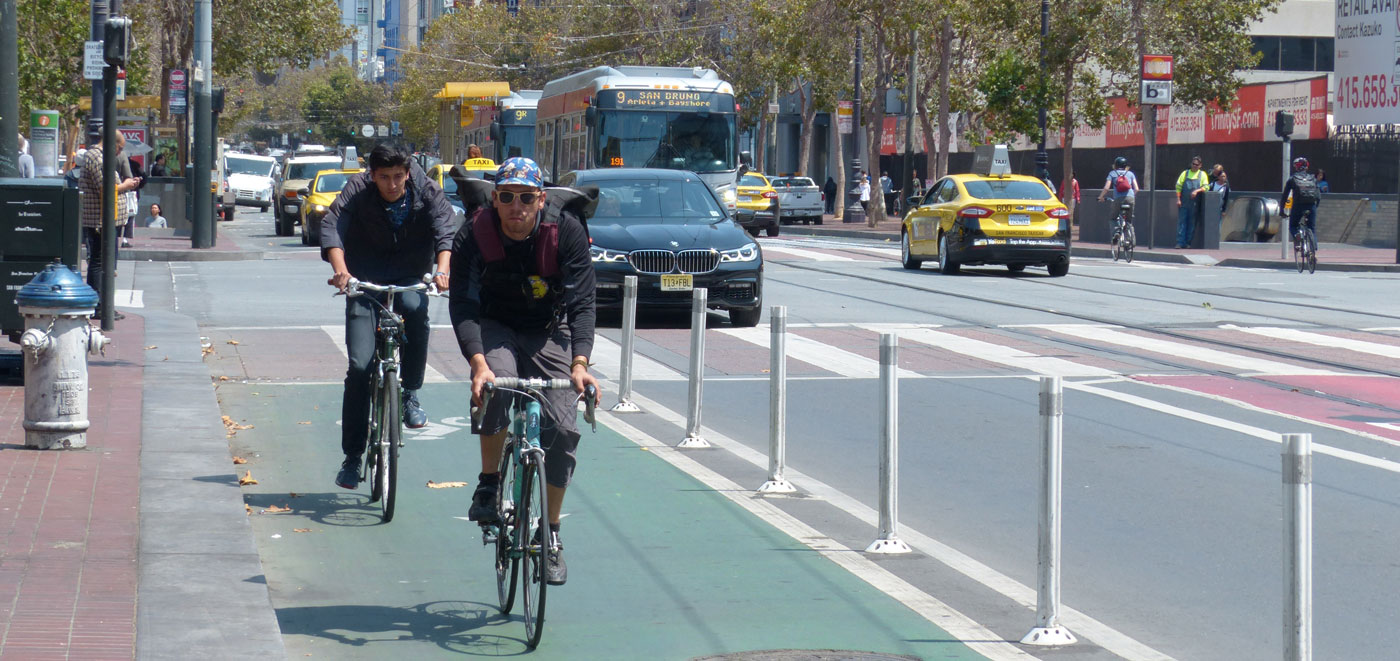
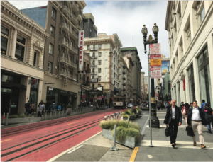
Local-serving retail businesses contribute to walkability. Residents and workers daily needs are within convenient walking distance, and ‘eyes on the street’ enhance street safety and make walking interesting.

Since 70% of trips are non-work trips, walkable retail can reduce the need for auto trips, especially when located along transit lines and around transit stations.

Retail businesses foster community and sociability. Eating and drinking especially provide vital ‘third spaces’ – beyond work and home – that make city life more social, people more connected, and even foster innovation. Independent businesses like bookstores and hardware stores offer not only goods for purchase, but also knowledge and expert advice.

Many small businesses, especially those with worker-owners, become hubs for the community to stop in and chat about the neighborhood. Long-standing relationships between community members, worker-owners, staff and other customers make up an important part of the social fabric. Independent retailers provide color, character and a unique, neighborhood-specific feel to a district.

But retail is at a crossroads. The rise of internet retailers and the delivery economy threatens many local retailers, and San Francisco, like other American cities, finds rows of empty storefronts on even its most popular corridors.

The City’s skyrocketing rents are another formidable threat, as is the consolidation of both retail business and property ownership into fewer and fewer hands, as banks, real estate trusts and development firms buy up retail spaces once operated by small landlords.

“There’s too much retail,” is a common refrain, including from many decision-makers. “We ought to accept the takeover of retail and brick-and-mortar stores by big internet retailers.”

We argue that the death of retail is neither inevitable, nor desirable. The internet and other technological, economic, and social forces will transform retail enormously in years to come, but the vast contributions retail makes to city livability is something we can, and should, preserve. Getting retail right is a powerful tool for advancing neighborhood livability, sustainability, equity, and health.

City policies clearly support neighborhood-serving retail. The first of the eight Priority Policies in San Francisco’s Planning Code is that “existing neighborhood-serving retail uses be preserved and enhanced and future opportunities for resident employment in and ownership of such businesses enhanced”.

However the City’s regulations and practices don’t always pull in the same direction as its policies. Livable City has long championed programs and policies that support neighborhood-serving retail, as well as transit-oriented regional retail and visitor-oriented retail.

Here we present our comprehensive program for retail in San Francisco, supporting a more sustainable, equitable, and livable City. Part one addresses buildings and zoning. Part two will address streets, transportation, and citywide planning, and includes an action plan.

The paradox of high rents and high vacancies

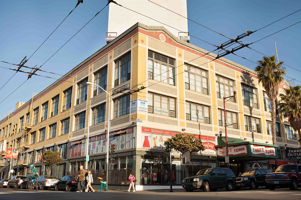
In the past few years, San Francisco has seen huge increases in both commercial rents and the number of vacant storefronts. Every day, the papers are filled with stories of small businesses forced out by cataclysmic rent increases, or landlords refusing to renew leases. Many spaces in newly-built buildings have never been leased, with huge, gleaming empty storefronts sitting below pricey condo, apartment, or office buildings. Office and housing developers tout proximity to San Francisco’s commercial districts to market their properties, but many of those same developments have left their retail spaces untenanted.

Rising rents make the ‘we have built too much retail’ arguments questionable. If there’s too much retail, why are retail rents still increasing?

The answers are complex. In San Francisco’s overheated property market, buildings can make more money as investments than they do in rents. Property owners may be holding out for chain stores that will offer steep rents, long leases, and financial guarantees that many local businesses can’t afford. The way commercial property is financed can encourage owners to keep properties vacant, rather than lower rents to what potential tenants can afford.

Vacant stores impose a burden on communities and on local government. They sap community vitality, reduce sidewalk safety, and attract graffiti, litter, dumping, and arson. It’s in the general neighborhood interest – and in the interest of property owners – to keep retail spaces occupied, but landlords often try to maximize their individual interests above the common good.

Strengthening financial disincentives for leaving retail spaces vacant will nudge owners to either lease the spaces, and make necessary improvements, or sell to someone who will. San Francisco passed a fee on long-term vacant commercial property, but loopholes in the law make it easy to avoid the fee. Recently some cities have imposed a special tax on vacant property. Such a tax in San Francisco would require voter approval. State law outlaws any form of commercial rent control.

The City can also expand its assistance to small businesses by securing long-term leases or purchasing their buildings, and for brokering vacant properties to potential tenants. In the past, these programs were often funded through the City’s Redevelopment Agency, and many were dropped when the State dissolved redevelopment agencies in 2011 during the nationwide recession. Reviving and expanding the more successful of these programs would be a smart investment.

Creating the right mix of uses

Retail works best when mixed with other uses and activities in complete and diverse neighborhoods. Residential districts are enhanced by walking distance to retail, including corner stores and neighborhood commercial streets. Retail also enhances office districts. Walkable retail benefits from nearby concentrations of residents, workers, and visitors.

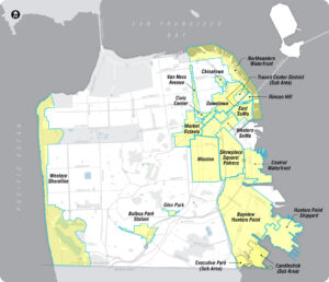
The City’s Planning Code regulates which uses are permitted in each of the City’s 113 zoning districts. The majority of the City’s zoning districts permit retail, at least on the ground floor.

Zoning controls can enhance retail vitality by permitting complementary uses, and keeping in check other uses – chiefly office spaces – which can displace desirable retail.

The City’s Neighborhood Commercial and Residential-Commercial zoning districts prohibit office uses entirely. However, in Downtown and SoMa, offices are generally permitted on the ground floor, and booming demand for office space has displaced retail from some street-facing ground floor spaces. As these neighborhoods grow denser and add more residents, preserving and fostering neighborhood-serving retail becomes increasingly important, and the zoning in Downtown and SoMa must treat retail as more than an afterthought.

Access to healthy food is essential for neighborhood livability. Many neighborhoods are ‘food deserts’, lacking nearby places to buy healthy and affordable groceries.  The City’s Healthy Retail SF program is working with owners of existing stores to encourage them to stock and market healthy foods, and provides technical and financial assistance to store owners and residents.

The City doesn’t have a strategy for attracting new grocery stores to neighborhood food deserts, or to expand alternatives, like farmer’s markets and community farms and gardens, which increase access to healthy and affordable food.

Formula retail controls impose additional restrictions on where retail chains can open, and are meant to reduce the competition retail chains impose on small and locally-owned businesses. The first Formula Retail controls were established in 2004 in a handful of Neighborhood Commercial Districts.

In 2007, the voters extended formula retail controls to all of the City’s Neighborhood Commercial districts, and they were extended to Residential and Residential-Commercial districts in 2014. Formula Retail controls generally require conditional use authorization – a public hearing and approval by the Planning Commission – before a formula retail business can be established.

When communities have input, they tend to strike a balance between local businesses and formula retail ones that fits their neighborhood’s needs. A 2014 study commissioned by the Planning Department concluded that “the community has generally supported conditional use applications for formula retail that fills long-standing needs, but organized to oppose a formula retail use that competed with existing small businesses.”

The zoning in many commercial districts imposes limitations on certain types of retail uses, particularly restaurants, bars, liquor stores, and entertainment venues. These restrictions may involve quotas – an upper limit on businesses of a certain type, or conditional use authorization, which requires an application process and a public hearing at the Planning Commission. Restrictions like these either originated decades ago when zoning districts were first established, or were created in response to a perceived overabundance of these types of retail uses at some point in the past, or in response to certain neighbors’ disapproval of certain types of businesses.

Once the restrictions are in place, there is no established procedure to review and evaluate them, so they tend to stick around. These limitations can impose a burden on local businesses. Conditional use authorization can take up to a year, and approval is at the discretion of the Planning Commission, so a small business may need to pay rent for several months before they can open, without any assurance that they will get approval.

Approval for a use is granted to a particular space, but not to a particular business, which gives landlords an advantage in lease negotiations. When a business’ lease expires, they may not have the option of leasing another space in the same neighborhood; they must either pay whatever the landlord demands, or move out of the neighborhood or close up shop entirely. San Francisco should thoroughly and periodically review, and where advisable relax, controls on uses which have outlived their usefulness, and which are contributing to the demise of neighborhood-serving businesses.

The City also employs conditional use and prohibition of uses to manage potential conflicts between certain types of businesses and neighbors. Mixed uses, especially mixing residences with other uses, does create the potential for conflict, even if the non-residential uses are otherwise neighborhood-serving. To foster livability and diversity, impacts like noise, odors, queueing, and vehicle loading must be addressed.

Livable City worked with the Planning Department to create, clarify, and expand standard operating conditions which apply to specific uses, and address their impacts. These operating conditions require businesses to manage impacts such as noise, odors, trash, and so on, and businesses can be held accountable for violation. Operating conditions, also known as performance zoning, is an effective way of making mixed use work, by setting clear parameters for successful coexistence in close proximity. As we improve our performance zoning, we can consider relaxing restrictions on certain types of neighborhood-serving uses.

Combining production and retail – food, beverages, clothing, personal and household goods, etc. – can make both more viable. San Francisco has higher rents and higher labor costs than many nearby communities, but many production businesses find that combining retail with production – bakery cafes, coffee roasters, factory stores, etc. – offsets the higher cost of doing business here. A healthy production, distribution, and repair sector creates a more diverse job base for the City, and provides esssential goods and services to other City businesses. The City’s industrial zoning districts permit accessory retail, but the city’s commercial and mixed-use zones restrict on production accessory to retail. In 2011, the City relaxed limits on production accessory to retail in the City’s Neighborhood Commercial Districts, but the Commercial, Residential-Commercial, and Mixed-Use zoning districts still maintain the old restrictions.

Non-retail uses which are currently restricted – namely arts activities and nonprofits – should be permitted in Neighborhood Commercial and Residential-Commercial districts. These serve local residents, and arts spaces especially attract visitors, and serve as the cornerstone of arts-centered economic revitalization in corridors that need a boost. Arts and nonprofits generally won’t out-compete retail on rents, but are increasingly getting displaced by office uses in districts where both are permitted.

Livable City’s arts strategy has more about how to make San Francisco friendlier to artists and arts spaces, and engage the arts in enhancing neighborhood vitality and character.

Getting zoning right, so that the right uses are permitted, incompatible uses are restricted, and all uses make good neighbors, can do a lot to allow neighborhood-serving retail businesses and retail districts to thrive.

The City can, and should, take a more proactive role in assisting small and local businesses. The Legacy Business Program, which helps longstanding local businesses secure long-term leases, can be expanded. Community-based business incubators like La Cocina are helping expand economic opportunity by assisting San Franciscans, especially women and people of color, grow and expand food-based businesses.

The City can expand facade improvement programs like SF Shines, which provide grants and loans for signage, awnings, windows, and other facade improvements. Facade improvements benefit both individual businesses and the neighborhood as a whole by enhancing street life and walkability.  The City can again offer its PACE program to small businesses, providing financing for energy-conserving equipment and building retrofits.

 Fostering diverse and high-quality retail spaces

High-quality retail spaces – level with and facing onto the sidewalk, transparent to the street, and with tall ceilings – make better retail districts. Older commercial buildings typically have these features, and contribute to the walkability, vitality, and character of commercial our districts.

Livable City helped revise the City’s zoning controls to ensure that buildings mostly have active uses, which may be residential or commercial, facing towards the street, and that ground-floor commercial spaces in new buildings include transparent windows and doors. Garage doors are limited in width, and may be oriented away from the main commercial street. Adoption of these standards has improved ground-level building design, although the Planning Department’s enforcement of its own standards is very uneven.

We also worked to amend height controls in various zoning districts of the city, so that developers can create taller ground-floor ceilings or raise dwellings a few steps from the sidewalk without having to lose an upper floor. The Planning Department’s formula retail study found that buildings with ‘design challenges’ – including ugly buildings, buildings with small windows or low ceilings, and buildings that are awkwardly connected to the sidewalk – often prove difficult to lease. The vacant buildings create gaps in street activity which reduce the walkability and vitality of the commercial corridor. With sufficient investment, design-challenged buildings can be improved, but it’s better to build them right in the first place.

Off-street parking and garage entrances can compromise building design. The imposition of citywide parking requirements after 1955 meant that that all new buildings had to provide parking off-street. Garage doors proliferated in commercial and residential districts, and storefronts and on-street parking were displaced to make way for them.

Livable City has worked to relax or eliminate minimum parking requirements, and permit the conversion of garages to storefronts or living space. These conversions have helped create new retail spaces for neighborhood-serving businesses, and enhanced the character and walkability of commercial districts by replacing garage doors and driveway cuts with active storefronts and uninterrupted sidewalks.

The size of retail spaces is also a factor in sustaining diverse and healthy retail districts. Independent businesses often prefer smaller and shallower retail spaces, and retail districts which provide a mix of spaces that includes smaller retail spaces have proved more diverse and resilient. Developers of new mixed-use tend to favor large retail spaces; fewer, larger spaces are cheaper to build, simpler to landlord, and are more attractive to national chains.

However larger commercial spaces generally stay vacant longer, especially as the national retail chains they cater to continue to merge and downsize.

Neighborhood Commercial Districts generally have a maximum size limit for commercial uses, above which Conditional Use is required, and a few have prohibited the merger of ground-floor commercial spaces to create larger spaces. Some over-large retail spaces be able to be divided into smaller stores, but in many cases building design or layout may make such retrofits impractical. As with ground-floor transparency and ceiling heights, establishing a mix of retail space sizes as buildings are designed and approval stage is much easier than trying to divide them later.

Continue to Part 2

2017: The Year in Livability

We knew going into it that 2017 would be an eventful year, and a pivotal one for sustainability, equity, and livability. Here are some of the highlights, breakdowns, and breakthroughs which shaped San Francisco’s livability in 2017.

Donald Trump vs. the Planet

Donald Trump and the Republican congress led an unprecedented assault on federal environmental and consumer protections, clean energy, health care, immigrants rights, sustainable transportation, and other values San Franciscans hold dear. Trump declared he would withdraw from the Paris Climate Accord, which would make the US the only country in the world to do so.

Many of Trump’s initiatives were blocked or nullified by the courts. Others, like his effort to increase the mining and use of dirty fossil fuels, face court challenges as well as powerful market and technological forces, and resistance from states and local communities. Despite Trump’s efforts to drill, mine, and burn more fossil fuels, 2017 was a great year for clean energy. Worldwide consumption of coal declined by a record amount in 2016. Dozens of planned coal power plants were cancelled or delayed, and existing plants closed or announced their closure. Power generated by renewable sources, chiefly wind and solar, increased faster than ever, and faster than any other power sources. The cost of electricity generated by wind and solar continues to drop relative to coal and other fossil fuels. The shift from coal to renewables helped stop annual global greenhouse gas emissions from growing for the third year in a row.

Greening the Golden State

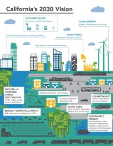
California’s clean energy mandates contributed to the decline in coal use in California, and since California is the largest electricity consumer in the western US, in neighboring states as well. In 2017, California’s growing greenhouse gas emissions from transportation  surpassed emissions from electricity generation for the first time, making transportation – mostly automobiles – the state’s biggest single contributor to climate change. The state legislature approved a gasoline tax increase to reinvest in California’s roads, highways, transit, cycling, and walking, which went into effect on November 1. On December 14, the California Air Resources Board adopted its 2030 plan to reduce California’s greenhouse gas emissions 40% below 1990 levels within the next 13 years. The plan relies on expanding renewable power sources and electric vehicles, but also walkable and bikeable communities, expanding and electrifying public transit and intercity rail, focusing housing and jobs near transit, and capturing carbon by restoring the states’ soils, forests, wetlands, and grasslands.

Sunday Streets

Livable City organized eight Sunday Streets events in San Francisco neighborhoods, with more activities and programs, and deeper collaboration with communities along the routes. We started planning for Sunday Streets’ 10th Anniversary in 2018, with more events and new routes.

Play Streets

We kicked off a Play Streets program in partnership with the City, bringing active recreation and play to low-income communities with limited open space and recreation opportunities. We organized 16 Play Streets in 2017, and are planning 40 in 2018.

Housing and livable neighborhoods

SF housing by the numbers. San Francisco added 5,250 new housing units in 2016, a 70% increase from 2015 and a it a record year for housing production. 4,895 were in new buildings, and 359 were created in existing buildings. 800 new units were permanently affordable, 16% of the total and a 52% increase from 2015. 4,050 units were approved for construction in 2016, mostly in large projects of 20 or more units. According to various rental listing websites, San Francisco apartment rents didn’t increase much in 2017, but remained stubbornly high and unaffordable to many, at $35oo or more per month on average.

Accessory Dwelling Units. In 2016, San Francisco legalized accessory dwelling units – new units within existing buildings – citywide. The state legislature approved two bills allowing one ADU per residential lot statewide, which went into effect on January 1. The state ADU requirements were more permissive than San Francisco law in some regards, and San Francisco’s were more permissive in others. Early this year the Board of Supes reconciled the City law with the new state law, and Livable City successfully advocated that the City keep the more permissive provisions of San Francisco law as it incorporated the new state standards. As of September 2017, San Francisco had received applications for over a thousand new rent-stabilized ADUs, and awarded permits for over 500.

Affordable housing. In 2016, the Board of Supervisors enacted two ordinances aimed at increasing the percentage of permanently affordable housing built in the City. In July, the Board amended the City’s Inclusionary Affordable Housing Program to increased the percentage of affordable units required in new projects to 18% of new units in rental projects, and 20% of new units in for-sale projects. The required units must be at a range of affordability, from low-income to moderate- and middle-income. Developers still have the option of building units off-site, or paying a fee equivalent to 33% of units. The Board also approved Home-SF program, which grants height and other bonuses to projects which provide 30% or more permanently affordable units on-site. Both programs are complex, and were overlaid onto San Francisco’s notoriously complicated zoning controls, with many ‘pipeline’ projects grandfathered in under the prior rules, so it’s not yet clear what the effects of these programs will be on the City’s affordable and overall housing production. San Francisco’s state legislators sponsored bills to increase state support for affordable housing. Assemblymember David Chiu’s SB 2 will fund affordable housing and homeless programs through a new fee on real estate transactions, and Senator Scott Wiener’s SB 35 will require streamined approval of infill projects that provide a certain percentage of affordable housing on-site.

Arts and nonprofits. San Francisco’s high rents, competition for space, and complex regulations make it an increasingly challenging place for artists and art spaces, nonprofits, and small businesses to survive and thrive. Livable City released our arts strategy late in 2016, and this year we developed several legislative proposals to make San Francisco’s zoning more arts- and nonprofit-friendly. Livable City’s work complements that of the Community Arts Stabilization Trust, which set a goal of securing 100,000 square feet of permanent, nonprofit space for arts in San Francisco and Oakland. The community-initiated project to preserve the historic Geneva Car Barn and Powerhouse near Balboa Park Station and transform it into San Francisco’s newest public arts center moved forward in 2017, as CAST and the City secured funding for the first phase of construction, and the City selected Performing Arts Workshop to activate the space once it opens.

Small business. Thriving commercial corridors make San Francisco a more livable and walkable place, but San Francisco’s approach to its neighborhood-serving retail districts remains unstrategic, largely uncoordinated, and sometimes contradictory. Livable City also worked with community and merchant groups on citywide and neighborhood-specific proposals to preserve and foster neighborhood-serving businesses, and diverse and walkable commercial districts. We also expanded Sunday Streets’ role in supporting neighborhood businesses.

Sustainable transportation

SF Transportation by the numbers. The SF County Transportation Authority released a survey of San Franciscans’ travel behavior, which found the percentage of trips by auto declined from 50% to 43% from 2013 and 2o17, while TNC (Uber and Lyft) trips increased from 1% to 4%, and the percentage of transit (26%), walking (25%), and cycling (2%) trips remained steady.

Caltrain’s great leap forward. The project of transforming Caltrain from a diesel commuter rail to an electrified regional metro system connecting Downtown San Francisco to the peninsula celebrated two important milestones in 2017. Caltrain electrification secured full funding early in the year, and broke ground in June. Plans to restore passsenger rail service over the Dumbarton Rail Bridge, which connects the peninsula to the East Bay, were revived in 2017, and a study of alternatives is underway. The Transbay Terminal’s first phase, which includes an elevated bus staion and underground train box for future rail service, is nearing completion, and buses will start using the terminal in 2018. The second phase, which includes an underground extension of Caltrain to the Transbay Terminal, is not fully funded, and has no definite timeline. Transbay buses are one of the best near-term solutions to overcrowding on BART, and LC is advocating for greatly expanded Transbay bus service in 2018, including dedicated lanes on the Bay Bridge and the bridge approaches.

Prioritizing transit. Construction of the bus rapid transit project on Van Ness Avenue ramped up in 2017, and in July SFMTA approved plans for bus rapid transit on Geary. Transit-priority and safety projects on Mission Street and Taraval Avenue were approved in 2016 over rancorous objections. Both projects were modified in 2017 – two right-turn restrictions on Mission were removed in August, and in December SFMTA agreed to install five passenger-boarding islands on Taraval which had been omitted from the initial project to placate those opposed to removing parking.

The City’s Better Market Street project continues to progress very slowly. In 2017, the City released its preferred plan for a car-free Market Street between Van Ness and The Embarcadero, with separated bicycle paths and improvements to transit performance and accessibility.

Curbing the cluster. The proliferation of TNCs, or rideshare as Lyft and Uber prefer to be called, emerged as one of the biggest transportation dilemmas of 2017. Lyft and Uber market themselves as alternatives to private car ownership and as ‘last mile’ transportation providers which complement public transit. However research out of New York suggests that TNCs have been worsening traffic congestion in the city. In San Francisco, the lack of regulation, enforcement, and designated loading zones has put TNCs in conflict with the safety and mobilty of people who walk, cycle, and take public transit.

Livable City’s “Curbing the Cluster” project explored the potential for ‘geo-fencing’ to reduce conflicts between TNCs and sustainable modes of transportation. Geo-fencing involves designating certain curbs as prohibited in the TNC app, directing passengers and drivers to nearby loading zones. Our pilot with Lyft at the 4th and King Caltrain Station showed that the geo-fencing concentrated passenger pick-ups in the existing loading zone, and reduced pick-ups on prohibited curbs, including bus stops.

Wider use of geo-fencing, together with designating more loading zones in popular areas, could do much to reduce conflicts between rideshare and transit, cyclists, and pedestrians. However a bigger question is whether San Francisco can find a way to make rideshare a complement to a sustainable transportation strategy which centers on public transit, walking, cycling, and complete and compact neighborhoods, or whether rideshare will be allowed to compete with sustainable transportation, worsening congestion, pollution, street safety, and inequity.

Parking. Research for the City’s Transportation Demand Management (TDM) ordinance, approved early in 2017, found that reducing auto parking, and charging for parking, were the most effective ways to reduce auto congestion and encourage sustainable transportation choices. In December SFMTA extended its SFpark program’s demand-responsive parking pricing to all metered spaces. SFpark was implemented in six neighborhoods in 2011, and has proved effective in reducing traffic congestion while increasing the availability of street parking.

Minimum parking requirements have been demonstrated to increase traffic, housing costs, and pollution, and San Francisco’s TDM and Home-SF ordinances permit case-by-case reductions in minimum parking requirements. Livable City proposes eliminating minimum parking requirements altogether, and lowering the amount of parking permitted in congested, high-density neighborhoods. In 2017, minimum parking requirements were eliminated in the Polk Street and Pacific Avenue neighborhood commercial districts, and additional restrictions on excess parking were approved in the ‘Hub’ around Van Ness and Market.

Shared mobility. We were sad to see local nonprofit City Car Share disband at the end of 2016, but San Franciscans’ shared, pollution-free mobility options generally increased in 2017. Ford GoBike‘s network of bike-share stations expanded into neighborhoods outside the Downtown core, with plans for further expansion in 2018. Scoot provides a network of electric scooters, while Jump offers shared electric bikes and Ofo plans to offer dockless bike-share. SFMTA is permitting some limited pilots while working to devise a permit system and standards for on-street bike, scooter- and car-sharing. Several years ago Livable City worked to amend San Francisco’s Planning Code to permit car-sharing in any existing parking space citywide, but current law prohibits off-street bike-share or scooter-share across much of the City. We support broadening the car-share provisions of the Planning Code to include shared bikes, scooters. Supervisor Breed introduced legislation to permit off-street scooter-share in the same way we permit car-share, but that legislation hasn’t moved forward since June.

Greening and open space

Street trees. Voters approved Proposition E in 2016, which dedicated funding to maintaining the city’s street trees. This year the Department of Public Works completed a survey of street trees in San Francisco, and devised a plan for maintaining them. Prop E does not include funding for planting new trees, but Friends of the Urban Forest and other community groups have sustained their tree-planting programs.

The Waterfront. The Port’s Waterfront Land Use Plan wrapped up its second phase in December. Phase three will develop detailed plans for development and open space along The Embarcadero, including reuse of the Historic piers. Livable City is advocating for expanded open spaces and public access along The Embarcadero and and the City’s Central and Southern Waterfront, and continuous bicycle and pedestrian paths along the Waterfront from the Golden Gate Bridge to the City’s southern limit. The City’s Embarcadero Improvement Project, which is studying alternatives for a dedicated bicycle lane and pedestrian improvements along The Embarcadero, made little progress in 2017.

Livability Awards

Livable City’s 2017 Livability Awards celebrated San Franciscans who are making an outstanding contribution to the City’s livability. At our celebration and member party in San Francisco’s Green Room in October, we honored

  • City Attorney Dennis Herrera, for defending progressive city legislation like sanctuary laws, tenant protections, and transportation reform, and for vigorous and pro-active enforcement of health, safety, environmental, and consumer protections.
  • Chinatown Community Development Center, for leadership in developing and protecting affordable housing, and championing green and safe streets through the Broadway Streetscape and Chinatown Alleyways projects.
  • Grassroots biodiversity advocates, for protecting and restoring San Francisco’s amazing biodiversity: Literacy For Environmental Justice for habitat restoration, environmental education, and the eco-center at Heron’s Head Park; Nature in the City for environmental education and establishing wildlife corridors through the City; and The Wild Oyster Project for bringing San Francisco Bay’s native Olympia Oyster back from the brink of local extinction.

Join the movement for a more Livable City

We’re looking forward to 2018. We’ll be celebrating the tenth anniversary of Sunday Streets with more routes in more neighborhoods, and expanding Play Streets. We’ll solidify projects to protect and foster housing affordability, sustainable transportation, green streets and open spaces, arts and neighborhood-serving small businesses, and environmental protection, and make progress on new initiatives in these and other areas.

Livable City has grown into one of the most effective advocates and program providers in the City, and has helped to transform the City in many positive ways, great and small. The programs we provide, like Sunday Streets and Play Streets, directly serve tens of thousands of San Franciscans each year, and the policy and advocacy work we do is transforming the City for all of us. Yet we have a way to go before San Francisco truly lives up to its cherished values. We need your continued support to keep transforming our City into a more livable place for all. We ask you to make a tax-deductible donation to Livable City this year to help sustain our work and progress towards livability. You can contribute using our secure donation page. You can also contribute as a volunteer, or we may be able to assist with livability projects in your community; let us know!

2017 Livability Awards – Thursday September 21, 2017

You’re invited to join us as we honor San Francisco’s most dedicated livability advocates who work at the intersection of land-use, environment, public health, and social equity in the Bay Area.

You’ll enjoy great food, drink and company at this year’s annual fundraising event, to be held at the Green Room in the War Memorial with an expected attendance of 300 movers and shakers from the public, nonprofit, and private sectors. Support Livable City’s mission and join the region’s political, government, and business communities in celebrating this year’s distinguished honorees: Dennis Herrera – San Francisco City Attorney, CCDC – Chinatown Community Development Center, Nature in the City, Literacy for Environmental Justice, and the Wild Oyster Project.

Awards Ceremony  tickets are $50.   VIP Reception + Awards Ceremony tickets are at $75 each, with only a limited supply available. 

***** SCHEDULE *****

Thursday, September 21, 2017
VIP Cocktail Reception: 5:30 – 6:30
Livability Awards: 6:30 – 9:30

GET TICKETS

To learn more about Livability Awards sponsorship opportunities contact: [email protected].

Livable City would like to thank our event sponsors: The Green Fairy Fund, Google, Robin Chiang & Company, le Cupboard, Build Group, Nick Josefowitz, Marc Babsin & Marianne David, Wisfe Aish, OFO, David Baker Architects, Stamats Communications Inc., Martin Building Company, Kodorski Architects, XL Construction, Hospital Council of Northern and Central California, Mithun Solomon, Emerald Fund, Solomon Cordwell Buenz, Plant Construction, San Francisco Giants, Trammell Crow Residential, Herczeg + Tobias Architects, Clark Construction, José Campos, Juan Jurado, Bi-Rite, Arlequin Wine Merchant, Boulevard Brewing, Brewery Ommegang and Duvel.


MISSION // We work to create a San Francisco of great streets and complete neighborhoods, where walking, bicycling, and transit are the best choices for most trips, where public spaces are beautiful, well-designed, and well-maintained, and where housing is more plentiful and more affordable.

All contributions directly support Livable City, a 501(c)(3) non-profit, and are tax deductible to the extent allowed by law.

Keeping Arts and Artists in San Francisco

The Ghost Ship Fire in Oakland tragically showed the insecurities and dangers faced by people seeking affordable space to live, create art, and share art. It focused attention on what San Francisco and other Bay Area cities can do to keep artists, artisans, and makers in the city, and create and sustain affordable living, studio, and exhibition spaces.

Artists and art spaces, along with nonprofits and industrial uses, face increasing competition for space in San Francisco and neighboring cities. Offices and market-rate housing can pay more for that same space, crowding out arts, makers, and other uses.

Our region needs offices and housing, but we need arts too. Arts and artists improve urban life for the rest of us; it’s hard to imagine a city without art, and it certainly wouldn’t be a livable one. Artists and artisans and their spaces are essential to a diverse and robust local economy, and support other big sectors of the economy like tourism. Smart land use planning and other policies can create and sustain places for artists and art spaces in our city even as we address other housing and jobs needs.

San Francisco does a good job funding arts programs and organizations. The Arts Element of our General Plan includes strong set of policies on arts and artists. However implementing these policies, especially regarding land use, housing, and City investment in preserving and expanding arts spaces, needs to improve.

Preserving Artist Spaces

The Live-Work Experiment

In the 1950s and 60s, San Francisco established a Planning Code that regulated land use. The code aimed to segregate land uses – residential, commercial (offices and shops), and industrial – from one another, and to ban most commercial or production activities from residential zoning districts, and from dwellings in all districts. It imposed minimum parking requirements on all new uses, and strict density and other requirements on housing.

San Francisco’s zoning requirements proved a bad fit with the way artists use buildings. In 1971, Project Artaud managed to use the City’s group housing definition to convert an existing building into a complex that includes artist’s studios and performance and exhibition spaces. In 1988, the city enacted the live-work ordinance. It was intended to ease the reuse of existing buildings as living and working spaces for artists and artisans and construct new buildings to house artists. Live-work units were defined as a use, a hybrid of residential and non-residential uses but distinct from either. “Arts activities” were defined as a non-residential use, and permitted in certain areas of the city. Live-work units were permitted greater flexibility on density, parking, lot coverage, and private open space, and were exempt from certain development fees.

The live-work ordinance created new housing for artists and artisans. But developers also took advantage of the new flexibility to create loft housing in various neighborhoods of the city, including industrial neighborhoods. Many of the new residents weren’t artists, and the new loft buildings displaced and created conflicts with established industrial and entertainment uses in various neighborhoods.

The Board of Supervisors ended live-work in 2001. Existing live-work units could remain, but no new live-work units could be built.

One big lesson of the live-work experiment was how the City’s many arbitrary limits on housing, like parking requirements and density caps, perpetuate the City’s chronic housing shortage. Various neighborhood plans adopted in the last decade have relaxed these limits in some areas, but much remains to be done.

Today, artists wanting to live and work in the same space must use the accessory use provisions of the planning code. The code allows the use of up to one-third of a non-residential space as a residence, provided that the residential portion meets the residential requirements of the building code. Limiting artist spaces to accessory uses poses several challenges. Residents of commercial spaces don’t enjoy the City’s tenant protections – rent control and limitations on no-fault evictions and conversion of residential spaces. The limitations on accessory use don’t provide much flexibility. The requirements of the building code for such hybrid spaces aren’t always clear.

Eastern Neighborhoods

In 2008, the City adopted the Eastern Neighborhoods plans. They were the culmination of about a decade’s worth of planning for industrial uses, and were intended to determine which areas should be preserved for industrial and complementary uses, and which areas opened to more intensive housing and office development.

Eastern Neighborhoods preserved 5% of the City’s land area as PDR (production, distribution, and repair) districts. PDR districts permit a range of industrial and related uses, including arts activities, allowing office and retail to occupy up to a third of building area. Accessory residential use is permitted, but housing is not.

Other portions of Eastern Neighborhoods became mixed-use districts. Mixed Use districts permit housing, office, retail, arts, and some PDR uses, but don’t require a mix of uses in any given building. This has permitted offices to take over entire buildings, displacing other uses and reducing the diversity of uses in mixed-use districts.

Neighborhood Commercial districts, found in commercial corridors within Eastern Neighborhoods and across the city, still don’t permit arts activities.

Preserving Artist Spaces

Moving Forward

We can and should do more to protect artists, artisans, and arts spaces from displacement. San Francisco can help create new places for artists to work and live. Doing so requires coordination across several city departments, including planning, building, housing, and economic development, which is no easy feat. However, we have precedent for success. Over the last three years, Livable City campaigned to legalize accessory units and protect residents of accessory units from displacement, protecting and creating tens of thousands of units citywide.

Here are seven ways we can preserve and expand vibrant arts spaces:

  • Protect Residents of Arts Spaces. Artists living in commercial spaces are vulnerable to displacement. The residential accessory provisions provide little security against conversion to other uses, and few tenant protections; generally residents can be evicted within 30 days with no cause. Expanded tenant protections for residents of commercial spaces will help artists remain in San Francisco.
  • Expand Code Compliance Assistance. Building and housing codes are necessary to protect life, health, and safety. Planning Codes, done right, can foster livability and preserve diversity. However, since the Ghost Ship fire, code compliance has been used by some building owners a tool to displace residents. We can design vigorous code compliance around the imperatives of preserving housing and preventing displacement. The City can expand technical and financial assistance for code compliance. We should also provide proactive assistance, including useful and up-to date bulletins, guidelines, handbooks, and voluntary screenings. The City should expand use of an existing building code to make health and life-safety improvements in older buildings more feasible.
  • Create and Fund a City Arts Strategy. San Francisco has long talked about its love for the arts. It’s time to embrace arts as an essential feature of urban life and a valued sector of the economy. Artists’ housing and arts spaces would benefit from focused and effective inter-departmental strategy to provide financial and technical assistance to create artist housing and sustain arts spaces, including co-operative enterprises for housing, exhibition and performance space, and marketing.
  • Permit Arts Activities in Neighborhood Commercial Districts. Today, arts activities are not a permitted use in Neighborhood Commercial districts, but they should be. Arts uses in storefronts and upper-story spaces enhance neighborhood character and complement retail uses in commercial corridors. Commercial corridors with many empty storefronts would benefit from arts-centered economic development strategy.
  • Limit Office Sprawl into PDR Districts. Over the past two decades, the City has allowed large office developments to spread out from the downtown core, into the city’s industrial districts and in to areas poorly served by public transit. This has aggravated displacement of arts and PDR uses. It has also worsened traffic congestion and pollution, since transit ridership is sharply lower in offices that aren’t a short walk from transit. The Board of Supervisors has opened up more PDR districts to dense office development. The City needs to end its piecemeal approach to office development, and return to policies that focus office development in areas within a convenient walk of BART and Caltrain.
  • Preserve a diversity of uses in Mixed-Use Districts. The City’s Mixed-Use Districts, located primarily in SoMa, permit a broad range of uses, including housing, offices, retail, arts, and some PDR. However they don’t require a mix of uses, and parts of SoMa have been moving towards a monoculture of tech offices. Mixed Use zones should preserve PDR and arts uses from conversion, and reserve ground-floor space for neighborhood-serving retail, arts, and services uses that create walkable commercial corridors.
  • Expand arts spaces in Pier 70 and Hunters Point Shipyard. The proposed developments at Pier 70 and Hunters Point Shipyard present big opportunities to create or preserve art spaces. The arts component of both developments should be strengthened, including preserving and rehabilitating buildings currently slated for demolition as arts spaces.
  • Preserve and Restore Neighborhood Landmarks as Arts Spaces. We live in a City filled with a rich architectural history. Several City-owned landmark buildings could, if the City and private development reinvests in them, have a new life as community arts spaces, providing space for performances, museums and galleries, arts and vocational education, and arts nonprofits. Some of these spaces include the Geneva Car Barn and Powerhouse, the Old Mint, and the former Muni substation on Fillmore Street. Many San Francisco neighborhoods have fine historic theaters which have closed or are in danger of closing. These theaters can, with City assistance, be sustained or revived as nonprofit arts and performances spaces like Brava TheaterGray Area’s Grand Theater, and ACT’s Strand Theater. Neighborhood movie theaters and arts venues provide a resource and amenity for residents, strengthen neighborhood identity, attract visitors, and boost local businesses’ bottom lines.

Your support helps Livable City advocate for creative and effective solutions like preserving artist spaces and affordable housing, improve street safety and transit, plan better for growth, equity, and sustainability, and protect and green the City’s public spaces – our streets, parks, and the waterfront. Donate to Livable City today or send us a message letting us know you want to join in keeping arts and artists in San Francisco.

Green City, City of Sanctuary: Moving Forward Together

The November election is now behind us, and we suddenly face a very uncertain future. The election of Donald Trump to the presidency threatens much we hold dear as Americans, as lovers of freedom, and as San Franciscans. More than ever, San Francisco, the Bay Area, and California will play a critical role in preserving and growing a more equitable, inclusive, and sustainable society, and help show the US the way forward.

We don’t yet know exactly what the election of Trump as President, along with Republican control of the Senate and House of Representatives, will mean for the United States, but the outlines are becoming clear. It’s clear that the incoming administration, and its allies in congress, will make life much tougher for immigrants to the United States, promising mass deportations and discrimination against Muslim immigrants. There are ominous signs of tough times ahead for LGBTQ, women’s, and public health issues, and near-certain backward steps on climate and environmental issues.

Our Federal social safety net, from Social Security to health care and support for housing, is also threatened. Our safety net is already weak compared to peer countries, and income inequality continues to worsen, making threatened cutbacks even more dire for an increasingly broad swath of Americans.

Standing Firm on our Environmental Commitments

A Trump administration is shaping up to be a disaster for the national and global environment. President Obama has taken important steps to protect the global climate, using his executive and statutory authority to overcome Congressional opposition to climate action. The Obama administration strengthened fuel economy standards for new cars and trucks, and tightened air pollution regulations on fossil-fuel burning power plants, particularly coal. He concluded an agreement with China, the world’s largest carbon polluter, on reducing carbon emissions. The European Union and India also agreed to cut carbon emissions. In October, the Paris Climate treaty reached the necessary threshold of participating countries to go into effect. The shift away from coal power towards renewable energy and natural gas in the US, China, and other countries caused global carbon emissions to stop increasing in 2014 and 2015. Effective climate action is also a boon to health; decreasing our reliance on dirty fossil fuels will prevent millions of illnesses and premature deaths from air pollution.

Trump has pledged to withdraw immediately from the Paris Climate Treaty, to reduce restrictions on burning coal, and to open up more federal lands for oil and gas extraction. Federal incentives for renewable energy could disappear.  Trump wouldn’t be the first US president to renege on an international climate treaty; During his presidency, George W. Bush and his congressional allies refused to enact the weaker Kyoto Climate Accords. There’s far more global momentum towards climate action now than at any point in the past. As the climate crisis continues to worsen, however, the stakes of delay and failure are increasingly more dramatic. International peer pressure may be stronger now. The Chinese government has several times admonished Trump to maintain the US’ climate commitments, and promised to move ahead with with its own climate plan. French presidential candidate Nicolas Sarkozy promised to enact a carbon tariff on European imports from the US should the US withdraw from the Paris treaty.

For the next few years, the actions states, cities, and citizens will be critical in creating a more equitable, inclusive, and sustainable United States. Fortunately California, the most populous and wealthy US state, continues to lead the way. Earlier this year, the state strengthened its climate protection goals and standards, including renewing the states carbon cap and trade program. Washington state’s carbon tax proposal was defeated on election day, leaving California as the US’ climate action leader.

Welcoming Immigrants Means Welcoming Housing

Meanwhile in San Francisco, City leaders reiterated their commitment to San Francisco’s Sanctuary City status. San Francisco has long been a sanctuary for immigrants, but also for domestic migrants, fleeing intolerance at home.

As we move forward, how can San Francisco fulfill it’s commitment to becoming both a City of Sanctuary – a city that embraces diversity and inclusion, and welcome those who want – or need – to come here, while supporting those who want to stay here, and a Green City – moving boldly towards a more sustainable and healthy future for people, for our unique, diverse, and irreplaceable local biodiversity, and for the planet? Can San Francisco and the Bay Area become urban and regional exemplars of sustainability and environmental justice?

San Francisco’s Sanctuary City status will be little more than symbolic without easing San Francisco’s brutal housing affordability crisis. At present, between 6,000 and 7,000 San Franciscans are homeless, and many other San Franciscans feel increasingly insecure about their ability to afford housing in the City. On election day, San Francisco made some progress towards becoming a more affordable City. Voters approved Measure C, which will provide over $150 million to acquire and rehabilitate affordable housing citywide. It was one of several successful measures around the bay to fund affordable housing, which collectively commit over $2 billion toward a solution. San Franciscans rejected measures P and U, preventing the weakening of key City housing affordability programs. Voters approved Measure J, which would have provided $50 million annually for homeless services and housing, but didn’t approve Measure K, the actual mechanism to deliver funding for Proposition J.

These ballot box victories complement recent legislation, championed by Livable City, to protect the City’s rental housing from demolition, merger, and conversion, and legalize the creation of new rent-stabilized housing in existing buildings. The City is now free to adopt new standards for inclusionary affordable housing which can increase the number of new affordable units in market rate developments while sustaining the overall production of needed housing.

The Next Era of Transportation

The Bay Area took a step towards a more equitable, sustainable, and livable future by approving Measure RR, a bond measure to renew and reinvest in the aging BART system. San Franciscans overwhelmingly approved Measure E, which established City responsibility and funding for maintaining street trees and repairing sidewalks. San Francisco voters approved the same Measure J aimed to support homeless services and housing, which also called for $100 million per year in increased spending on safer walking and cycling, maintaining and improving public transit, and road repair. The failure to pass Proposition K makes these improvements unlikely.

2017 Livable City Priority Areas

As we move into 2017, Livable City will be working to sustain and deepen the City’s recent progress on preserving and building affordable housing, improving street safety and sustainable mobility, building livable and inclusive neighborhoods, planning better for growth, equity, and sustainability,  and protecting and greening the city’s public spaces – our streets, parks, and the waterfront. It’s incumbent upon us as a diverse community to light the path for the rest of the country to follow.

[one_half]

Livable Neighborhoods

  • Revive neighborhood planning for residents, businesses, transportation, streetscapes, and open spaces
  • Expand affordable housing citywide

[/one_half]

[one_half_last]

Complete Streets

  • Bigger, better, more Sunday Streets
  • Fulfill Vision Zero and eliminate road deaths by 2020
  • Expand street tree planting and sidewalk greening

[/one_half_last]

[one_half]

Sustainable Transportation

  • Electrify and modernize Caltrain and bring it Downtown
  • Reduce conflicts between curb loading vehicles and walking, cycling, and transit
  • Create a citywide network of protected cycle lanes

[/one_half]

[one_half_last]

Open Space

  • Continuous walking and cycling path along the Bay and Ocean
  • San Miguel Hills Great Park: Connect hilltop open space from Golden Gate Park to Twin Peaks and Glen Park
  • Expand parks and open spaces in underserved neighborhoods

[/one_half_last]

Livable City’s 2016 General Election Recommendations

Livable City 2016 Endorsements

Livable City has taken a position on 12 of the 42 local, regional, and state ballot measures on this November’s ballot. Livable City recommends the following measures:

Yes on Proposition RR – BART Safety, Reliability, and Traffic Relief

If you live anywhere near the Bay Area, ride transit, or read the news, you know the BART system is aging and breaking down. The system was designed to carry 100,000 weekly riders. Now, BART serves 430,000 riders. BART estimates that it will need $9.6 billion to cover its capital needs for the next decade. This measure bridges $3.5 billion of that gap, and BART has identified approximately $4.8 billion from other sources.

Livable City consistently supports investments in transit that make San Francisco more livable, sustainable, and equitable. Improving BART’s reliability, safety, and capacity will help San Franciscans, Bay Area residents, and visitors access home, work, and play via a sustainable mode of transportation. Livable City recommends voting yes on Proposition RR.

Yes on Proposition C – Loans to Finance Acquisition and Rehabilitation of Affordable Housing

Proposition C will provide loans for the acquisition, improvement and rehabilitation of “at-risk” multi-unit residential properties, to convert such properties to permanent affordable housing, and to finance the cost of needed seismic, fire, health and safety upgrades or other major rehabilitation for habitability on such structures. It does so by amending an existing bond program which provides loans for the seismic strengthening of unreinforced masonry buildings. The majority of funds available for the masonry building program weren’t ever used, leaving almost $150 million in bond capacity available for new purposes.

This measure will further San Francisco’s (and Livable City’s) goal of  preserving and expanding the city’s stock of affordable housing. The availability of funding for acquisition and rehabilitation will bolster the City’s efforts, championed by Supervisor Peskin, to step up code enforcement on Residential Hotels, protect them from conversion to other uses, rehabilitate them, and make them permanently affordable. Livable City recommends voting yes on Proposition C.

Yes on Proposition E – Responsibility for Maintaining Street Tress and Surrounding Sidewalks

Today, maintenance of certain street trees, and the sidewalks around those street trees, is the duty of the adjacent property owner. Owners are liable for injuries or property damage resulting from improperly maintained trees or sidewalks. Prior to 2009, the City had planted and maintained many street trees at City expense – on Market Street, for example. However the city’s commitment to both street tree planting and maintenance has waxed and waned.

Proposition E will ensure the city is responsible for street tree planting and maintenance, including repair of sidewalks damaged by tree roots, starting July 1, 2017. The measure sets aside $19 million annually for street tree maintenance, adjusted up or down each year based on the percentage increase or decrease in the City’s discretionary revenues.

Street trees are essential ingredients for urban livability. Street trees benefit our health, happiness, ecology and economy. As parts of the City grow denser, sustaining a healthy urban forest is even more vital to sustaining heath, happiness, and livability. Trees are also important components of complete streets projects and can be effective at traffic calming.  It’s time for us to consider trees as an essential part of the City. Livable City recommends voting yes on Proposition E.

Yes on Proposition J – Funding for Homelessness and Transportation

As San Francisco grows, the City faces shortfalls in transportation operating and capital funding, and also needs to comprehensively address homeless housing and social services. Enter Proposition J and companion Proposition K.

Both transportation and housing are policy priorities for Livable City. Proposition J is funded by the companion sales tax (Proposition K). Sales taxes are regressive, which Livable City generally does not support. However, most of the new funding will go to projects and programs which benefit low-income San Franciscans – transit, including subsidized transit fares for low-income households, seniors, youth, and the disabled; walking and cycling; and homeless services.

While most of the funding from measure will go to transit, walking, and cycling, Livable City does not agree that nearly a third of the Transportation Fund should go toward road maintenance. User fees on automobiles ought to pay for more of the direct costs of auto infrastructure, including maintenance of streets and parking and traffic safety. Prop. J meets some, but not all, of the projected shortfall in street capital needs. We support an increase in the Vehicle License Fee (VLF) in San Francisco to provide further funding for street maintenance and repair and traffic safety. The Mayor’s office has twice refused to bring the VLF measure to a public vote (2014, and earlier this year), so we’ll be advocating for a VLF measure in 2018. Livable City recommends voting yes on Propositions J and K.

Yes on Proposition K – General Sales Tax

Proposition J, this measure’s companion Charter Amendment will, if approved by the voters, dedicate new revenues to Transportation (.5%) and homeless services (.25%) for the next 25 years. If it does not, and Proposition K does, the money will be placed in the General Fund and allocated through the City budget process. The current combined sales tax in San Francisco County (state, regional, and county) will drop to 8.5% in December when a .25% temporary state sales tax expires. This measure will increase the combined tax to 9.25% starting in April 2017.

Although regressive, this sales tax will benefit low-income San Franciscans – transit, including subsidized transit fares for low-income households, seniors, youth, and the disabled; walking and cycling; and homeless services. Livable City recommends voting yes on Propositions J and K.

No on Proposition O: Office Development in Candlestick Point and Hunters Point

In the 1986, San Francisco voters approved Proposition M. Among other things, Prop. M established an annual limit on office square footage of about 1 million square feet per year. Applications for office space in San Francisco have never exceeded the annual limit. Prop. M gave office square footage in redevelopment areas priority, but did not exempt it from the annual limit. This measure would exempt office square footage in Candlestick Point and Hunters Point redevelopment from the Prop. M limits.

Our 1980s office limits may be due for a re-think, but developer-written ballot-box planning is the wrong way to do it. Prop. O was placed on the ballot with no public dialogue or analysis. It prioritizes office development in only two areas of the city which are ill-served by transit. Office developments in these less transit-rich areas are more auto-dependent, and will generate more traffic congestion and pollution than office development Downtown. The “yes” campaign claims Prop. O is about affordable housing, but it’s about offices, not housing. Livable City recommends voting no on Proposition O.

No on Prop. P: Competitive Bidding for Affordable Housing Projects on City-Owned Property

Currently, the Mayor’s Office of Housing and Community Development (MOHCD) administers a developer selection process, using requests for proposal (RFPs). Prop. P would require MOHCD to use a bidding process specified in the measure. Prop. P requires that the city receive at least three bids; if not, all bids must be rejected.

Prop. P will likely slow down the production of affordable housing, without improving the process or outcomes. If MOHCD’s procedures need improvement or transparency, they ought to be fixed administratively or legislatively, not at the ballot box. Livable City recommends voting no on Proposition P.

No on Proposition Q: Prohibiting Tents on Public Sidewalks

Virtually everyone agrees that the solution to homelessness is housing. Prop. Q is an unproductive measure opposed by the City’s homeless service providers and housing advocates. We agree Prop. Q shouldn’t be on the ballot, and will do nothing to move homeless San Franciscans living in tents into shelter or housing.

Fortunately, there are measures on the ballot which will build and preserve housing for homeless San Franciscans – Prop. C will allow for the acquisition and rehabilitation of permanently affordable housing, and Propositions J and K will provide $50 million per year to build housing and provide services to homeless San Franciscans. Livable City recommends voting no on Proposition Q.

No on Proposition U: Affordable Housing Requirements for Market-Rate Development Projects

Prop. U, placed on the ballot by the San Francisco Association of Realtors, would weaken the City’s requirements for inclusionary affordable housing (affordable housing in market-rate projects), and shift eligibility for affordable housing from low- and moderate-income households towards wealthier households earning 100% or more of median household income.

Inclusionary housing is an important part of the City’s affordable housing strategy, and an important public benefit from market-rate development in the City. Inclusionary requirements should be set high enough to maximize affordable housing, but not so high as to discourage housing construction. Income eligibility standards should address households with the greatest need. Inclusionary requirements should not be arbitrarily set at the ballot box.

In June, San Francisco voters removed a charter cap on inclusionary requirements, and restored the Board of Supervisors’ ability to adjust them legislatively. The Board established a technical advisory committee of nonprofit and for-profit housing providers to determine the right approach to inclusionary requirements, and that committee is finalizing its recommendations. Livable City recommends voting no on Proposition U.

Yes on Proposition V: Tax on Sugar-Sweetened Beverages

Prop. V taxes companies that distribute sugary drinks one cent per ounce on sugary soda and other sugar-sweetened drinks. This Proposition has wide-spread support, as it did the last time it was on the ballot in 2014 when it received 55% of the vote (short of the necessary 2/3 for an earmarked tax). Livable City endorses Proposition V because evidence points to these types of beverages being the leading factor toward major health issues. One-third of all children and nearly half of African-American and Latino children, are predicted to develop diabetes in their lifetimes. They are also linked to increased risk of obesity and diseases such as heart and liver disease, and the most common chronic disease among children, tooth decay.

Since its inception in 2008, our Sunday Streets program has been a strong proponent of these types of health measures, partnering with Shape Up San Francisco and the SF Department of Public Health in Soda Free Summer, and we do not allow the sampling of sugary beverages or junk food at Sunday Streets. Moreover, Sunday Streets does not accept funds from these companies, whether as sponsors or donors.

This tax will help increase awareness and educate the public about the link between sugary drinks and chronic illnesses, and how the beverage industry targets its marketing towards youth and communities of color. It will reduce sugary drink consumption, as proven in similar measures in Berkeley and Mexico (both passed in 2014). These revenues can also be used to support community programs that combat the impact of sugary drink marketing, and the negative health consequences of sugary drink consumption. Livable City recommends voting yes on Proposition V.

Yes on Proposition W: Real Estate Transfer Tax on Properties Over $5 Million

Proposition W would increase the City’s existing real estate transfer tax on properties over $5 million – to 2.25 percent from 2 percent on properties worth $5 million to $10 million, to 2.75 from 2.5 percent on properties worth $10 million to $25 million; and to 3 percent from 2.5 percent on properties worth $25 million and up. Over 80% of the tax will be levied on non-residential properties, and most of that on large office buildings worth more than $25 million. The measure will raise an estimated $45 million annually for City services, including reducing City college tuition fees. Livable City recommends voting yes on Proposition W.

No on Proposition X: Preserving Space for Neighborhood Arts, Small Businesses and Community Services in Certain Neighborhoods

After a decade-long planning process, The city adopted the Eastern Neighborhoods plans in SoMa and the Mission. These plans established a complex system of zoning districts for the area. These zoning districts include production, distribution, and repair (PDR) districts and Mixed-Use Districts.

PDR districts were intended to protect clusters of PDR uses, a category which includes various industrial, automotive, and some retail uses. PDR districts prohibit housing and limit non-PDR uses, chiefly retail and office) in size and building area.

Proposition X would require that in certain Mixed Use Districts, any current square footage of PDR uses, Arts Activities, and Institutional Community Uses proposed for demolition or conversion to another use be replaced in kind. In-kind replacement is defined on a square footage basis of 1:1 or less, depending on the zoning district and the use.

Zoning in Mixed-Use districts should preserve, or provide for, a diversity of uses, including arts, light manufacturing, and neighborhood-serving institutions. However these uses should be balanced with other important uses, particularly housing and neighborhood-serving retail. Our planning and legislative process, including the ongoing Central SoMa plan effort, is the right forum for establishing such complex zoning controls, and revising them as needed. Prop. X is ballot-box planning, concocted with no analysis of its effects and overly broad in its reach. All of its provisions could be enacted legislatively, yet none of the sponsoring supervisors tried to legislate it before placing it on the ballot.

Despite its good intentions, Prop X has some major flaws. Mixed use districts are generally dense and transit-oriented, yet Prop X privileges automotive uses (car washes and gas stations, for example) over housing or neighborhood-serving retail. Mixed-use districts were purposely zoned for dense housing, yet the replacement requirements will make new housing, including affordable housing, less feasible on many sites. These are the sorts of flaws that could have been fixed through a rigorous planning and legislative process – exactly the process that Prop. X tries to end-run. Prop. X is opposed by SFMade, the trade association representing the City’s makers and manufacturers.

For its serious flaws and inflexibility, Prop. X ought to be rejected. But some of the problems Prop. X attempts to solve – making space for arts, production, and community institutions in Mixed-Use neighborhoods – deserve the City’s careful attention, and effective solutions. Livable City recommends voting no on Prop. X.


Preserving Rental Housing in San Francisco

San Francisco’s housing affordability crisis has been painful for renters. Two-thirds of San Francisco households rent, and a small percentage of renters live in permanently affordable housing. Many renters feel heightened insecurity about getting displaced from housing they can afford, and all but the most affluent feel squeezed by rising housing costs. The goal of decent and affordable housing for all seems remote.

However every crisis is an opportunity for fresh thinking and new ways forward. In the past few years, San Francisco has made some smart moves towards preserving the City’s rental housing – protecting housing from earthquakes and other disasters, discouraging demolition, conversion, and merger of affordable units, and supporting acquisition and rehabilitation of housing.

San Francisco needs to add new housing, especially affordable units. Preservation and new construction complement each other. The Urban Institute’s recent report emphasized the importance of preserving affordable housing as part of an overall housing affordability strategy:

While new construction is part of the puzzle, the complex and costly process of development means these efforts have not kept up with demand. Preserving existing affordable housing is an important supplement to new developments, and it prevents displacement, is generally cheaper than building new housing, and conforms to existing land-use patterns

San Francisco still has room to add housing without losing any existing housing. The City’s General Plan Housing Element estimated that there’s room for nearly 70,000 new housing units on vacant land, underutilized sites, and in three large development areas (Mission Bay, Treasure Island, and Hunters Point-Candlestick Point). Modest zoning changes  could create room for even more housing on available land, and legalizing accessory units can add more units in existing buildings.

San Francisco had 382,551 housing units at end of 2015. About 172,000 are rent-stabilized, while 6,300 are public affordable housing and 16,000 are permanently affordable, mostly in nonprofit ownership.

In 2015, San Francisco started tracking its housing balance – the number of permanently affordable units built, acquired, or rehabilitated, against the number of rent-stabilized and affordable units lost to demolition, conversion, merger, and long-term removal from the rental market. In the decade 2005-2014, 5,759 units were added, while 4,104 lost their protected status. These figures highlight our need to do more to protect affordable rental housing even as we redouble our efforts to create new housing.

Earthquake safety

In 2013, the city required that soft-story buildings – multi-unit wood frame buildings built over a structurally weak basement, parking, or storefront level – must undergo mandatory earthquake safety retrofit work. The Mandatory Soft Story Retrofit Program includes about 5000 buildings citywide. Retrofit work must be completed between 2017 and 2020, depending on the specific building type. Retrofit costs may be passed through to tenants.

In 2015, Livable City worked with the Board of Supervisors to permit buildings to add units as they undergo safety retrofit. New units can strengthen vulnerable buildings by adding interior walls, and can help owners defray the cost of retrofit work by providing an additional source of rental income. The program was enacted in April 2015, and there were 72 applications for 130 units as of June this year.

The City offers a low-interest Public Financing Option for mandatory and voluntary earthquake retrofit work, including adding units. The City is currently exploring whether to require retrofits for other vulnerable building types, including certain concrete and steel buildings.

Preventing demolition, conversion, and merger

In 2008, the city strengthened its provisions for the demolition, conversion, and merger of units, to discourage the loss of units, and encourage their in-kind replacement when units are lost. In recent years, the city closed two loopholes in the law to protect more units. Prior to 2014, the Planning Code forbade building owners from improving or expanding dwelling units which exceed current density limits, and the Code’s merger criteria encouraged the removal of these units. Density limits were imposed citywide from the 1950s through the 1970s, and are often arbitrary and a poor fit with the diversity of buildings in established neighborhoods. Over 50,000 units, mostly older and rent-controlled, are lawfully existing but exceed current density limits, and were vulnerable to loss under the old law. Livable City helped draft changes to the law to permit the improvement and enlargement of nonconforming units, and to discourage demolition, conversion, or merger regardless of current density limits.

San Francisco has an estimated 20,000-30,000 unauthorized rental units. Most of these units are in rent-stabilized buildings. In 2014 the city created a path to legalization for these units. However building owners could still remove unauthorized units at will. 2015 saw a fourfold increase in the removal of unauthorized units, and unauthorized units account for most of the units lost since 2014. Livable City worked with Supervisor Avalos to close this loophole, and in April of this year the City amended the law to require that all unit removals, whether unauthorized or not, be reviewed and approved by the Planning Commission.

Supporting acquisition and rehabilitation

San Francisco hasn’t always been thoughtful about the loss of affordable housing. Prior to 1976, 14,207 units of low- and moderate-income housing were demolished by the San Francisco Redevelopment Agency. which were replaced with only 7,498 units, a net loss of 6,709 units. Much of the housing lost was in residential hotels.

During the 1970s, the Redevelopment Agency reversed course, and began to fund more acquisition and rehabilitation of rental housing, along with new affordable housing. After the 1989 Loma Prieta Earthquake, redevelopment funds were used to preserve, rehabilitate, and replace affordable housing in South of Market and elsewhere. In 1990 the City adopted the Residential Hotel Unit Conversion and Demolition Ordinance.

In 2011 the state dissolved redevelopment agencies, and redevelopment funds are no longer available for acquisition and rehabilitation outside the three remaining redevelopment project areas. However the city has made other funds available, including through the new Small Sites Acquisition Program. Last year the San Francisco Community Land Trust used Small Sites and other funds to acquire and protect the Pigeon Palace on Folsom Street, where long-term tenants were facing displacement.

The City’s efforts to preserve and rehabilitate residential hotels has been a success. The number of nonprofit residential hotel rooms grew from 3,314 units in 61 buildings in 2000 to 5,479 rooms in 87 buildings in 2013.  In 2013 there were still 13,903 for-profit residential hotel rooms in 414 buildings. About 2500 units are master leased by nonprofits. Many of the for-profit residential hotels are in poor repair, and residents also face high rents and threats of displacement.

To expand acquisition and rehabilitation of affordable rental housing, Livable City supports Proposition C on the November ballot. Prop C would make up to $250 million in bond funding available as loans for the acquisition, improvement and rehabilitation of “at-risk” multi-unit residential properties. Funds could be used to convert properties to permanent affordable housing, and to finance the cost of needed seismic, fire, health and safety upgrades, and other rehabiltation needs.

Adding accessory units existing buildings

Accessory units are new units located within existing buildings. In 2014, the City adopted legislation to permit unauthorized accessory units – units built without permits – to be legalized, by providing for exceptions from the Planning Code’s density limits, parking requirements, and other requirements. This month, the City permitted new accessory units in existing buildings citywide.

Unauthorized units or new units in rent-stabilized buildings are also rent-stabilized, and legalizing accessory units will increase the city’s rent-stabilized housing supply after decades of declines.

Livable City is advocating for low-cost financing, similar to the city’s earthquake safety retrofit financing programs, to add accessory units, bring units up to current code, or improve comfort, environmental performance, and accessibility.

Resources

Get in Touch

Staff Directory

Darin Ow-Wing, Executive Director
[email protected]

Jessica Tovar, Program Director
[email protected]

Sally Chen, Deputy Director
[email protected]

Tom Radulovich, Senior Policy Fellow
[email protected]

Isaac Santiago, Sunday Streets Program Manager [email protected]

Reina Terry, Program & Development Associate, reina@livablecity.org