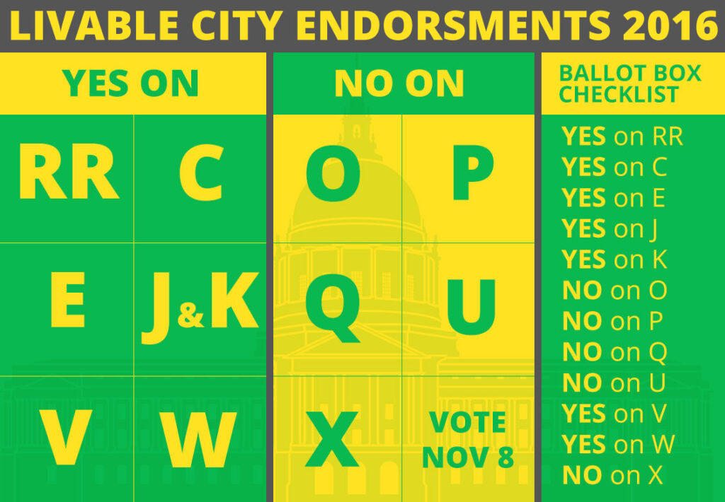
Livable City has taken a position on 12 of the 42 local, regional, and state ballot measures on this November’s ballot. Livable City recommends the following measures:
Yes on Proposition RR – BART Safety, Reliability, and Traffic Relief
If you live anywhere near the Bay Area, ride transit, or read the news, you know the BART system is aging and breaking down. The system was designed to carry 100,000 weekly riders. Now, BART serves 430,000 riders. BART estimates that it will need $9.6 billion to cover its capital needs for the next decade. This measure bridges $3.5 billion of that gap, and BART has identified approximately $4.8 billion from other sources.
Livable City consistently supports investments in transit that make San Francisco more livable, sustainable, and equitable. Improving BART’s reliability, safety, and capacity will help San Franciscans, Bay Area residents, and visitors access home, work, and play via a sustainable mode of transportation. Livable City recommends voting yes on Proposition RR.
Yes on Proposition C – Loans to Finance Acquisition and Rehabilitation of Affordable Housing
Proposition C will provide loans for the acquisition, improvement and rehabilitation of “at-risk” multi-unit residential properties, to convert such properties to permanent affordable housing, and to finance the cost of needed seismic, fire, health and safety upgrades or other major rehabilitation for habitability on such structures. It does so by amending an existing bond program which provides loans for the seismic strengthening of unreinforced masonry buildings. The majority of funds available for the masonry building program weren’t ever used, leaving almost $150 million in bond capacity available for new purposes.
This measure will further San Francisco’s (and Livable City’s) goal of preserving and expanding the city’s stock of affordable housing. The availability of funding for acquisition and rehabilitation will bolster the City’s efforts, championed by Supervisor Peskin, to step up code enforcement on Residential Hotels, protect them from conversion to other uses, rehabilitate them, and make them permanently affordable. Livable City recommends voting yes on Proposition C.
Yes on Proposition E – Responsibility for Maintaining Street Tress and Surrounding Sidewalks
Today, maintenance of certain street trees, and the sidewalks around those street trees, is the duty of the adjacent property owner. Owners are liable for injuries or property damage resulting from improperly maintained trees or sidewalks. Prior to 2009, the City had planted and maintained many street trees at City expense – on Market Street, for example. However the city’s commitment to both street tree planting and maintenance has waxed and waned.
Proposition E will ensure the city is responsible for street tree planting and maintenance, including repair of sidewalks damaged by tree roots, starting July 1, 2017. The measure sets aside $19 million annually for street tree maintenance, adjusted up or down each year based on the percentage increase or decrease in the City’s discretionary revenues.
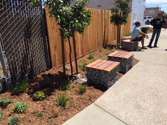
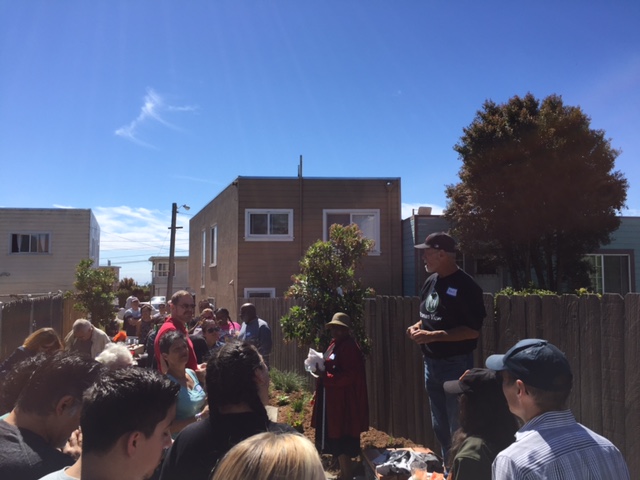
Street trees are essential ingredients for urban livability. Street trees benefit our health, happiness, ecology and economy. As parts of the City grow denser, sustaining a healthy urban forest is even more vital to sustaining heath, happiness, and livability. Trees are also important components of complete streets projects and can be effective at traffic calming. It’s time for us to consider trees as an essential part of the City. Livable City recommends voting yes on Proposition E.
Yes on Proposition J – Funding for Homelessness and Transportation
As San Francisco grows, the City faces shortfalls in transportation operating and capital funding, and also needs to comprehensively address homeless housing and social services. Enter Proposition J and companion Proposition K.
Both transportation and housing are policy priorities for Livable City. Proposition J is funded by the companion sales tax (Proposition K). Sales taxes are regressive, which Livable City generally does not support. However, most of the new funding will go to projects and programs which benefit low-income San Franciscans – transit, including subsidized transit fares for low-income households, seniors, youth, and the disabled; walking and cycling; and homeless services.
While most of the funding from measure will go to transit, walking, and cycling, Livable City does not agree that nearly a third of the Transportation Fund should go toward road maintenance. User fees on automobiles ought to pay for more of the direct costs of auto infrastructure, including maintenance of streets and parking and traffic safety. Prop. J meets some, but not all, of the projected shortfall in street capital needs. We support an increase in the Vehicle License Fee (VLF) in San Francisco to provide further funding for street maintenance and repair and traffic safety. The Mayor’s office has twice refused to bring the VLF measure to a public vote (2014, and earlier this year), so we’ll be advocating for a VLF measure in 2018. Livable City recommends voting yes on Propositions J and K.
Yes on Proposition K – General Sales Tax
Proposition J, this measure’s companion Charter Amendment will, if approved by the voters, dedicate new revenues to Transportation (.5%) and homeless services (.25%) for the next 25 years. If it does not, and Proposition K does, the money will be placed in the General Fund and allocated through the City budget process. The current combined sales tax in San Francisco County (state, regional, and county) will drop to 8.5% in December when a .25% temporary state sales tax expires. This measure will increase the combined tax to 9.25% starting in April 2017.
Although regressive, this sales tax will benefit low-income San Franciscans – transit, including subsidized transit fares for low-income households, seniors, youth, and the disabled; walking and cycling; and homeless services. Livable City recommends voting yes on Propositions J and K.
No on Proposition O: Office Development in Candlestick Point and Hunters Point
In the 1986, San Francisco voters approved Proposition M. Among other things, Prop. M established an annual limit on office square footage of about 1 million square feet per year. Applications for office space in San Francisco have never exceeded the annual limit. Prop. M gave office square footage in redevelopment areas priority, but did not exempt it from the annual limit. This measure would exempt office square footage in Candlestick Point and Hunters Point redevelopment from the Prop. M limits.
Our 1980s office limits may be due for a re-think, but developer-written ballot-box planning is the wrong way to do it. Prop. O was placed on the ballot with no public dialogue or analysis. It prioritizes office development in only two areas of the city which are ill-served by transit. Office developments in these less transit-rich areas are more auto-dependent, and will generate more traffic congestion and pollution than office development Downtown. The “yes” campaign claims Prop. O is about affordable housing, but it’s about offices, not housing. Livable City recommends voting no on Proposition O.
No on Prop. P: Competitive Bidding for Affordable Housing Projects on City-Owned Property
Currently, the Mayor’s Office of Housing and Community Development (MOHCD) administers a developer selection process, using requests for proposal (RFPs). Prop. P would require MOHCD to use a bidding process specified in the measure. Prop. P requires that the city receive at least three bids; if not, all bids must be rejected.
Prop. P will likely slow down the production of affordable housing, without improving the process or outcomes. If MOHCD’s procedures need improvement or transparency, they ought to be fixed administratively or legislatively, not at the ballot box. Livable City recommends voting no on Proposition P.
No on Proposition Q: Prohibiting Tents on Public Sidewalks
Virtually everyone agrees that the solution to homelessness is housing. Prop. Q is an unproductive measure opposed by the City’s homeless service providers and housing advocates. We agree Prop. Q shouldn’t be on the ballot, and will do nothing to move homeless San Franciscans living in tents into shelter or housing.
Fortunately, there are measures on the ballot which will build and preserve housing for homeless San Franciscans – Prop. C will allow for the acquisition and rehabilitation of permanently affordable housing, and Propositions J and K will provide $50 million per year to build housing and provide services to homeless San Franciscans. Livable City recommends voting no on Proposition Q.
No on Proposition U: Affordable Housing Requirements for Market-Rate Development Projects
Prop. U, placed on the ballot by the San Francisco Association of Realtors, would weaken the City’s requirements for inclusionary affordable housing (affordable housing in market-rate projects), and shift eligibility for affordable housing from low- and moderate-income households towards wealthier households earning 100% or more of median household income.
Inclusionary housing is an important part of the City’s affordable housing strategy, and an important public benefit from market-rate development in the City. Inclusionary requirements should be set high enough to maximize affordable housing, but not so high as to discourage housing construction. Income eligibility standards should address households with the greatest need. Inclusionary requirements should not be arbitrarily set at the ballot box.
In June, San Francisco voters removed a charter cap on inclusionary requirements, and restored the Board of Supervisors’ ability to adjust them legislatively. The Board established a technical advisory committee of nonprofit and for-profit housing providers to determine the right approach to inclusionary requirements, and that committee is finalizing its recommendations. Livable City recommends voting no on Proposition U.
Yes on Proposition V: Tax on Sugar-Sweetened Beverages
Prop. V taxes companies that distribute sugary drinks one cent per ounce on sugary soda and other sugar-sweetened drinks. This Proposition has wide-spread support, as it did the last time it was on the ballot in 2014 when it received 55% of the vote (short of the necessary 2/3 for an earmarked tax). Livable City endorses Proposition V because evidence points to these types of beverages being the leading factor toward major health issues. One-third of all children and nearly half of African-American and Latino children, are predicted to develop diabetes in their lifetimes. They are also linked to increased risk of obesity and diseases such as heart and liver disease, and the most common chronic disease among children, tooth decay.
Since its inception in 2008, our Sunday Streets program has been a strong proponent of these types of health measures, partnering with Shape Up San Francisco and the SF Department of Public Health in Soda Free Summer, and we do not allow the sampling of sugary beverages or junk food at Sunday Streets. Moreover, Sunday Streets does not accept funds from these companies, whether as sponsors or donors.
This tax will help increase awareness and educate the public about the link between sugary drinks and chronic illnesses, and how the beverage industry targets its marketing towards youth and communities of color. It will reduce sugary drink consumption, as proven in similar measures in Berkeley and Mexico (both passed in 2014). These revenues can also be used to support community programs that combat the impact of sugary drink marketing, and the negative health consequences of sugary drink consumption. Livable City recommends voting yes on Proposition V.
Yes on Proposition W: Real Estate Transfer Tax on Properties Over $5 Million
Proposition W would increase the City’s existing real estate transfer tax on properties over $5 million – to 2.25 percent from 2 percent on properties worth $5 million to $10 million, to 2.75 from 2.5 percent on properties worth $10 million to $25 million; and to 3 percent from 2.5 percent on properties worth $25 million and up. Over 80% of the tax will be levied on non-residential properties, and most of that on large office buildings worth more than $25 million. The measure will raise an estimated $45 million annually for City services, including reducing City college tuition fees. Livable City recommends voting yes on Proposition W.
No on Proposition X: Preserving Space for Neighborhood Arts, Small Businesses and Community Services in Certain Neighborhoods
After a decade-long planning process, The city adopted the Eastern Neighborhoods plans in SoMa and the Mission. These plans established a complex system of zoning districts for the area. These zoning districts include production, distribution, and repair (PDR) districts and Mixed-Use Districts.
PDR districts were intended to protect clusters of PDR uses, a category which includes various industrial, automotive, and some retail uses. PDR districts prohibit housing and limit non-PDR uses, chiefly retail and office) in size and building area.
Proposition X would require that in certain Mixed Use Districts, any current square footage of PDR uses, Arts Activities, and Institutional Community Uses proposed for demolition or conversion to another use be replaced in kind. In-kind replacement is defined on a square footage basis of 1:1 or less, depending on the zoning district and the use.
Zoning in Mixed-Use districts should preserve, or provide for, a diversity of uses, including arts, light manufacturing, and neighborhood-serving institutions. However these uses should be balanced with other important uses, particularly housing and neighborhood-serving retail. Our planning and legislative process, including the ongoing Central SoMa plan effort, is the right forum for establishing such complex zoning controls, and revising them as needed. Prop. X is ballot-box planning, concocted with no analysis of its effects and overly broad in its reach. All of its provisions could be enacted legislatively, yet none of the sponsoring supervisors tried to legislate it before placing it on the ballot.
Despite its good intentions, Prop X has some major flaws. Mixed use districts are generally dense and transit-oriented, yet Prop X privileges automotive uses (car washes and gas stations, for example) over housing or neighborhood-serving retail. Mixed-use districts were purposely zoned for dense housing, yet the replacement requirements will make new housing, including affordable housing, less feasible on many sites. These are the sorts of flaws that could have been fixed through a rigorous planning and legislative process – exactly the process that Prop. X tries to end-run. Prop. X is opposed by SFMade, the trade association representing the City’s makers and manufacturers.
For its serious flaws and inflexibility, Prop. X ought to be rejected. But some of the problems Prop. X attempts to solve – making space for arts, production, and community institutions in Mixed-Use neighborhoods – deserve the City’s careful attention, and effective solutions. Livable City recommends voting no on Prop. X.

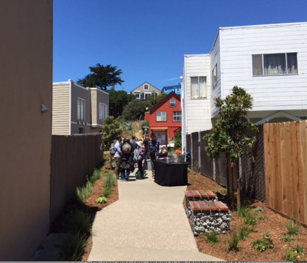

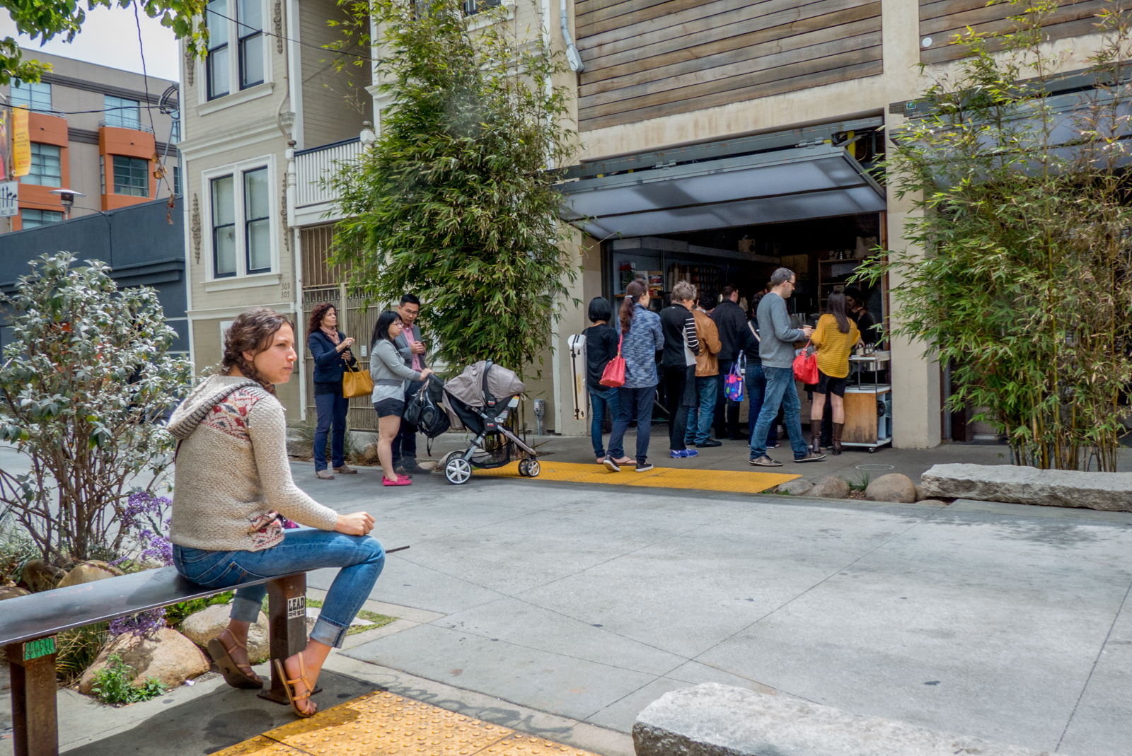


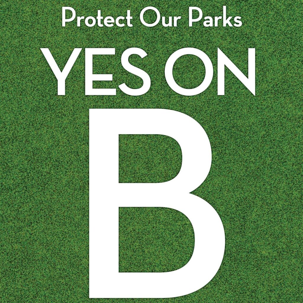 Measure B will extend the city’s current budget set-aside for parks, recreation and open space, and will expand the fund by $3 million/year for the next decade, except in bad economic years. As San Francisco grows denser, we should also grow greener. Prop B will help maintain parks and open spaces in good repair, and expand parks and open spaces in under-served areas of the city.
 Measure C will require that new development projects of 25 units or more set aside 25% of units as permanently affordable. It removes the current 12% cap on affordability requirements from the City Charter, allowing future affordable housing requirements to be adjusted through the legislative process. The San Francisco City Economist’s